The Overzealous Translator: Why Models Overestimate the El Niño–Hurricane Link
Over the warm waters of the Atlantic, air begins to swirl like water spiraling down a drain. That is a future hurricane, and its fate depends on what happens thousands of kilometers away in the Pacific Ocean. When the El Niño current warms up there, storms in the Atlantic become fewer. The models that forecast hurricane season know about this link. But they convey it like a translator who translates every word too literally and loses the meaning.
[caption]A translator who jumps at every rustle in the room turns a one-hour meeting into two[/caption]
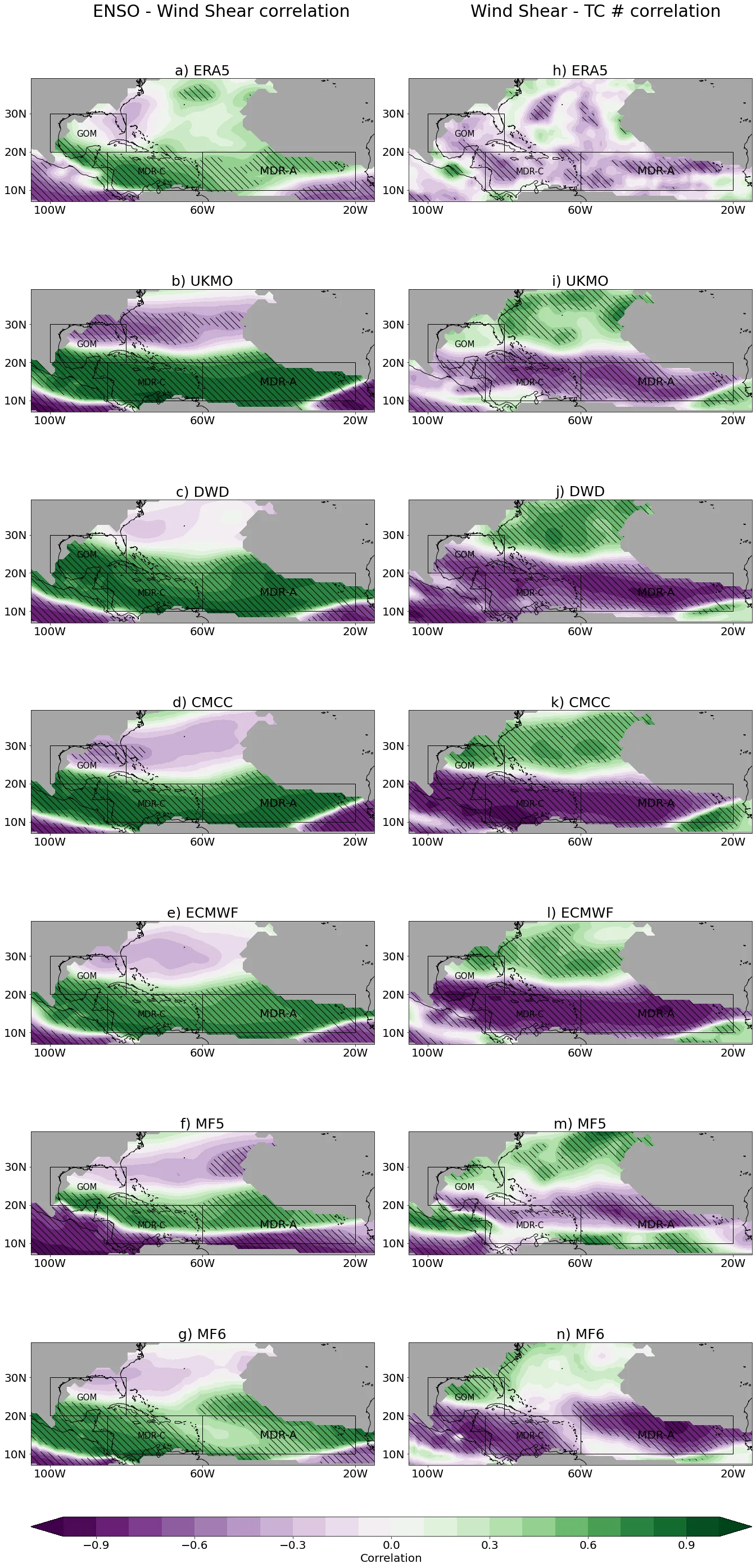
Six European seasonal forecast models were compared against real observations over 22 seasons, from 1993 to 2014. The overall conclusion is correct: in El Niño years there are fewer hurricanes, in La Niña years more. But when you look at individual regions, the picture falls apart. In the eastern Caribbean, the models confidently predict a strong connection, but the real data show none. North of 25 degrees latitude, the models draw a sharp transition in the sign of the connection that observations do not confirm.
The cause of the error lies in wind shear. This is the difference in wind speed at different altitudes, and it determines whether a hurricane embryo can grow. El Niño intensifies shear over the Atlantic, and the models blow this connection out of proportion. In the main cyclone development zone, they overestimate how much shear depends on El Niño, while in the subtropics the link between shear and cyclone numbers has the wrong sign. Humidity, by contrast, is well represented by the models and does not explain the errors.
[caption]The error likely stems from models misplacing the boundary of the Hadley cell, the large-scale air circulation between the tropics and subtropics[/caption]
This mistake is costly. Even if a model correctly predicts the total number of hurricanes in a season, its forecast for the Caribbean basin may be wrong. Model developers will need to improve the physics of atmospheric circulation, and operational centers should use such forecasts cautiously for individual regions. For now, the translator tries too hard and loses the nuances.
In 2020, during La Niña, a record 30 tropical cyclones were recorded in the Atlantic, surpassing even the previous record from 2005.