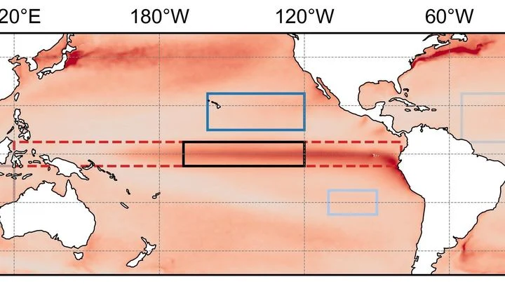
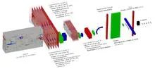
A line of buoys across the equatorial Pacific, run by NOAA PMEL and JAMSTEC, measuring temperature at a dozen depths, wind and currents every day since the 1980s.
This array matters because the tropical Pacific is the engine room of the world's climate variability. The interaction between the ocean and atmosphere there drives the El Niño-Southern Oscillation (ENSO), which affects weather patterns across the globe. Before the array was deployed, scientists had to rely on sparse ship measurements that missed the rapid changes that occur during ENSO events. The moorings provide the detailed observations needed to detect the onset of El Niño months in advance, to validate and improve climate models, and to test theories of how the coupled ocean-atmosphere system works. The array is a joint effort between the U.S. National Oceanic and Atmospheric Administration (NOAA) and the Japan Agency for Marine-Earth Science and Technology (JAMSTEC), with the U.S. operating the eastern part (TAO) and Japan the western part (TRITON).
History
The array began in the 1980s as the TAO (Tropical Atmosphere Ocean) project, initiated by NOAA's Pacific Marine Environmental Laboratory (PMEL) under the leadership of Stanley Hayes and later Michael McPhaden. The first moorings were deployed in 1984, and the array was completed across the Pacific by 1994. In the late 1990s, Japan's JAMSTEC added the TRITON (Triangle Trans-Ocean Buoy Network) moorings in the western Pacific, replacing some of the original TAO buoys.
How it works
Each mooring consists of a surface buoy tethered to a heavy anchor on the seafloor, with a line of temperature sensors strung between them. The surface buoy carries meteorological sensors and a satellite transmitter, while the subsurface sensors record temperature at set depths. Data from all sensors is collected by the buoy's electronics and transmitted several times per day to satellites, which relay it to shore stations. The array is designed to measure the key variables that control ENSO: the strength of the trade winds, the depth of the warm surface layer (the thermocline), and the temperature of the water at depth. When the trade winds weaken, the thermocline deepens in the eastern Pacific, and the moorings capture this shift in real time.
In practice
The real-time data from the array is used by NOAA's Climate Prediction Center and other forecast centers to issue El Niño/La Niña advisories, by oceanographers to study equatorial currents and upwelling, and by climate modelers to initialize and verify seasonal forecasts.
Fun fact
The array survived the 1997-98 El Niño, the strongest on record, and its data showed that the event was triggered by a series of westerly wind bursts that pushed warm water eastward—a process that had been theorized but never directly observed before.
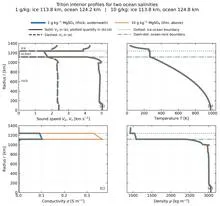
Triton's icy shell is like a locked door to a basement where water sloshes behind the wall. We can't open it, but we can press our ear to it and listen for echoes of footsteps: how Neptune's magnetic field responds within the moon's interior, how the ice trembles from distant impacts.
Every year, as December approaches, the water off the coast of Peru becomes anomalously warm or anomalously cold. This is El Niño and La Niña, two phases of the same climate pendulum that swings in the equatorial Pacific. The pendulum is not a simple one: it remembers what happened to it several months earlier, and this memory determines which way it will swing next.
A translator in a conference hall tries to convey the speaker's words, but the hall is noisy: someone coughs, chairs creak, and the street outside is loud. If the speaker lowers their voice, the translator still keeps translating, but their voice drowns in the noise.
A student who has spent years solving problems from other people's textbooks suddenly receives three notebooks with real ocean observations. There are few problems, but they have already seen hundreds of similar ones, and now a couple of examples suffice to catch the new teacher's style.
In 1991, Mount Pinatubo erupted with such force that it blanketed the planet in a thin veil of ash and gases for years. That veil, like a blanket on a hot night, trapped heat and cooled the ocean surface, causing tropical sea surface temperatures to dip. This event marks the start of a detective story about why some oceans are spawning ever more ferocious hurricanes while others remain calm.
Every winter, the tropical Pacific Ocean seems to replay the same script: sea surface temperatures off the coast of Peru rise, trade winds weaken, and a wave of droughts and floods spreads across the planet. This is El Niño, and its peak almost always falls in December. Why winter in particular?
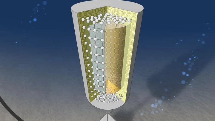
In the depths of the ocean, where light never reaches, a plan is taking shape to capture particles that barely interact with anything. Geoneutrinos, tiny messengers from the scorching mantle, are emitted during the decay of uranium and thorium. Their flux carries information about how much heat lies hidden beneath our feet.
A tuning fork produces a pure tone, but if you strike it too hard, it starts to rattle, and a musician might mistake that rattle for complexity in the sound.
In the Pacific Ocean, there is a warm current that flows eastward against all the others. It is called the North Equatorial Countercurrent, or NECC. In normal years, this band of warm water, a few hundred kilometers wide, quietly carries heat from Indonesia toward the Americas.
An orchestra plays in a dark hall, and the listener hears only a hum: hundreds of instruments blend into a dense noise in which no melody can be discerned. That is roughly what spectra extracted from climate data by methods like the Koopman operator look like: hundreds of components, each with its own frequency, and it is unclear which ones are true musicians and which are the rattling of chairs.
Enceladus is a tiny moon of Saturn, covered in a thick crust of ice. Beneath it sloshes a salty ocean, and deep down, a hot, porous core may be at work, like a sponge soaked with water and heat. But how do you see through tens of kilometers of ice? No need to drill: you can use an electromagnetic "echo."
A person with a metal detector walks along a beach.
Two observers watch the Pacific Ocean. One studies surface heat maps, the other listens to the rhythm of temperature and heat stored in the water column. On their own, each notices only part of the picture, but together they can sense the approach of El Niño months before the warm current alters weather across the planet.
Over the warm waters of the Indian Ocean, every six to eight weeks, a vast wave of moist air gathers. It moves eastward at a pedestrian pace—about five meters per second—and takes forty to ninety days to circle half the planet.
The ocean does not shout about its intentions. It whispers: a warm patch off the coast of Peru, a cold tongue near Hudson Bay, a barely perceptible shift in a current. The atmosphere does not respond immediately, and by winter Europe may get either mild slush or Siberian frosts.
Two pendulums hang on the same wall, swinging out of sync, but suddenly they move as one, only with an 18-month delay. One pendulum is the Indian monsoon, the seasonal wind that brings rain to South Asian farmland. The other is the deep water of the tropical oceans, which slowly accumulates heat and remembers it for years.
Every few years, the Pacific Ocean off Peru warms so abruptly that fish disappear and rains flood the desert. This phenomenon is called El Niño, and it acts like a pendulum that swings the planet's climate. But when the planet itself warms, the pendulum behaves strangely: first its swing widens, then it suddenly fades.
The bronze plates of a gamelan do not sound according to a single tuning standard: each orchestra on Java keeps its own tuning, and two neighboring ensembles may play the same melody in slightly different intervals.
Two barometers hang on the wall. One reads clear, the other says partly cloudy. Which weather do you trust? That is roughly the question facing a group of climate scientists when two independent methods predicted different futures for the Pacific Ocean in 2026.
Every few years, the warm current off the coast of Peru shifts, and fishermen come home empty-handed. This is El Niño, the breath of the tropical Pacific, which affects weather from Indonesia to California. Predicting its arrival is as hard as predicting where a stone thrown into a raging river will roll.
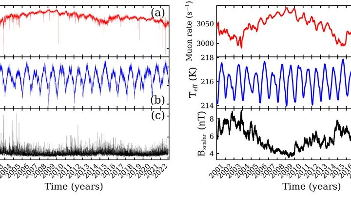
Every second, invisible particles from space, cosmic rays, strike Earth's atmosphere. Colliding with air molecules, they produce showers of secondary particles, among which muons are especially abundant. A muon is a heavy cousin of the electron that lives only a couple of microseconds but still manages to reach the ground.
The Pacific Ocean breathes slowly and deeply. Every few years, its warm surface waters shift eastward toward the coast of South America, and then Peru gets drenched while Australia goes up in flames. A year or two later, the water retreats, and the picture flips. This breathing is called El Niño, and until now its rhythm could only be guessed a couple of steps ahead.
The tropical Pacific Ocean heats and cools like a giant battery, and its rhythm affects weather from India to Canada. This rhythm is called El Niño–Southern Oscillation, or ENSO for short. Forecasting it months ahead is like predicting when a pot will boil without knowing the strength of the flame.
The Tibetan Plateau is a giant sponge that soaks up rain and snow, then releases water to Asia's rivers. Since 2000, the sponge has been getting wetter. Scientists decided to check: does this moisture make the sponge stronger, or does it soften it?
They used a measure of disorder — entropy.
In 1997, the Pacific Ocean warmed so much that corals bleached from Indonesia to the Galápagos, and floods and droughts swept across five continents. Such events, which climate scientists call extreme El Niños, occur every few decades, and to understand how often they will arrive in the future, we need thousands of years of observations.
A warm ocean off the coast of Peru can make winter in Moscow unusually mild. Climate scientists call these invisible threads that link weather in distant corners of the planet teleconnections. For a long time, they were thought of as something like permanent wiring: the signal sources may pulse, but the wires themselves lie still.
The Pacific Ocean is like a giant swing: warm water piles up in the west, then slides toward the east, and the temperature off the coast of South America jumps. Such warm years are called El Niño, and cold ones La Niña. But the swing doesn't move on its own: it's pushed by the wind.
An orchestra of a hundred musicians plays without a conductor. As long as the score is familiar, each player confidently follows their part, and together they sound harmonious. But when the composer changes the rhythm, discord creeps in: some instruments keep playing the old tune, others try to adapt, and a few fall silent.
Every day, about 40,000 thunderstorms flash across the planet. In that moment, the atmosphere resembles an orchestra without sheet music: warm air rises like a bow stroke, winds aloft carry the melody, and lightning punctuates the finale. But who conducts this orchestra?
Eavesdropping on a distant planet's atmosphere is hampered by the star's noise. In the TRAPPIST-1 system, astronomers used a planet-"bug": TRAPPIST-1 b — an airless neighbor that records only the interference.
Two conductors stand before one orchestra. One waves the baton quickly, setting the tempo every few bars. The second is almost motionless, but his slow breathing changes the overall sound throughout the symphony. So it is in the tropical Pacific: one part of the wind governs the fast oscillations of El Niño, the other governs decadal climate shifts.
Imagine an interpreter in a negotiation room who hears the tropics whisper and repeats it too loudly. That is how the neural-network climate model DLESyM behaves when forced with real Pacific sea surface temperatures. The ocean whispers "El Niño," and the atmosphere shouts back as if being shaken by the shoulders.
The climate of the United States is not a straight line creeping upward. It is an orchestra without a conductor, where every violin and every drum plays its own part, and together they create an intricate pattern of warm and cold, wet and dry years.
Imagine a pendulum that is pushed in time with the seasons: harder in winter, softer in summer. But this pendulum has a quirk: a switch that operates with a delay. When the pendulum passes through zero, the switch clicks and changes the direction of the push. That is exactly how the simplified El Niño model built by mathematicians works.
A team of forty forecasters prepares an El Niño forecast two years ahead. Each works with the same model but slightly different initial conditions and settings, so their outputs diverge. Typically, forecasting centers average all forty opinions, assuming each member is equally useful.
The ocean hums like a crowded hall: in one corner, voices argue about decades; in another, about years; in a third, about the changing seasons. To pick apart these voices, climatologists used to rely on filters they tuned themselves, letting through only slow waves or only fast ones. But the Pacific plays by its own rules: a warm patch off the coast of Peru can be a brief spike or part of a long-term rearrangement.
In a room with 80 advisors, each shouts their own opinion, and if you simply listen to everyone and take the average, you get mush. So it is with El Niño forecasts: a model produces 80 possible futures, but not all are equally useful. Some err less often, others more, and still others talk about something else entirely.
A translator that learned the grammar of the wind, not just the vocabulary. The wind blows over the Pacific, and the water responds with waves, currents, and upwellings of cold depths. The KIST-Ocean neural network was taught not just to memorize how the ocean looked yesterday, but to understand why it will become what it is tomorrow.
An invisible relay race runs through Earth's tropics: a wave of heavy rain and winds, which meteorologists call the Madden–Julian Oscillation, travels eastward at about five meters per second. Most runners tire quickly, but rare marathoners carry the torch all the way across the Pacific.
The tropical Pacific Ocean lives in two rhythms. The first is fast: a wave of thunderstorms born over the Indian Ocean races eastward and dies out off the coast of the Americas within a month or two. The second is slow: every few years, the ocean surface warms enough to alter weather across the entire planet. That is El Niño. Between these rhythms lies a bridge, and building it took climatologists decades.
You can sit on a seesaw and pump your legs, or you can just tip from one side to the other. The Pacific Ocean does both. Every few years, warm water off the coast of Peru gives way to cooler water, and rainfall patterns, winds, and entire ecosystems across half the planet reshuffle. These shifts are called El Niño and La Niña, together known as ENSO: Earth's climate seesaw.