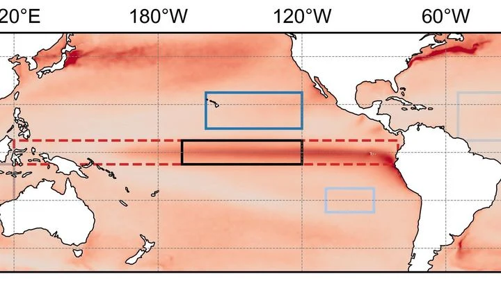
The Pacific Marine Environmental Laboratory and its array of moored buoys along the equator, TAO/TRITON. It measures the ocean below the surface, down to 500 m.
The array also serves as an early-warning system. When scientists see subsurface temperature anomalies building in the western Pacific, they can anticipate an El Niño forming months before surface signs appear. This lead time is crucial for governments, farmers, and disaster planners. The TAO/TRITON array is a prime example of how sustained ocean observation transforms our understanding of climate from a vague concept into a quantifiable, predictable system.
History
The array was developed in the 1980s through a collaboration between NOAA's PMEL and the Tropical Atmosphere Ocean project, with the first buoys deployed in 1985. The western Pacific portion was later extended by Japan's TRITON buoys, giving the array its full name. The system has been maintained continuously since then, with periodic upgrades to sensors and telemetry.
How it works
The array's design targets the thermocline—the boundary between warm surface water and colder deep water—which typically sits at 100–200 meters in the eastern Pacific and deepens to 200–300 meters in the west. By measuring down to 500 meters, the buoys capture the full range of temperature changes that matter for ENSO. The data is processed and made publicly available within hours, feeding into climate models and forecast systems worldwide.
In practice
The data is used operationally by weather and climateforecasting centers worldwide to predict El Niño and La Niña events, guide agricultural planning, and inform disaster preparedness for floods and droughts.
Fun fact
The array's buoys are so reliable that they have survived decades of harsh tropical storms, and some have been in place for over 20 years, providing one of the longest continuous records of subsurface ocean conditions anywhere on Earth.
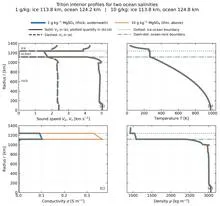
Triton's icy shell is like a locked door to a basement where water sloshes behind the wall. We can't open it, but we can press our ear to it and listen for echoes of footsteps: how Neptune's magnetic field responds within the moon's interior, how the ice trembles from distant impacts.
High in the mountains, where the air is clear and still, physicists are preparing to catch elusive visitors from space — neutrinos. These particles, like ghosts, pass straight through the Earth, leaving almost no trace. But occasionally a neutrino does slam into an atom, producing a shower of particles that can be seen.
A student who has spent years solving problems from other people's textbooks suddenly receives three notebooks with real ocean observations. There are few problems, but they have already seen hundreds of similar ones, and now a couple of examples suffice to catch the new teacher's style.
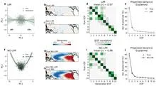
An orchestra plays in a dark hall, and the listener hears only a hum: hundreds of instruments blend into a dense noise in which no melody can be discerned. That is roughly what spectra extracted from climate data by methods like the Koopman operator look like: hundreds of components, each with its own frequency, and it is unclear which ones are true musicians and which are the rattling of chairs.
Two observers watch the Pacific Ocean. One studies surface heat maps, the other listens to the rhythm of temperature and heat stored in the water column. On their own, each notices only part of the picture, but together they can sense the approach of El Niño months before the warm current alters weather across the planet.
Over the warm waters of the Indian Ocean, every six to eight weeks, a vast wave of moist air gathers. It moves eastward at a pedestrian pace—about five meters per second—and takes forty to ninety days to circle half the planet.
The ocean does not shout about its intentions. It whispers: a warm patch off the coast of Peru, a cold tongue near Hudson Bay, a barely perceptible shift in a current. The atmosphere does not respond immediately, and by winter Europe may get either mild slush or Siberian frosts.
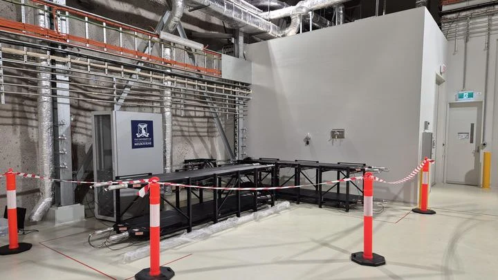
Deep underground, in a former gold mine in Australia, stands a laboratory where silence is broken only by rare flashes of light. These flashes are the traces of cosmic particles that punch through hundreds of meters of rock. Eight plastic panels, resembling large glowing sheets, catch these particles.
Every few years, the Pacific Ocean off Peru warms so abruptly that fish disappear and rains flood the desert. This phenomenon is called El Niño, and it acts like a pendulum that swings the planet's climate. But when the planet itself warms, the pendulum behaves strangely: first its swing widens, then it suddenly fades.
The bronze plates of a gamelan do not sound according to a single tuning standard: each orchestra on Java keeps its own tuning, and two neighboring ensembles may play the same melody in slightly different intervals.
Two barometers hang on the wall. One reads clear, the other says partly cloudy. Which weather do you trust? That is roughly the question facing a group of climate scientists when two independent methods predicted different futures for the Pacific Ocean in 2026.
Deep inside a dying star eight times heavier than the Sun, a quiet fever begins a few days before the final explosion. The star's core contracts and heats up, releasing neutrinos — tiny particles that barely interact with matter. This stream is like a faint whisper before a loud cry: the supernova hasn't flashed yet, but it's already sending a signal of its imminent demise.
The Pacific Ocean breathes slowly and deeply. Every few years, its warm surface waters shift eastward toward the coast of South America, and then Peru gets drenched while Australia goes up in flames. A year or two later, the water retreats, and the picture flips. This breathing is called El Niño, and until now its rhythm could only be guessed a couple of steps ahead.
The tropical Pacific Ocean heats and cools like a giant battery, and its rhythm affects weather from India to Canada. This rhythm is called El Niño–Southern Oscillation, or ENSO for short. Forecasting it months ahead is like predicting when a pot will boil without knowing the strength of the flame.
The Tibetan Plateau is a giant sponge that soaks up rain and snow, then releases water to Asia's rivers. Since 2000, the sponge has been getting wetter. Scientists decided to check: does this moisture make the sponge stronger, or does it soften it?
They used a measure of disorder — entropy.
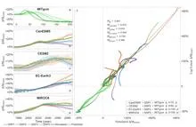
In 1997, the Pacific Ocean warmed so much that corals bleached from Indonesia to the Galápagos, and floods and droughts swept across five continents. Such events, which climate scientists call extreme El Niños, occur every few decades, and to understand how often they will arrive in the future, we need thousands of years of observations.
A team of forty forecasters prepares an El Niño forecast two years ahead. Each works with the same model but slightly different initial conditions and settings, so their outputs diverge. Typically, forecasting centers average all forty opinions, assuming each member is equally useful.
In a room with 80 advisors, each shouts their own opinion, and if you simply listen to everyone and take the average, you get mush. So it is with El Niño forecasts: a model produces 80 possible futures, but not all are equally useful. Some err less often, others more, and still others talk about something else entirely.
An interpreter in a conference room hears not just words but intonations, pauses, and gestures. From these cues, they anticipate where the conversation will turn. The Pacific climate speaks the language of wind, heat, and currents, and PTSTnet listens like an experienced simultaneous interpreter, grasping the grammar of ocean and atmosphere.
Imagine a translator sitting in on a conversation between two parties: the ocean and the atmosphere. Usually, the translator conveys the meaning with a six-month delay, and in spring it loses the thread entirely. The new model, called CTEFNet, translates up to two years ahead and, on top of that, explains which remark turned the tide.
In the hall, fifty sages confer, each observing the ocean in their own way. One listens to surface temperature, another to the wind, a third to how heat hides in the depths. Their judgments often contradict each other, but there is an elder who knows which of them to trust more.
In 2015, downpours in Chennai turned streets into rivers overnight. The city was caught unprepared: seasonal models offered only a vague warning. Yet the monsoon is not a whim of the sky; it is the pulse of a vast machine linking oceans and continents.
An interpreter at negotiations hears only the words already spoken, yet still guesses the next phrase. This is how the new El Niño forecasting method works: it doesn't peek into the future but relies solely on the past, like an honest listener.
An experienced navigator steers the ship by a well-tested chart, but in unfamiliar waters the chart lies. A cabin boy who has watched the navigator err for years learns to anticipate where the chart will fail. Together they plot a course more accurately than either could alone.
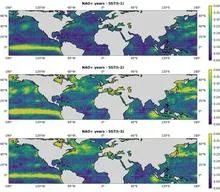
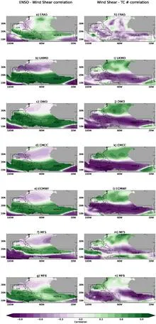
Each Atlantic hurricane season is like a game of dice, where the number of spots depends on three major climate forces: El Niño, ocean temperature in the 'hurricane nursery,' and the North Atlantic Oscillation.
Imagine an orchestra playing without a conductor. Each section takes its turn: first the winds introduce the theme, then the strings join in, and sometimes an unexpected percussionist solos.
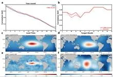
Imagine an interpreter in a huge hall who hears not only the person next to them but also a whisper in the far corner, and from those fragments reconstructs the entire conversation. That's how the CAS-Canglong neural network works: it picks up connections between pressure, wind, and heat across the whole planet and uses them to predict what the ocean will look like three months from now.
When the Pacific off the coast of Peru heats up, the planet's familiar weather map goes haywire: droughts in some places, floods in others. That's El Niño, and it costs the global economy trillions of dollars. Scientists have long been able to predict it, but now, for the first time, they are testing whether it can be weakened while it's still developing.
An artist painting the ocean does not limit themselves to two colors: warm and cold. Likewise, climatologists studying El Niño increasingly speak of a whole palette of shades. El Niño is a warm current off the coast of Peru that, every few years, alters weather across the planet. Its counterpart, La Niña, brings cold.
Every few years, the Pacific Ocean changes its character. Sometimes it warms up off the coast of South America, which is called El Niño, and sometimes it cools down, bringing La Niña. For someone on the other side of the planet, this is not just a weather report item. The ocean acts as a conductor, setting the tempo for heat and drought over Eurasia.
The Pacific Ocean breathes, and that breath has a pulse. Every few years, its surface warms more than usual, bringing torrential rains to Peru and drought to Australia. This is El Niño, the warm phase of the ocean temperature oscillation.
The Pacific Ocean remembers. Water warmed off the coast of Peru drifts slowly westward, and six months later its heat returns to South America. Scientists call this six-month journey the delay. It turns a simple climate model into a maze where the route depends not only on your current position but also on where you were half a year ago.
A translator in a large hall hears both a whisper right next to their ear and a conversation at the far end. The same mind picks up local nuances while keeping track of the overall discussion. That is how ResoNet works: a neural network that predicts El Niño.
El Niño is a warm current in the equatorial Pacific that, every few years, alters weather across all continents.
A blindfolded sapper searches for a mine by tossing pebbles at random. He cannot see the map or calculate where the charge is buried. But if he throws enough pebbles and listens for which one lands with a duller thud, he can pinpoint the danger. That is roughly how a new method for predicting El Niño works: the warm current that every few years alters weather across the entire planet.
A translator who gets distracted by every rustle in the room turns a one-hour meeting into two. That is how old statistical El Niño models worked: they picked out individual numbers from ocean maps but missed how a warm patch off Peru connects to a cool tongue near Australia. The new neural network behaves differently: it follows not every word but the meaning of the paragraph.
A fisherman pulls on his net and listens to it ring. Each strand quivers in its own way, but before a strong tug, all the strands begin to vibrate in unison. So it is with complex systems: before a sharp state jump, the individual parts suddenly start to oscillate in concert, and that synchrony betrays the coming jump.
The Pacific Ocean spans half the planet, and its mood decides whether India gets rain or Australia gets drought. In the center of this giant, in a region that climatologists call NINO3.4, water temperatures rise and fall, affecting millions of lives.
An invisible barometer hangs over the Pacific Ocean. Its needle swings from the western shores to the central waters, and in December it shows what the next storm will be like: not just whether it will come, but where it will hit hardest.
Over the warm waters of the Atlantic, air begins to swirl like water spiraling down a drain. That is a future hurricane, and its fate depends on what happens thousands of kilometers away in the Pacific Ocean. When the El Niño current warms up there, storms in the Atlantic become fewer. The models that forecast hurricane season know about this link.
The ocean plays with three hands. One hand is fast: the surface temperature of the Pacific Ocean changes over weeks. Another hand is medium: the depth of the warm layer rearranges over months. The third hand is slow: the entire system tilts toward warm El Niño or cold La Niña, and that takes years.