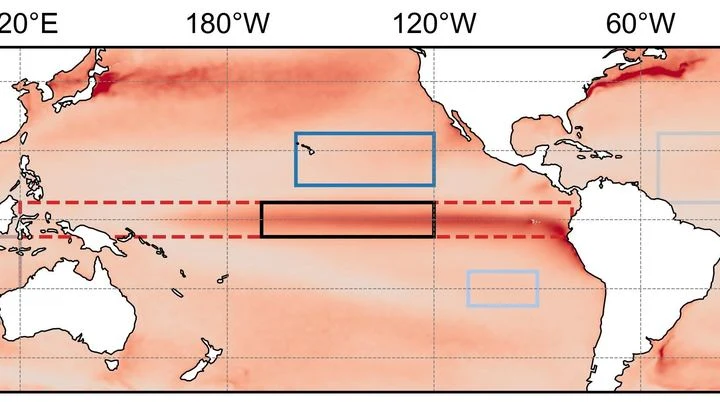
La Niña is the cold counterpart to El Niño, part of the same natural oscillation known as the El Niño-Southern Oscillation (ENSO). During La Niña, sea surface temperatures in the central and eastern tropical Pacific drop below average, often by 1–3°C. This cooling strengthens the normal trade winds, pushing warm water even more strongly toward the western Pacific and enhancing upwelling of cold, nutrient-rich water along South America. The result is a shift in global weather patterns that is often the mirror image of El Niño, bringing wetter conditions to some regions and drier conditions to others.
History
The term 'La Niña' (Spanish for 'the girl child') was coined in the 1980s as the cold phase of ENSO became more widely recognized, following the naming of El Niño. The phenomenon itself was known earlier through its regional effects, such as droughts in South America, but its global connection was established through the same research that clarified El Niño.
How it works
La Niña begins when trade winds intensify, accelerating the westward flow of warm surface water and increasing the upwelling of cold water in the eastern Pacific. The cold water cools the atmosphere above it, suppressing thunderstorm activity in the central Pacific and shifting convection toward Indonesia and northern Australia. This altered heating pattern changes the position of the jet streams, leading to specific regional effects: for example, the southern United States often becomes drier and warmer, while the Pacific Northwest and parts of South America become wetter and cooler.
In practice
La Niña forecasts help agricultural planners anticipate droughts or floods, water managers prepare for reservoir levels, and public health officials predict disease outbreaks linked to rainfall patterns, such as malaria in parts of Africa and South America.
Fun fact
La Niña events often lead to more active Atlantic hurricane seasons because the reduced wind shear in the Atlantic allows storms to strengthen more easily.
Every year, as December approaches, the water off the coast of Peru becomes anomalously warm or anomalously cold. This is El Niño and La Niña, two phases of the same climate pendulum that swings in the equatorial Pacific. The pendulum is not a simple one: it remembers what happened to it several months earlier, and this memory determines which way it will swing next.
In 1991, Mount Pinatubo erupted with such force that it blanketed the planet in a thin veil of ash and gases for years. That veil, like a blanket on a hot night, trapped heat and cooled the ocean surface, causing tropical sea surface temperatures to dip. This event marks the start of a detective story about why some oceans are spawning ever more ferocious hurricanes while others remain calm.
Every winter, the tropical Pacific Ocean seems to replay the same script: sea surface temperatures off the coast of Peru rise, trade winds weaken, and a wave of droughts and floods spreads across the planet. This is El Niño, and its peak almost always falls in December. Why winter in particular?
In the Pacific Ocean, there is a warm current that flows eastward against all the others. It is called the North Equatorial Countercurrent, or NECC. In normal years, this band of warm water, a few hundred kilometers wide, quietly carries heat from Indonesia toward the Americas.
A giant musical instrument hides underground. It picks up not sound but the trembling of space itself — gravitational waves from the mergers of dead stars. But this instrument has a problem: it is bothered by Earth's 'breathing.' Winds, storms, even the changing seasons make the ground vibrate, creating noise.
Two observers watch the Pacific Ocean. One studies surface heat maps, the other listens to the rhythm of temperature and heat stored in the water column. On their own, each notices only part of the picture, but together they can sense the approach of El Niño months before the warm current alters weather across the planet.
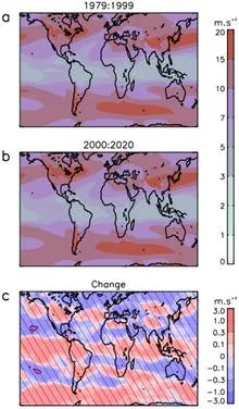
Over the warm waters of the Indian Ocean, every six to eight weeks, a vast wave of moist air gathers. It moves eastward at a pedestrian pace—about five meters per second—and takes forty to ninety days to circle half the planet.
Beneath Enceladus's icy crust churns an ocean, acting like a perfect heat pump. It pushes heat from the equator to the poles, spending a thousand times less energy than it transports — like a perpetual motion machine built into the moon. The secret lies in salt.
In 2023, the ocean off the coast of Peru warmed so much that fishermen came back empty-handed, while meteorologists argued over the strength of the upcoming El Niño. The sea surface temperature map they were looking at was the only one available, but how much could they trust it?
The ocean does not shout about its intentions. It whispers: a warm patch off the coast of Peru, a cold tongue near Hudson Bay, a barely perceptible shift in a current. The atmosphere does not respond immediately, and by winter Europe may get either mild slush or Siberian frosts.
Two pendulums hang on the same wall, swinging out of sync, but suddenly they move as one, only with an 18-month delay. One pendulum is the Indian monsoon, the seasonal wind that brings rain to South Asian farmland. The other is the deep water of the tropical oceans, which slowly accumulates heat and remembers it for years.
Imagine a radiator in a room: it heats up, but if its surface is clogged with dust, heat escapes less efficiently. Something similar is happening to our planet. Earth receives energy from the Sun and must radiate the excess back into space, otherwise temperatures rise. Scientists call this ability to shed excess heat radiative feedback.
Every few years, the Pacific Ocean off Peru warms so abruptly that fish disappear and rains flood the desert. This phenomenon is called El Niño, and it acts like a pendulum that swings the planet's climate. But when the planet itself warms, the pendulum behaves strangely: first its swing widens, then it suddenly fades.
The bronze plates of a gamelan do not sound according to a single tuning standard: each orchestra on Java keeps its own tuning, and two neighboring ensembles may play the same melody in slightly different intervals.
Two barometers hang on the wall. One reads clear, the other says partly cloudy. Which weather do you trust? That is roughly the question facing a group of climate scientists when two independent methods predicted different futures for the Pacific Ocean in 2026.
A student learned physics from a textbook and is taking an exam. The first two problems are solved brilliantly, but on the third, they err on something not covered in the book. That is roughly what the hybrid atmospheric model NeuralGCM faced when run through three levels of testing: cyclones, El Niño, and anomalous warming.
The Pacific Ocean breathes slowly and deeply. Every few years, its warm surface waters shift eastward toward the coast of South America, and then Peru gets drenched while Australia goes up in flames. A year or two later, the water retreats, and the picture flips. This breathing is called El Niño, and until now its rhythm could only be guessed a couple of steps ahead.
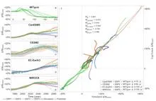
The tropical Pacific Ocean heats and cools like a giant battery, and its rhythm affects weather from India to Canada. This rhythm is called El Niño–Southern Oscillation, or ENSO for short. Forecasting it months ahead is like predicting when a pot will boil without knowing the strength of the flame.
A warm ocean off the coast of Peru can make winter in Moscow unusually mild. Climate scientists call these invisible threads that link weather in distant corners of the planet teleconnections. For a long time, they were thought of as something like permanent wiring: the signal sources may pulse, but the wires themselves lie still.
The Pacific Ocean is like a giant swing: warm water piles up in the west, then slides toward the east, and the temperature off the coast of South America jumps. Such warm years are called El Niño, and cold ones La Niña. But the swing doesn't move on its own: it's pushed by the wind.
Every day, about 40,000 thunderstorms flash across the planet. In that moment, the atmosphere resembles an orchestra without sheet music: warm air rises like a bow stroke, winds aloft carry the melody, and lightning punctuates the finale. But who conducts this orchestra?
Two conductors stand before one orchestra. One waves the baton quickly, setting the tempo every few bars. The second is almost motionless, but his slow breathing changes the overall sound throughout the symphony. So it is in the tropical Pacific: one part of the wind governs the fast oscillations of El Niño, the other governs decadal climate shifts.
The orchestra assembled, the instruments were tuned, but there was barely any music: that's what the 2025 Atlantic hurricane season looked like. The ocean was the fifth warmest on record, and a weak La Niña usually adds strength to storms. But instead of a continuous concert, we got isolated thunderous chords: three Category 5 hurricanes, with silence in between.
Why was the orchestra silent?
The climate of the United States is not a straight line creeping upward. It is an orchestra without a conductor, where every violin and every drum plays its own part, and together they create an intricate pattern of warm and cold, wet and dry years.
A camera on a tripod shoots the same landscape for decades. If you don't touch the lens, the images get hazy: the landscape changes, but the focus stays put. That's roughly how climate norms work. According to World Meteorological Organization rules, they are calculated as the average over the last 30 years.
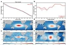
Every spring, El Niño forecasts lose their edge, like a translator who gets distracted by every rustle in the room and turns a one-hour meeting into a two-hour one. Scientists call this the spring predictability barrier: in March and April, models that confidently predicted a warm phase in the Pacific back in January start making mistakes twice as often.
Imagine a pendulum that is pushed in time with the seasons: harder in winter, softer in summer. But this pendulum has a quirk: a switch that operates with a delay. When the pendulum passes through zero, the switch clicks and changes the direction of the push. That is exactly how the simplified El Niño model built by mathematicians works.
A team of forty forecasters prepares an El Niño forecast two years ahead. Each works with the same model but slightly different initial conditions and settings, so their outputs diverge. Typically, forecasting centers average all forty opinions, assuming each member is equally useful.
The ocean hums like a crowded hall: in one corner, voices argue about decades; in another, about years; in a third, about the changing seasons. To pick apart these voices, climatologists used to rely on filters they tuned themselves, letting through only slow waves or only fast ones. But the Pacific plays by its own rules: a warm patch off the coast of Peru can be a brief spike or part of a long-term rearrangement.
In summer, the South China Sea can show a strange pattern: the water in the north warms while the south cools at the same time. A year later, it's the opposite. This isn't random; it's a steady seesaw that the ocean rocks every summer.
A translator that learned the grammar of the wind, not just the vocabulary. The wind blows over the Pacific, and the water responds with waves, currents, and upwellings of cold depths. The KIST-Ocean neural network was taught not just to memorize how the ocean looked yesterday, but to understand why it will become what it is tomorrow.
An invisible relay race runs through Earth's tropics: a wave of heavy rain and winds, which meteorologists call the Madden–Julian Oscillation, travels eastward at about five meters per second. Most runners tire quickly, but rare marathoners carry the torch all the way across the Pacific.
The tropical Pacific Ocean lives in two rhythms. The first is fast: a wave of thunderstorms born over the Indian Ocean races eastward and dies out off the coast of the Americas within a month or two. The second is slow: every few years, the ocean surface warms enough to alter weather across the entire planet. That is El Niño. Between these rhythms lies a bridge, and building it took climatologists decades.
In May 2024, thermometers in Jalisco seemed to go haywire: on May 10, one station recorded 38.4°C, nearly matching the historical maximum from 1994. The heat was so intense that even agave plants, accustomed to scorching conditions, slowed their growth. And the rains, which usually arrive in June, were delayed, leaving farmers nervously glancing at the sky.
You can sit on a seesaw and pump your legs, or you can just tip from one side to the other. The Pacific Ocean does both. Every few years, warm water off the coast of Peru gives way to cooler water, and rainfall patterns, winds, and entire ecosystems across half the planet reshuffle. These shifts are called El Niño and La Niña, together known as ENSO: Earth's climate seesaw.
Picture a pendulum hanging in a room with drafts. Sometimes a gust pushes it harder, sometimes softer. If the pendulum barely loses energy, it will swing long and steady. But if friction is strong, each push quickly fades, and the motion becomes jerky: a sharp swing, then a long sway. That's exactly how the tropical Pacific behaves when the heat of El Niño gives way to the cold of La Niña.
From July 2023 to July 2024, Earth's atmosphere gained carbon dioxide at a rate of 3.66 parts per million per year. That is the fastest pace since 1979. The reason is not that factories and cars suddenly started emitting more CO₂. The planet's lungs—forests and soils—took a shallower breath.
The planet breathes through its green cover.
A translator at a high-stakes negotiation doesn't just render words quickly; they make sure the meaning doesn't get lost. CAMulator does the same: it takes the complex climate model CAM6 and translates it into the language of a neural network that runs hundreds of times faster, without losing the physical essence.
The Pacific Ocean breathes. Every few years, its warm western "lung" exhales eastward, and from Peru to Indonesia, rains, droughts, and hurricanes shift. This breath is called El Niño–Southern Oscillation, or ENSO.
An interpreter in a conference room hears not just words but intonations, pauses, and gestures. From these cues, they anticipate where the conversation will turn. The Pacific climate speaks the language of wind, heat, and currents, and PTSTnet listens like an experienced simultaneous interpreter, grasping the grammar of ocean and atmosphere.