How GPS Stations Weigh the Water Beneath Your Feet
Each GPS station is like a sensitive scale standing on the ground, noticing when it sinks or rises by a few millimeters. If water accumulates underground, the ground subsides. If water leaves, the ground rebounds. These movements are very slow, but the stations see them every day.
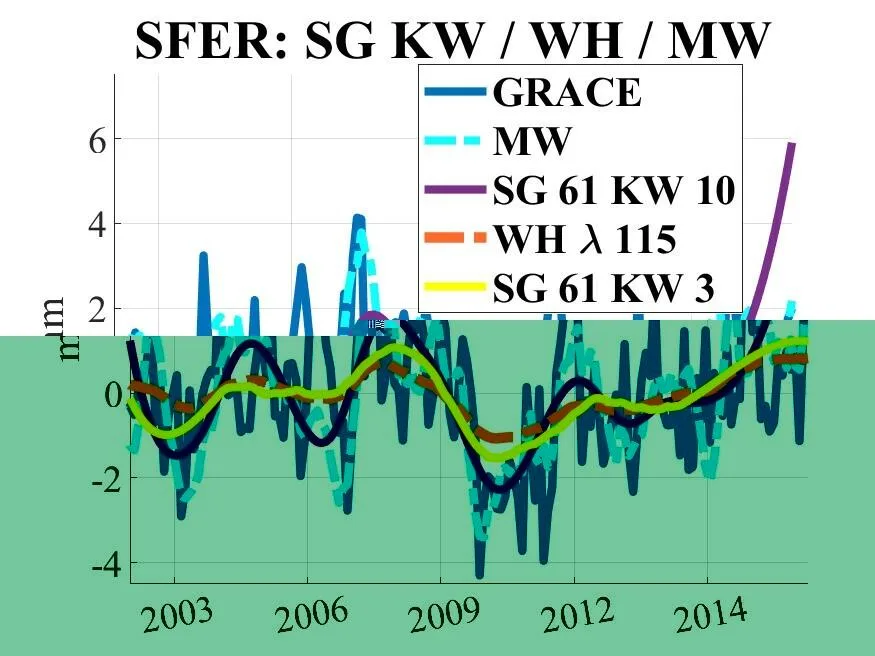
Previously, researchers thought that water-related changes couldn't be extracted from these records because there are too many disturbances: air pressure, ocean loading, and thermal expansion of rocks. But the scientists took data from 122 stations spanning 17 years, subtracted all the disturbances, and applied a special filter that preserves slow waves. Then they compared the results with what the GRACE satellite sees from orbit.
It turned out that in central Europe, ground stations and the satellite see the same thing. But near coasts and in mountains, the satellite goes blind, while ground stations continue to see details. For example, a station in Kyiv noticed the ground subsiding when snow and ice accumulated behind the Dnieper dam, and then rising when the water was released. The satellite did not see this.
Now these scales can be used to monitor droughts and floods in real time. Previously, GPS was considered suitable only for rapid movements, but now it is clear that it is excellent at weighing water.
The Savitzky–Golay filter used in this study was proposed back in 1964 for smoothing spectroscopic data, yet it remains one of the fastest and most reliable ways to extract slow trends from noisy series. In geodesy, it has been applied to seismic signals and self-potential anomalies, but for hydrospheric time series it was a novelty.