GPS-free navigation refers to methods of determining position and course without relying on the Global Positioning System or other satellite-based systems. Instead, these techniques use onboard sensors that measure physical quantities like acceleration, rotation, or local gravitational and magnetic fields. This matters because GPS signals can be jammed, spoofed, or simply unavailable in deep space, underwater, or inside buildings, so alternative navigation is critical for autonomous vehicles, submarines, spacecraft, and even some terrestrial robots.
History
Inertial navigation was developed in the mid-20th century for military applications, notably for submarines and missiles. Gravity-based navigation has been explored since the 1960s, but practical implementations have only become feasible recently with more sensitive sensors and better gravity maps.
How it works
Inertial navigation systems (INS) use accelerometers and gyroscopes to track changes in velocity and orientation from a known starting point, integrating these measurements over time to estimate position. Gravity-based navigation, on the other hand, compares local gravitational field measurements against a precomputed map of the Earth's gravity anomalies to infer location, much like matching a fingerprint. Some systems also use magnetic field variations or even seismic signals as natural 'beacons' for positioning.
In practice
Used in submarines for silent navigation, in spacecraft for deep-space missions where GPS is unavailable, and in autonomous vehicles for operation in GPS-denied environments.
Fun fact
Some animals, like sea turtles and birds, are believed to use the Earth's magnetic field for navigation, a natural analog to these sensor-based systems.
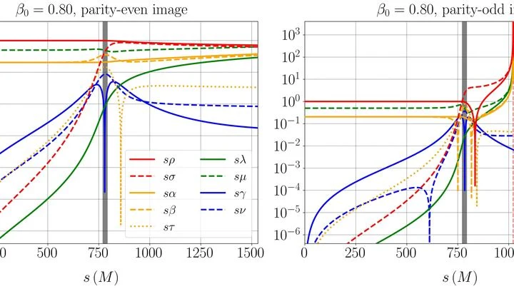
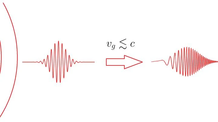
Light bends in a lens — everyone knows that. Gravitational waves passing a massive body also curve their path. But the authors of this work looked further: what happens to the wave's very "color" — its polarization, that is, the direction of oscillation?
Gravitational lensing is the deflection of…
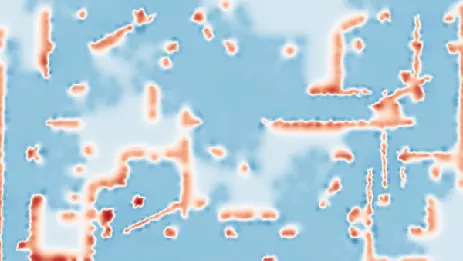
A group of robot explorers is like a team of cooks tasting the same dish. Each samples their own portion and shares an impression: clear, occupied, or uncertain. But tastes are subjective — one might miss a chair leg, another might only lick the edge.
At the heart of the system is a rail with clip-on antennas moving along it, each emitting a radio signal. The smartphone receives these and, knowing the speed of light, calculates the distance to each antenna from the time delay.
In calm water, the route is clear. But in turbulent flows, a robot needs a different strategy. Typical approaches demand an accurate map of currents, but in reality, you can't get one. Nature does it differently: fish feel pressure and vortices right against their bodies.
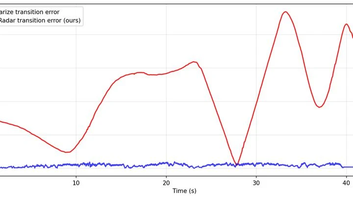
A regular radar works like an amateur photographer: it takes a series of blurry snapshots and tries to stitch them into a panorama. Details are smeared, and in a long corridor or crowd, the robot easily gets lost.
The principle is simple: like a bat, the radar emits a wave and catches the echo.
A person in a boat turns by shifting their body weight. An unmanned vessel uses the same trick: a sliding weight inside the hull does the steering. Its movement is controlled by a neural network, anticipating the chaos of waves and gusts of wind. The propeller pushes the boat forward, while the weight shifts balance — like moving from one foot to the other.
Two sensitive microphones are listening to the Universe. One hears a low hum, the other hears almost nothing. It's not a malfunction: it's about how they are oriented.
Gravitational-wave observatories like LIGO don't just catch loud bursts from black hole mergers.
Light passing near a massive body slightly changes its path — gravity pulls even on rays. In ordinary situations, a beam of light from a distant star is squeezed as if drawn together by an invisible rubber band. This property is called the null convergence condition: gravity makes light trajectories converge rather than diverge.
An invisible fence blocks the strait. You can't climb over it or dive under it: it's not made of steel, but of a stream of particles penetrating the water column. That's one way to describe the idea of detecting nuclear submarines by their antineutrino emission.
Imagine a mountain range where height represents an organism's fitness. Every point on the slope is a particular set of genes. Evolution climbs upward, but the terrain of this phylogenetic network landscape is cut by ridges and valleys.
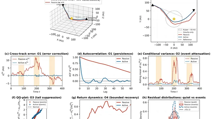
An icy rock is flying through the Solar System on an open trajectory — coming in from interstellar space, swinging around the Sun, and heading back into the dark.
A comet hurtling through space is a mountain of ice and dust that carries itself across the Solar System. If you mount small engines on such a mountain, it becomes a ship with its own fuel: gas from the interior can be vented through nozzles to change course.
A radiation sensor in the city is like a street musician: it has to hit the right notes even when fingers go numb from cold or the instrument is baked by the sun. Usually, such devices are kept in greenhouse conditions, with heating or cooling, otherwise the energy scale (which distinguishes harmless potassium in concrete from dangerous cesium) starts to lie.
In August 2017, gravitational wave detectors caught a signal from the merger of two neutron stars — the ultra-dense remnants of exploded stars. At that very moment, life on Earth was business as usual: planes were landing, cars were driving, and navigators were plotting routes.
A spring scale in a geologist's backpack responds sensitively to every mountain and valley beneath their feet. But springs get tired, and their readings drift — the instrument needs frequent recalibration against a reference. An atomic gravimeter measures gravity flawlessly, but it's the size of a refrigerator and doesn't like being jostled.
In a meeting room, an interpreter listens not only to the speaker but to the entire buzz of voices, catching who is looking at whom and who falls silent before an important remark. That's how SEA-ViT reads the ocean: it sees not isolated points from buoys but the whole current field at once, like a single conversation of water.
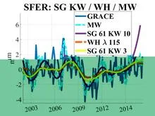
Imagine sensitive scales scattered across Europe. Each GPS station is one such scale, recording daily how much the ground beneath it has risen or fallen. When water accumulates underground, the surface sags slightly; when water leaves, the surface lifts. These movements are tiny, on the order of millimeters, but the stations pick them up.
Setting up an orchestra without a conductor: the algorithm itself decides which instruments (basis functions) and at what volume (weights) should play to reproduce Earth's gravitational symphony.