Earth Breathes Water: How GPS Stations Weigh Continents
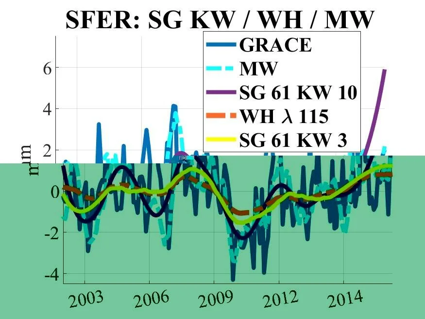
Imagine sensitive scales scattered across Europe. Each GPS station is one such scale, recording daily how much the ground beneath it has risen or fallen. When water accumulates underground, the surface sags slightly; when water leaves, the surface lifts. These movements are tiny, on the order of millimeters, but the stations pick them up.
It used to be thought that on timescales longer than a year, the GPS signal was too noisy to extract water-related changes. There are too many interfering contributions: atmospheric pressure, ocean tides, thermal expansion of rocks. But the authors decided to test what happens if you carefully subtract all these disturbances and apply a filter that preserves the shape of slow waves. They took data from 122 stations over 17 years and compared them with readings from the GRACE satellite pair, which measures Earth's gravitational field from orbit.
After cleaning, the correlation between GPS and GRACE in central Europe exceeded 0.6. That means both systems see the same thing: a slow change in water storage. But near coasts and in mountainous areas, the correlation drops to zero or even goes negative. The reason is that the satellite simply cannot distinguish details at those scales, while ground stations continue to see local effects.
A particularly striking example is the station in Kyiv. In 2010–2011, it recorded a sharp subsidence followed by an uplift. It turned out that snow and ice had piled up on the Dnieper dam, and then the water was released. GRACE missed this episode entirely. Another station in Paris showed a slow subsidence of the Paris Basin, which the satellite also failed to see.
Now these scales can be used for real-time monitoring of droughts and floods, especially in coastal areas where satellite gravimetry is unreliable. Previously, it was thought that GPS was only good for rapid motions and that slow water processes were beyond its reach. Now it is clear that with proper processing, it becomes a precise tool. And this is the first systematic test of such sensitivity over Europe.
The Savitzky–Golay filter used in this study was proposed back in 1964 for smoothing spectroscopic data, yet it remains one of the fastest and most reliable ways to extract slow trends from noisy series. In geodesy, it has been applied to seismic signals and self-potential anomalies, but for hydrospheric time series it was a novelty.