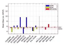
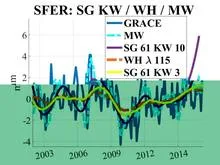
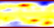
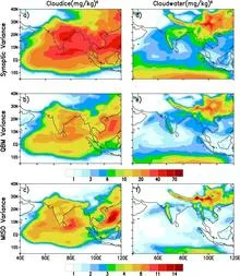
The Global Precipitation Climatology Project monthly product: satellites and rain gauges merged on a 2.5° grid over land and ocean since 1979, in millimetres per day.
The Global Precipitation Climatology Project (GPCP) is an international effort to produce a long-term, global record of rainfall. It merges data from many satellite sensors and ground-based rain gauges into a single monthly dataset on a regular grid. The result is a consistent estimate of how much rain (or snow, expressed as liquid water) falls over every part of the planet, including oceans where gauges are scarce.
History
GPCP was established in 1986 under the World Climate Research Programme to address the need for a global precipitation climatology, with the first multi-year products released in the 1990s.
How it works
Satellites estimate precipitation indirectly—for example, by measuring microwave emissions from raindrops or infrared cloud-top temperatures. Each method has biases. GPCP combines these satellite estimates with gauge measurements using statistical techniques that weight each source by its reliability in a given region and time. The merged product is then averaged onto a 2.5° latitude–longitude grid for each month.
In practice
GPCP data are used to validate climate models, monitor droughts and floods, study the global water cycle, and calibrate other satellite rainfall products.
Fun fact
Because rain gauges cover only about 20% of Earth's surface, satellites are the only way to measure precipitation over the vast oceans, which receive most of the planet's rainfall.
The Sun breathes, and that breath has a magnetic rhythm. Every 27 days, the visible surface of the star makes a full rotation, and with it, its magnetic field, like an invisible ribbon wrapped around the star.
From 1987 to 1991, astronomers last measured how Jupiter's icy moons reflect radio waves. Then came a long pause. In 2011–2024, researchers aimed a radar beam at Europa again: this time using the 70-meter antenna at Goldstone and the Green Bank Telescope.
Ice is nearly transparent to radio waves, like clear window glass is to light.
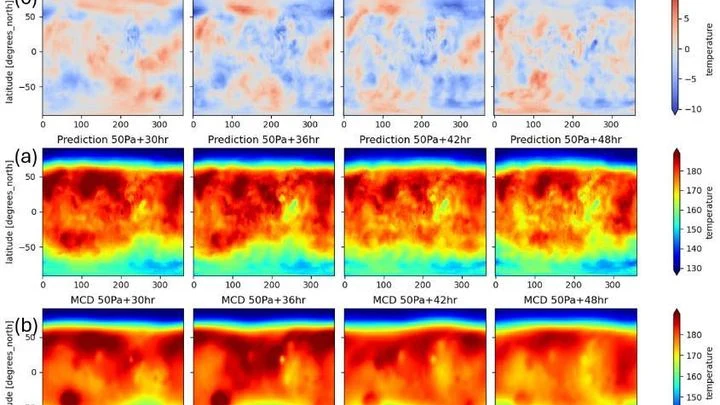
Meteorologists have grown used to trusting neural networks: the GraphCast model predicts Earth's weather days ahead by drawing on global snapshots of the atmosphere. But this 'brain' can be transplanted to another planet — where the air is thin and the Sun warms differently.
14 seconds. That’s all it takes for a new code to weave the full spectrum of a star, from ultraviolet to near-infrared. This spectrum is not just a rainbow but a detailed tapestry of thousands of dark absorption lines, each left by a specific atom in the star's atmosphere.
For decades, global atmospheric models resembled artists forced to paint planetary storms with coarse brushstrokes: a resolution of 25–100 km forced them to 'guess' convection through approximate schemes, introducing systematic errors in rainfall and climate forecasts.
Imagine a philharmonic orchestra playing, but the microphone picks up only a blended roar — a tutti where double basses, flutes, and timpani all merge. Physicists have grappled with a similar task for decades, staring at fields of density, temperature, or magnetic induction.
Gravity satellites have noticed that Earth's gravity field breathes imperceptibly with a period of about six years. It's as if an invisible pendulum swings the planet from within, and every six years the scale's needle shifts slightly. The signal turned out to be so clean that it could be separated from the noise of oceans and melting glaciers.
In the quiet of a laboratory, a graphite flake hovers above a magnetic grid. This is not just a demo of diamagnetism's magic — it's listening to the Universe. Like a spider casting its web to catch vibrations from an invisible world, this flake has become a gravitational web.
A mosaic of large colored tiles. Each tile is the average precipitation over an entire month for an area the size of a small country. For a general understanding, the picture is fine, but if you need to know whether a downpour hit a specific city yesterday, it's useless.
Drylands are like skin cracking from dehydration. When rainfall decreases, plants don't vanish overnight: they rearrange, leaving bare patches of soil between them. These patterns are visible even from space.
Scientists compared satellite images of eight arid regions, from the Sahel in Africa to Australian deserts.
The heart beats steadily, then slips into arrhythmia. The climate holds its familiar rhythm for decades, then shifts to a new state over a single summer. Such regime shifts are like a flick of a switch, but in real data we see only a noisy one-dimensional signal in which the moment of the break is hidden.
The Sun pulses in a slow rhythm, and that rhythm can be heard in the rains over Brazil. Sunspots on the solar disk thicken and thin roughly every eleven years, and along with them, pressure in the Pacific Ocean shifts, sea surface temperatures change, and then rainfall amounts in the northeast of the country follow suit.
The atmosphere is a chaotic system, and a detailed global forecast requires monstrous computing power. StretchCast sidesteps this by working like the human eye: it creates 'sharp vision' over a selected region with an ultra-fine grid, while seeing the rest of the world blurry, but sharp enough to capture global connections.
The Sun is not a perfectly steady lightbulb. Its brightness quivers slightly: it dims a bit, then brightens. For Earth's climate, even slow variations stretched over thousands and millions of years matter. They could have left their mark in the geological record of the last 540 million years.
Astronomer [scientist:A. M.
A radiation sensor in the city is like a street musician: it has to hit the right notes even when fingers go numb from cold or the instrument is baked by the sun. Usually, such devices are kept in greenhouse conditions, with heating or cooling, otherwise the energy scale (which distinguishes harmless potassium in concrete from dangerous cesium) starts to lie.
In the 1940s, long before modern sensors, instruments on Earth were already catching particles from space. When a powerful flare erupted on the Sun, it ejected a stream of charged particles — solar energetic particles.
A spring scale in a geologist's backpack responds sensitively to every mountain and valley beneath their feet. But springs get tired, and their readings drift — the instrument needs frequent recalibration against a reference. An atomic gravimeter measures gravity flawlessly, but it's the size of a refrigerator and doesn't like being jostled.
A student learned physics from a textbook and is taking an exam. The first two problems are solved brilliantly, but on the third, they err on something not covered in the book. That is roughly what the hybrid atmospheric model NeuralGCM faced when run through three levels of testing: cyclones, El Niño, and anomalous warming.
Earth's magnetic field is like an invisible river that meanders beneath our feet. Navigators and geologists rely on maps of this river, but instruments only take readings at scattered points, leaving blank spots in between. Filling those gaps is like trying to sketch the river's course from a few pebbles found on the bank.
Old Chinese chronicles are full of weather entries: "no rain in the third month," "the river overflowed its banks." But these are words, not numbers. Until now, turning them into precise precipitation data was nearly impossible.
The new approach works like a translator from the language of chronicles to the language of climatology.
A solar flare is like a shot from a giant cannon: it blasts a stream of charged particles into space. When that stream reaches Earth, the planet's magnetic field usually deflects it, but in polar regions, particles penetrate the atmosphere.
In a field stands a tank of water that usually catches particles from space. Now it keeps an eye on how much moisture is in the soil underfoot. The water in the tank acts as a trap for neutrons — tiny particles that fly out of the soil when cosmic rays hit it. The drier the ground, the more neutrons escape, and the more often the tank registers them.
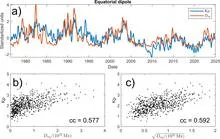
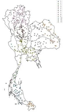
Tuning an old radio receiver requires patience: you slowly turn the dial, catch a crackle, turn it again, until a voice emerges through the static. In much the same way, a reinforcement learning agent searched the ocean for two patches whose temperature difference best predicts rains in Thailand.
Rain doesn't fall just any old way. If you take records from nearly fifty thousand rain gauges scattered across the globe and compare how much water falls on a rainy day in different parts of the planet, you'll spot a surprising pattern.
A bus schedule drifts: if you don't check it, you'll miss your ride. Planets around other stars have the same problem – their crossings of the star's disk gradually shift. The ExoClock project pooled 30,000 observations from Earth and space to refine the schedule for 620 distant worlds. For 45% of the planets, transits were found to be off by hours.
An orchestra of two musicians plays from the same score, but each hears only their own line. The atmosphere and ocean in a climate model resemble such a duet: they exchange heat and moisture every few hours, yet until recently their neural network counterparts could not keep a common rhythm.
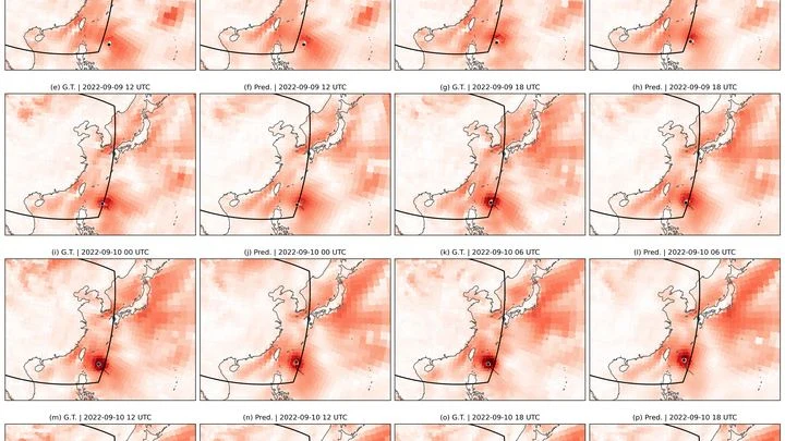
Over warm ocean waters, air rises, spins, and turns into a giant vortex that carries winds faster than a race car. For such a vortex to form, several conditions must align: rotation, heat, moisture, and calm winds aloft. Previously, meteorologists combined these conditions into complex indices, like a kitchen recipe with a dozen ingredients.
In February 2022, the eastern coast of Australia was hit by rains that lasted several days in a row. Water inundated towns in Queensland and New South Wales, insurers paid out 3.35 billion dollars, and the flood became the costliest in the country's history.
Every year, the same drama unfolds over West Africa: from June to September, the sky fills with moisture and releases rains that determine the harvests of millet, sorghum, and maize. This rainy season is driven by the West African monsoon, a giant atmospheric pump that pulls moist air from the ocean deep into the continent.
Imagine sensitive scales scattered across Europe. Each GPS station is one such scale, recording daily how much the ground beneath it has risen or fallen. When water accumulates underground, the surface sags slightly; when water leaves, the surface lifts. These movements are tiny, on the order of millimeters, but the stations pick them up.
In the mountains, an echo repeats any shout, and you can't immediately tell who shouted: a person or the wind. That's roughly how climate scientists work when they try to understand why an unusual heat wave or drought happened. They look for a human fingerprint in a weather disaster, but nature has its own voices that can sound similar.
Setting up an orchestra without a conductor: the algorithm itself decides which instruments (basis functions) and at what volume (weights) should play to reproduce Earth's gravitational symphony.
The orchestra of world weather is playing a tune we didn't expect. The first violin is not carbon dioxide but chlorofluorocarbons—gases that until recently hid in refrigerators and aerosol cans. They trap heat ten thousand times more effectively than CO₂, and for decades they have been quietly warming the planet.
Every summer, a giant atmospheric engine unfolds over India: moist ocean winds bring the rains that sustain crops and the lives of two billion people. But this engine sputters, and forecasting it a season ahead remains elusive. Models give only rough answers, and a monsoon forecast error can cost millions of tons of food.
Soil breathes. The top layer of the earth takes in moisture after rain, then releases it into the air, much like lungs inhale and exhale. This inhalation and exhalation happens everywhere on the planet, but its rhythm is not uniform: in some places it is fast and steady, in others irregular and deep.
Imagine a house of cards where each card supports the others. One wobbles, and the neighbors start to lean. Earth's climate system works similarly: ice sheets, ocean currents, tropical forests, all are connected. If one element crosses a threshold, it can drag the rest down with it.
Every June, the sky over India fills with moisture, and how much falls determines rice harvests, water reserves, and food prices for a billion people. But predicting the monsoon's strength in advance was like guessing someone's mood from a single photo: too many hidden springs.
The coast works like a conductor: it doesn't create the music, but it sets the rhythm and direction. Every morning, the sun heats the land faster than the sea, and warm air rises over the sand, pulling in a moist breeze from the ocean. By evening, the land cools and the wind reverses. This daily pendulum lines up clouds along the water's edge, like musicians following the baton.
In 2008, drought hung over South America. Rivers shrank, pastures yellowed, and farmers stared at the sky waiting for rain that never came. Meanwhile, 450 kilometers above, two satellites flying 220 kilometers apart continued their invisible work: they were weighing the continent.