A Hurricane Thermometer: A Simple Way to Know Where They'll Form ✛
A hurricane is like a giant funnel of wind and rain that forms over warm ocean waters. For that funnel to spin up, several ingredients are needed at once: warm water, moist air, rotation, and calm winds aloft. In the past, scientists measured each ingredient separately and combined them into a complex formula. But the formulas disagreed with each other: one said hurricanes would become more frequent, another said less.
Now, a thermometer has been devised. It shows a single number: the "ventilated intensity potential." It's like measuring body temperature: if it's high, a person might get sick, and if it's low, they won't. Here, it works the same way: if there's too much dry air, it smothers the hurricane, like a blanket smothering a fire, and the thermometer reads zero. That means a hurricane won't form there.
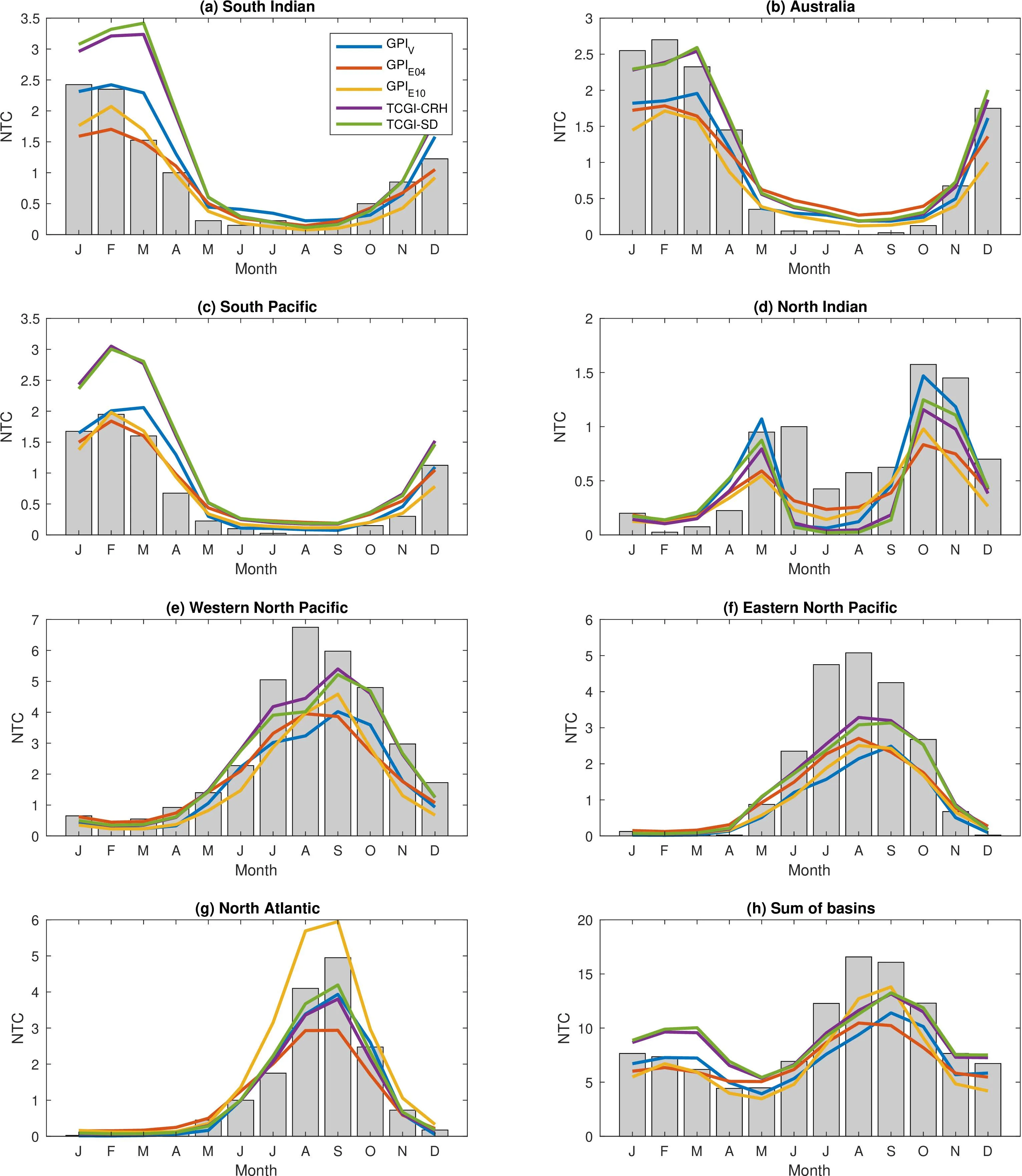
The second number on the thermometer is the rotation of the air. It's amplified several times to show how important spin is. Combined with the potential, you get a number that tells you how many hurricanes could form in that part of the ocean. The scientists tested the thermometer against forty years of data. It correctly shows that hurricanes are more frequent during hurricane season, and during El Niño they shift toward the Pacific Ocean.
In the future, as the climate warms, the thermometer will rise. By the end of the century, conditions in the Atlantic will become more favorable by more than half. This means hurricanes could appear where they never did before, for instance, closer to the poles. Such a simple thermometer could help people on coastlines prepare for danger in advance.
Ventilation potential intensity drops to zero when the ventilation index exceeds a threshold of 0.145, creating a sharp boundary between regions favorable and unfavorable for cyclones, something previous indices lacked.