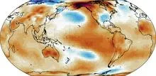
The relative Oceanic Niño Index (relative ONI) is a climate metric that adjusts the standard Oceanic Niño Index (ONI) for the background warming trend of the tropical oceans. The standard ONI measures sea surface temperature anomalies in the central Pacific to identify El Niño and La Niña events, but it uses a fixed baseline that does not account for long-term climate change. As the tropics warm overall, the standard ONI can show warmer-than-average conditions even when the ocean is not behaving like a typical El Niño. The relative ONI subtracts the tropical mean sea surface temperature anomaly from the standard ONI, isolating the part of the temperature signal that is tied to natural year-to-year variability rather than to the slow drift of global warming.
How it works
The standard ONI is computed as the difference between the observed sea surface temperature in the Niño 3.4 region (a rectangle in the central Pacific) and a 30-year average. The relative ONI takes an additional step: it first calculates the average sea surface temperature anomaly across the entire tropics (or a broad tropical band) for the same period, then subtracts that tropical mean anomaly from the standard ONI value. This removes the common warming signal that affects the whole tropical ocean, leaving only the spatial pattern of warm or cool anomalies that distinguishes El Niño from La Niña.
Because the tropical mean warming is subtracted, the relative ONI can indicate a La Niña-like state even when absolute sea surface temperatures in the central Pacific are still above the historical average.
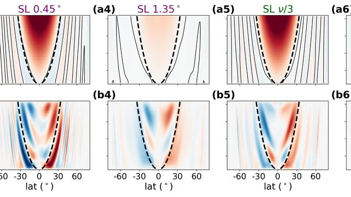
In the deep oceans of icy moons, water is not still. Warm plumes rise from the rocky seafloor, but the planet's rotation twists them into long, slanted rolls stretched along the rotation axis. Previously, this process could not be included in global models: it was too complex.
Every winter, the tropical Pacific Ocean seems to replay the same script: sea surface temperatures off the coast of Peru rise, trade winds weaken, and a wave of droughts and floods spreads across the planet. This is El Niño, and its peak almost always falls in December. Why winter in particular?
A tuning fork produces a pure tone, but if you strike it too hard, it starts to rattle, and a musician might mistake that rattle for complexity in the sound.
The open ocean is a vast basin where almost no one measures the wind directly. Fixed platforms are rare and expensive, and satellite scatterometers, instruments that probe the surface with radar, need ground truth for calibration. Coastal zones have such data, but far from shore, there's a void.
Deep underground, in the thickness of granite, detectors catch rare visitors from space — muons. These particles are born high in the atmosphere when cosmic rays slam into air nuclei. They make it to the underground lab thanks to their enormous speed, close to the speed of light.
Two observers watch the Pacific Ocean. One studies surface heat maps, the other listens to the rhythm of temperature and heat stored in the water column. On their own, each notices only part of the picture, but together they can sense the approach of El Niño months before the warm current alters weather across the planet.
The ocean does not shout about its intentions. It whispers: a warm patch off the coast of Peru, a cold tongue near Hudson Bay, a barely perceptible shift in a current. The atmosphere does not respond immediately, and by winter Europe may get either mild slush or Siberian frosts.
Two pendulums hang on the same wall, swinging out of sync, but suddenly they move as one, only with an 18-month delay. One pendulum is the Indian monsoon, the seasonal wind that brings rain to South Asian farmland. The other is the deep water of the tropical oceans, which slowly accumulates heat and remembers it for years.
Imagine a radiator in a room: it heats up, but if its surface is clogged with dust, heat escapes less efficiently. Something similar is happening to our planet. Earth receives energy from the Sun and must radiate the excess back into space, otherwise temperatures rise. Scientists call this ability to shed excess heat radiative feedback.
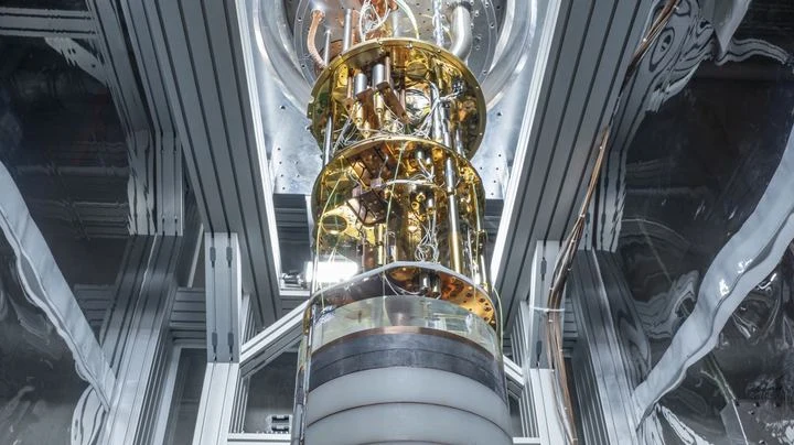
In a dark chamber where the temperature sits just four degrees above absolute zero, a sapphire crystal the size of a grain of rice lies waiting. When a neutrino, a ghostly particle that barely notices matter, flies through it, the crystal shudders and warms by a tiny fraction of a degree.
Every few years, the Pacific Ocean off Peru warms so abruptly that fish disappear and rains flood the desert. This phenomenon is called El Niño, and it acts like a pendulum that swings the planet's climate. But when the planet itself warms, the pendulum behaves strangely: first its swing widens, then it suddenly fades.
The bronze plates of a gamelan do not sound according to a single tuning standard: each orchestra on Java keeps its own tuning, and two neighboring ensembles may play the same melody in slightly different intervals.
Two barometers hang on the wall. One reads clear, the other says partly cloudy. Which weather do you trust? That is roughly the question facing a group of climate scientists when two independent methods predicted different futures for the Pacific Ocean in 2026.
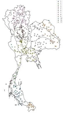
Tuning an old radio receiver requires patience: you slowly turn the dial, catch a crackle, turn it again, until a voice emerges through the static. In much the same way, a reinforcement learning agent searched the ocean for two patches whose temperature difference best predicts rains in Thailand.
In 1997, the Pacific Ocean warmed so much that corals bleached from Indonesia to the Galápagos, and floods and droughts swept across five continents. Such events, which climate scientists call extreme El Niños, occur every few decades, and to understand how often they will arrive in the future, we need thousands of years of observations.
A warm ocean off the coast of Peru can make winter in Moscow unusually mild. Climate scientists call these invisible threads that link weather in distant corners of the planet teleconnections. For a long time, they were thought of as something like permanent wiring: the signal sources may pulse, but the wires themselves lie still.
The Pacific Ocean is like a giant swing: warm water piles up in the west, then slides toward the east, and the temperature off the coast of South America jumps. Such warm years are called El Niño, and cold ones La Niña. But the swing doesn't move on its own: it's pushed by the wind.
A camera on a tripod shoots the same landscape for decades. If you don't touch the lens, the images get hazy: the landscape changes, but the focus stays put. That's roughly how climate norms work. According to World Meteorological Organization rules, they are calculated as the average over the last 30 years.
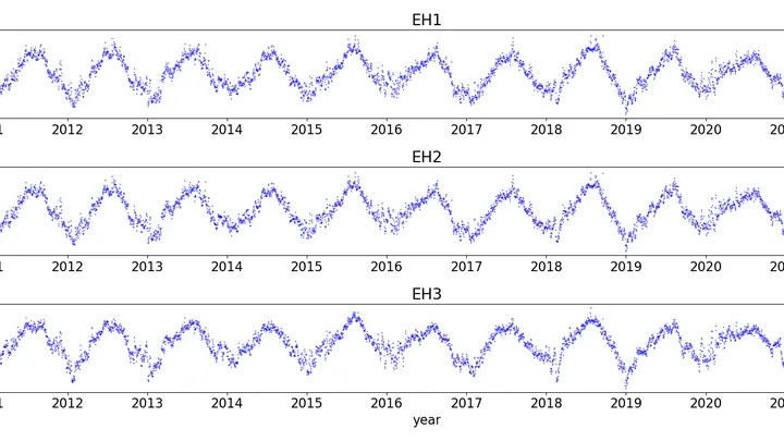
A team of forty forecasters prepares an El Niño forecast two years ahead. Each works with the same model but slightly different initial conditions and settings, so their outputs diverge. Typically, forecasting centers average all forty opinions, assuming each member is equally useful.
A translator that learned the grammar of the wind, not just the vocabulary. The wind blows over the Pacific, and the water responds with waves, currents, and upwellings of cold depths. The KIST-Ocean neural network was taught not just to memorize how the ocean looked yesterday, but to understand why it will become what it is tomorrow.
In May 2024, thermometers in Jalisco seemed to go haywire: on May 10, one station recorded 38.4°C, nearly matching the historical maximum from 1994. The heat was so intense that even agave plants, accustomed to scorching conditions, slowed their growth. And the rains, which usually arrive in June, were delayed, leaving farmers nervously glancing at the sky.
You can sit on a seesaw and pump your legs, or you can just tip from one side to the other. The Pacific Ocean does both. Every few years, warm water off the coast of Peru gives way to cooler water, and rainfall patterns, winds, and entire ecosystems across half the planet reshuffle. These shifts are called El Niño and La Niña, together known as ENSO: Earth's climate seesaw.
Picture a pendulum hanging in a room with drafts. Sometimes a gust pushes it harder, sometimes softer. If the pendulum barely loses energy, it will swing long and steady. But if friction is strong, each push quickly fades, and the motion becomes jerky: a sharp swing, then a long sway. That's exactly how the tropical Pacific behaves when the heat of El Niño gives way to the cold of La Niña.
From July 2023 to July 2024, Earth's atmosphere gained carbon dioxide at a rate of 3.66 parts per million per year. That is the fastest pace since 1979. The reason is not that factories and cars suddenly started emitting more CO₂. The planet's lungs—forests and soils—took a shallower breath.
The planet breathes through its green cover.
The Pacific Ocean breathes. Every few years, its warm western "lung" exhales eastward, and from Peru to Indonesia, rains, droughts, and hurricanes shift. This breath is called El Niño–Southern Oscillation, or ENSO.
An interpreter in a conference room hears not just words but intonations, pauses, and gestures. From these cues, they anticipate where the conversation will turn. The Pacific climate speaks the language of wind, heat, and currents, and PTSTnet listens like an experienced simultaneous interpreter, grasping the grammar of ocean and atmosphere.
The Pacific Ocean, ten thousand kilometers wide, breathes: warm water shifts eastward, cold water retreats, and this in-and-out repeats every few years. A model that captures this breathing takes weeks of computation even on a supercomputer.
The Pacific Ocean is a giant network of nerve endings that warns of an impending attack a year in advance. In 2023–2024, El Niño, the warm phase of the Pacific climate oscillation, pushed global temperatures to record highs. Now, two independent methods, like two doctors examining the same symptoms, agree: no new attack in 2025.
An experienced navigator steers the ship by a well-tested chart, but in unfamiliar waters the chart lies. A cabin boy who has watched the navigator err for years learns to anticipate where the chart will fail. Together they plot a course more accurately than either could alone.
The tropical Pacific breathes in two rhythms. One lasts several years: the water off the coast of Peru warms and cools, which fishermen call El Niño. The second rhythm is fast: every month or two, a giant cloud wave is born over the warm waters of the Indian and Pacific Oceans, creeping eastward at a runner's pace and dying out near South America.
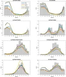
Each Atlantic hurricane season is like a game of dice, where the number of spots depends on three major climate forces: El Niño, ocean temperature in the 'hurricane nursery,' and the North Atlantic Oscillation.
When the Pacific off the coast of Peru heats up, the planet's familiar weather map goes haywire: droughts in some places, floods in others. That's El Niño, and it costs the global economy trillions of dollars. Scientists have long been able to predict it, but now, for the first time, they are testing whether it can be weakened while it's still developing.
Two dancers stand facing each other but cannot see each other's faces. One is the atmosphere, fast and noisy, forgetting its moves after just a couple of weeks. The other is the ocean, slow and heavy, remembering every touch for months. For the dance to work, they need to learn to lead each other while only looking at their partner's hands.
An artist painting the ocean does not limit themselves to two colors: warm and cold. Likewise, climatologists studying El Niño increasingly speak of a whole palette of shades. El Niño is a warm current off the coast of Peru that, every few years, alters weather across the planet. Its counterpart, La Niña, brings cold.
In the summer of 2023, thermometers around the world registered numbers that even the boldest forecasts had not anticipated. The planet's average temperature rose to 1.48°C above pre-industrial levels, a jump of 0.17°C that broke the previous record as if the climate had suddenly shifted gears.
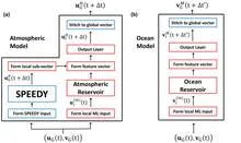
A translator at an important negotiation starts by simply repeating words, but gradually begins to anticipate what the counterpart will say. The new weather model works similarly: physics provides the framework, and machine learning learns from errors and fills in the gaps.
Water remembers. Every current, every eddy, every degree of temperature in the ocean's depths does not vanish without a trace; it leaves a mark that can be read. But until recently, that mark was read only by bulky physical models that spent weeks on supercomputers and still got the details wrong.
In the summer of 2022, the sky over western India seemed to have forgotten about drought: rains fell more often than usual, while eastern states languished in dryness. Such an imbalance puzzled forecasters, because ocean currents in the Pacific had promised a steady, abundant monsoon across the country.
Over warm ocean waters, air rises, spins, and turns into a giant vortex that carries winds faster than a race car. For such a vortex to form, several conditions must align: rotation, heat, moisture, and calm winds aloft. Previously, meteorologists combined these conditions into complex indices, like a kitchen recipe with a dozen ingredients.
Every few years, the Pacific Ocean changes its character. Sometimes it warms up off the coast of South America, which is called El Niño, and sometimes it cools down, bringing La Niña. For someone on the other side of the planet, this is not just a weather report item. The ocean acts as a conductor, setting the tempo for heat and drought over Eurasia.