A Hurricane Thermometer: How One Metric Can Predict Their Numbers ✛
Over warm ocean waters, air rises, spins, and turns into a giant vortex that carries winds faster than a race car. For such a vortex to form, several conditions must align: rotation, heat, moisture, and calm winds aloft. Previously, meteorologists combined these conditions into complex indices, like a kitchen recipe with a dozen ingredients. But the recipes contradicted each other: some said that with climate warming, hurricanes would become more frequent, others that they would become less so.
The new index works like a thermometer. Instead of measuring temperature, humidity, and wind shear separately, it shows a single quantity: the 'ventilated potential intensity.' This is the maximum wind speed a cyclone can achieve, adjusted for dry air that suffocates the vortex, much like a blanket smothers a fire. If there is too much dry air, the potential drops to zero, and the thermometer reads zero: no hurricane will form here.
The second component of the index is the rotation of air, accounting for Earth's rotation. It is raised to a power of about five to amplify the role of spin. Together with the potential, this yields a number that indicates how many cyclones could form at each ocean location. The exponent was chosen so that, on average, the planet would see 84.6 cyclones per year, exactly the number observed in reality.
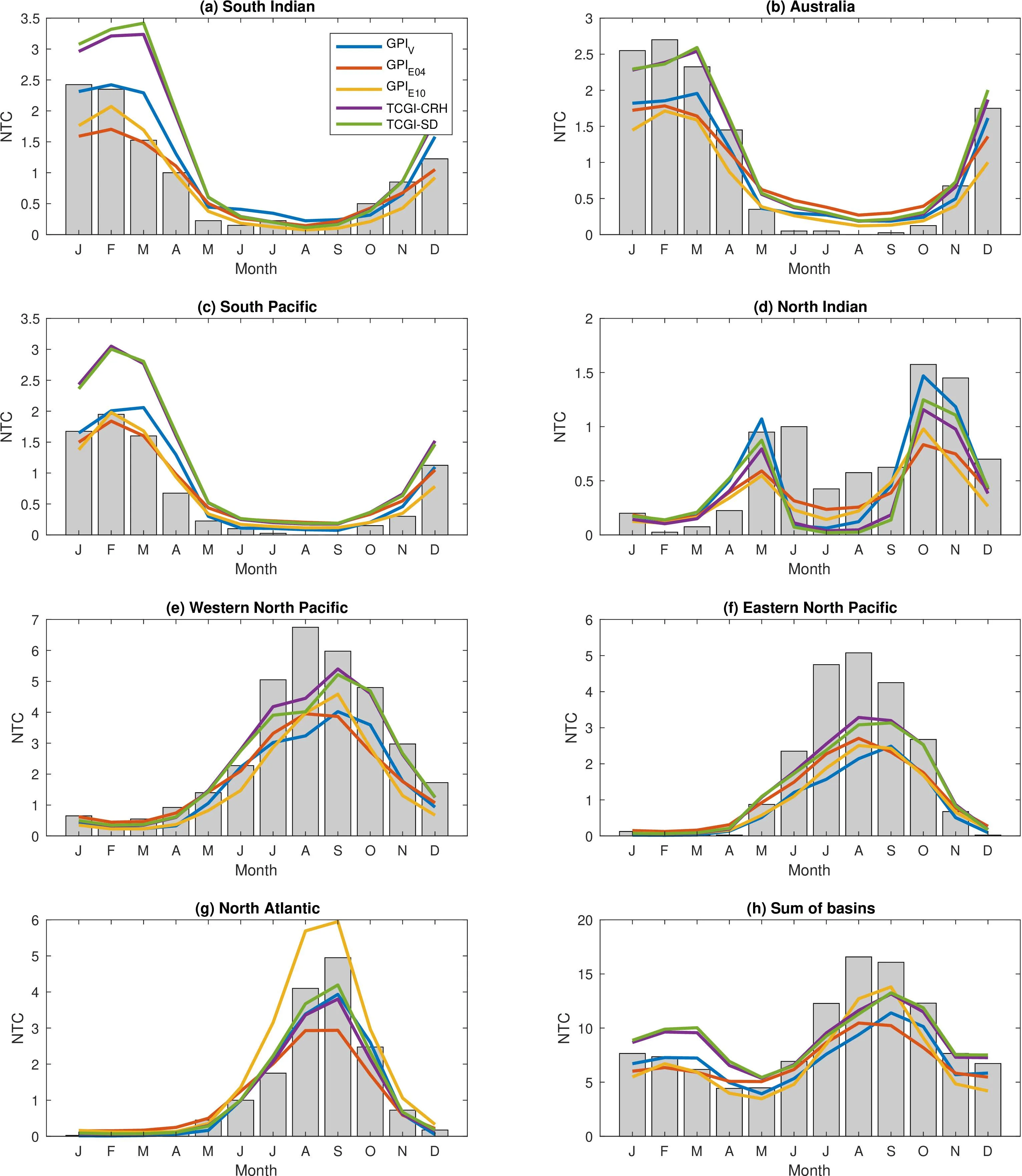
The index was tested against forty years of data and climate models. It correctly shows that during the Atlantic hurricane season, more vortices form, and during El Niño, their number shifts to the Pacific Ocean. In the future, according to projections, the thermometer will rise: by the end of the century under strong warming, the favorability of conditions will increase by 61.6% in the Atlantic and by 60.4% in the eastern Pacific. Meanwhile, changes in the tropics are barely noticeable, but in the subtropics and high latitudes, hurricanes may become possible where they never occurred before.
Such a thermometer is not just for show. Insurance companies, port authorities, and coastal residents want to know where to expect trouble thirty years from now. Previously, the answer depended on which index you chose. Now there is a simple tool with clear physics: dry air kills the vortex, while warm, moist ocean feeds it. And this tool says: as the climate warms, there is more fuel for hurricanes.
Ventilation potential intensity drops to zero when the ventilation index exceeds a threshold of 0.145, creating a sharp boundary between regions favorable and unfavorable for cyclones, something previous indices lacked.