Mars Close-Up: Thermal Maps at 12 Meters express
Warm rock and cold sand cool at different rates at night. An instrument orbiting Mars measures this heat, revealing whether the surface is loose dust, a dense crust, or solid rock. But thermal images have a resolution of 100 meters per point: an entire football stadium fits into a single pixel. Fine details (the beds of ancient streams, the edges of lava flows) are simply invisible.
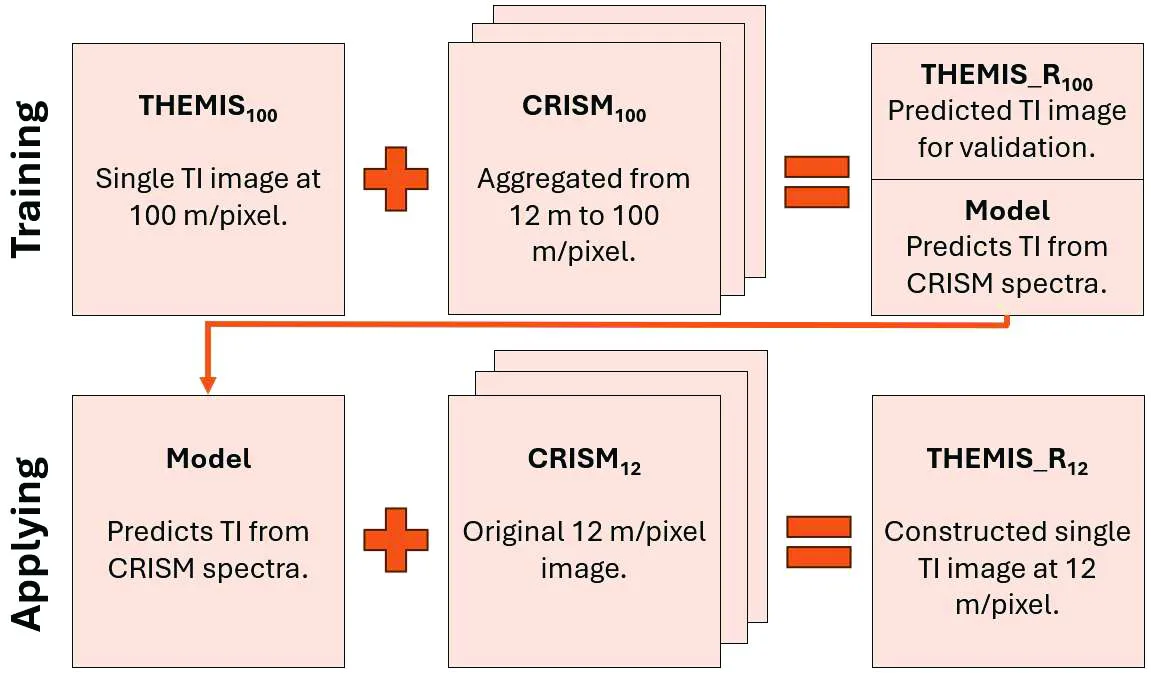
Another instrument takes color images at 12 meters per point, but it doesn't sense heat; it only sees how the surface reflects sunlight. Scientists fed the computer thousands of pairs: a color image and a thermal map of the same spot. The computer found a link between color and heat, like an experienced geologist who can tell from a rock's shade how quickly it will cool at night.
Now, you can take a color image of any region of Mars and generate a thermal map with 12-meter cells. That's eight times finer than before. On the new maps, stripes and patches the size of a house have emerged — previously they blended into a uniform background.
Such details matter not only for science. A future Martian base needs a flat, stable site without quicksand-like dust. A thermal map can show where the ground is firm and where it's loose dust that could bog down equipment. It can also reveal where water might be easier to extract from minerals — if you know what a slope is made of.
The difference between day and night temperatures on Mars can reach 80 degrees. Thermal inertia is how quickly a surface cools: rock holds heat longer than dust.
In Andy Weir's novel The Martian, the astronaut picks his camp spot by eye. The new thermal map would have made that choice more precise, and might have saved him a few sols.