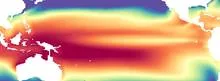
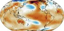
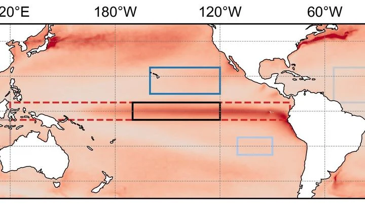
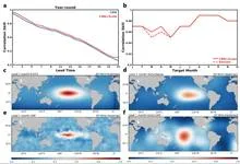
This dataset matters because it is the foundation for the official Oceanic Niño Index (ONI), the standard measure used to declare El Niño and La Niña events. When forecasters say the equatorial Pacific is 0.5°C warmer than average, that number comes from ERSST. Beyond El Niño, the dataset is a key tool for tracking global warming, ocean heat content changes, and decadal climate patterns like the Pacific Decadal Oscillation. It lets researchers ask questions like 'How unusual was this year's ocean warmth compared to the 20th century?' with confidence that the answer reflects real climate, not artifacts of changing measurement technology.
History
ERSST was developed in the early 2000s by scientists at the U.S. National Oceanic and Atmospheric Administration (NOAA), led by Thomas Smith and Richard Reynolds, building on earlier work by Reynolds and others who had created similar datasets for shorter periods. The first version was released in 2002, with subsequent updates (ERSST.v3, v4, v5) refining the bias corrections and extending the record.
How it works
ERSST works by taking all available sea surface temperature observations for a given month and averaging them onto a regular global grid (currently 2° by 2°). The reconstruction step uses a statistical technique called Empirical Orthogonal Teleconnections, which exploits the fact that ocean temperatures in different regions tend to vary together in predictable patterns. If a region has no measurements in a particular month, the algorithm estimates its temperature by looking at how that region historically correlates with nearby regions that do have data. The process also applies corrections for known biases, such as the warm bias in engine-room intake readings compared to bucket samples, and adjusts for the changing mix of measurement types over time.
In practice
ERSST is used operationally by NOAA's Climate Prediction Center to compute the ONI for El Niño/La Niña forecasts, and by climate researchers worldwide to study ocean temperature trends, validate climate models, and attribute extreme weather events to ocean conditions.
Fun fact
The earliest ERSST measurements come from 1854, when sailors recorded the temperature of water hauled up in wooden buckets, a method so crude that a single measurement could be off by more than a degree Celsius.
The merger of two neutron stars is not just a collision. Even before they touch, they deform each other through tidal forces, and this deformation depends on how 'soft' or 'stiff' the matter inside is. Stiff matter resists more; soft matter changes shape more easily.
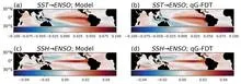
Every year, as December approaches, the water off the coast of Peru becomes anomalously warm or anomalously cold. This is El Niño and La Niña, two phases of the same climate pendulum that swings in the equatorial Pacific. The pendulum is not a simple one: it remembers what happened to it several months earlier, and this memory determines which way it will swing next.
A student who has spent years solving problems from other people's textbooks suddenly receives three notebooks with real ocean observations. There are few problems, but they have already seen hundreds of similar ones, and now a couple of examples suffice to catch the new teacher's style.
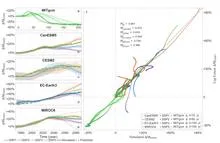
In 1991, Mount Pinatubo erupted with such force that it blanketed the planet in a thin veil of ash and gases for years. That veil, like a blanket on a hot night, trapped heat and cooled the ocean surface, causing tropical sea surface temperatures to dip. This event marks the start of a detective story about why some oceans are spawning ever more ferocious hurricanes while others remain calm.
Every winter, the tropical Pacific Ocean seems to replay the same script: sea surface temperatures off the coast of Peru rise, trade winds weaken, and a wave of droughts and floods spreads across the planet. This is El Niño, and its peak almost always falls in December. Why winter in particular?
A tuning fork produces a pure tone, but if you strike it too hard, it starts to rattle, and a musician might mistake that rattle for complexity in the sound.
In the Pacific Ocean, there is a warm current that flows eastward against all the others. It is called the North Equatorial Countercurrent, or NECC. In normal years, this band of warm water, a few hundred kilometers wide, quietly carries heat from Indonesia toward the Americas.
An orchestra plays in a dark hall, and the listener hears only a hum: hundreds of instruments blend into a dense noise in which no melody can be discerned. That is roughly what spectra extracted from climate data by methods like the Koopman operator look like: hundreds of components, each with its own frequency, and it is unclear which ones are true musicians and which are the rattling of chairs.
A giant musical instrument hides underground. It picks up not sound but the trembling of space itself — gravitational waves from the mergers of dead stars. But this instrument has a problem: it is bothered by Earth's 'breathing.' Winds, storms, even the changing seasons make the ground vibrate, creating noise.
Warm rock and cold sand cool at different rates at night. An instrument orbiting Mars measures this heat, revealing whether the surface is loose dust, a dense crust, or solid rock. But thermal images have a resolution of 100 meters per point: an entire football stadium fits into a single pixel. Fine details (the beds of ancient streams, the edges of lava flows) are simply invisible.
Two observers watch the Pacific Ocean. One studies surface heat maps, the other listens to the rhythm of temperature and heat stored in the water column. On their own, each notices only part of the picture, but together they can sense the approach of El Niño months before the warm current alters weather across the planet.
A barometer on Tahiti and one in Darwin, Australia, breathe in opposite phases. When pressure rises on one, it falls on the other, and this difference, known as the Southern Oscillation Index, serves as a pendulum for the global climate.
When a massive star dies and collapses into a supernova, a neutron star is born — a city-sized sphere with the Sun's mass. Its matter is so compressed that a teaspoon weighs more than Mount Everest. Physicists are trying to learn the "recipe" of this matter — the equation of state that explains how matter behaves under extreme pressure.
In 2023, the ocean off the coast of Peru warmed so much that fishermen came back empty-handed, while meteorologists argued over the strength of the upcoming El Niño. The sea surface temperature map they were looking at was the only one available, but how much could they trust it?
The ocean does not shout about its intentions. It whispers: a warm patch off the coast of Peru, a cold tongue near Hudson Bay, a barely perceptible shift in a current. The atmosphere does not respond immediately, and by winter Europe may get either mild slush or Siberian frosts.
Two pendulums hang on the same wall, swinging out of sync, but suddenly they move as one, only with an 18-month delay. One pendulum is the Indian monsoon, the seasonal wind that brings rain to South Asian farmland. The other is the deep water of the tropical oceans, which slowly accumulates heat and remembers it for years.
Imagine a radiator in a room: it heats up, but if its surface is clogged with dust, heat escapes less efficiently. Something similar is happening to our planet. Earth receives energy from the Sun and must radiate the excess back into space, otherwise temperatures rise. Scientists call this ability to shed excess heat radiative feedback.
Every few years, the Pacific Ocean off Peru warms so abruptly that fish disappear and rains flood the desert. This phenomenon is called El Niño, and it acts like a pendulum that swings the planet's climate. But when the planet itself warms, the pendulum behaves strangely: first its swing widens, then it suddenly fades.
The bronze plates of a gamelan do not sound according to a single tuning standard: each orchestra on Java keeps its own tuning, and two neighboring ensembles may play the same melody in slightly different intervals.
Two barometers hang on the wall. One reads clear, the other says partly cloudy. Which weather do you trust? That is roughly the question facing a group of climate scientists when two independent methods predicted different futures for the Pacific Ocean in 2026.
Every few years, the warm current off the coast of Peru shifts, and fishermen come home empty-handed. This is El Niño, the breath of the tropical Pacific, which affects weather from Indonesia to California. Predicting its arrival is as hard as predicting where a stone thrown into a raging river will roll.
The Pacific Ocean breathes slowly and deeply. Every few years, its warm surface waters shift eastward toward the coast of South America, and then Peru gets drenched while Australia goes up in flames. A year or two later, the water retreats, and the picture flips. This breathing is called El Niño, and until now its rhythm could only be guessed a couple of steps ahead.
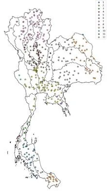
Tuning an old radio receiver requires patience: you slowly turn the dial, catch a crackle, turn it again, until a voice emerges through the static. In much the same way, a reinforcement learning agent searched the ocean for two patches whose temperature difference best predicts rains in Thailand.
The tropical Pacific Ocean heats and cools like a giant battery, and its rhythm affects weather from India to Canada. This rhythm is called El Niño–Southern Oscillation, or ENSO for short. Forecasting it months ahead is like predicting when a pot will boil without knowing the strength of the flame.
In 1997, the Pacific Ocean warmed so much that corals bleached from Indonesia to the Galápagos, and floods and droughts swept across five continents. Such events, which climate scientists call extreme El Niños, occur every few decades, and to understand how often they will arrive in the future, we need thousands of years of observations.
A warm ocean off the coast of Peru can make winter in Moscow unusually mild. Climate scientists call these invisible threads that link weather in distant corners of the planet teleconnections. For a long time, they were thought of as something like permanent wiring: the signal sources may pulse, but the wires themselves lie still.
The Pacific Ocean is like a giant swing: warm water piles up in the west, then slides toward the east, and the temperature off the coast of South America jumps. Such warm years are called El Niño, and cold ones La Niña. But the swing doesn't move on its own: it's pushed by the wind.
An orchestra of a hundred musicians plays without a conductor. As long as the score is familiar, each player confidently follows their part, and together they sound harmonious. But when the composer changes the rhythm, discord creeps in: some instruments keep playing the old tune, others try to adapt, and a few fall silent.
Every day, about 40,000 thunderstorms flash across the planet. In that moment, the atmosphere resembles an orchestra without sheet music: warm air rises like a bow stroke, winds aloft carry the melody, and lightning punctuates the finale. But who conducts this orchestra?
Two conductors stand before one orchestra. One waves the baton quickly, setting the tempo every few bars. The second is almost motionless, but his slow breathing changes the overall sound throughout the symphony. So it is in the tropical Pacific: one part of the wind governs the fast oscillations of El Niño, the other governs decadal climate shifts.
Imagine an interpreter in a negotiation room who hears the tropics whisper and repeats it too loudly. That is how the neural-network climate model DLESyM behaves when forced with real Pacific sea surface temperatures. The ocean whispers "El Niño," and the atmosphere shouts back as if being shaken by the shoulders.
A camera on a tripod shoots the same landscape for decades. If you don't touch the lens, the images get hazy: the landscape changes, but the focus stays put. That's roughly how climate norms work. According to World Meteorological Organization rules, they are calculated as the average over the last 30 years.
Every spring, El Niño forecasts lose their edge, like a translator who gets distracted by every rustle in the room and turns a one-hour meeting into a two-hour one. Scientists call this the spring predictability barrier: in March and April, models that confidently predicted a warm phase in the Pacific back in January start making mistakes twice as often.
A team of forty forecasters prepares an El Niño forecast two years ahead. Each works with the same model but slightly different initial conditions and settings, so their outputs diverge. Typically, forecasting centers average all forty opinions, assuming each member is equally useful.
The ocean hums like a crowded hall: in one corner, voices argue about decades; in another, about years; in a third, about the changing seasons. To pick apart these voices, climatologists used to rely on filters they tuned themselves, letting through only slow waves or only fast ones. But the Pacific plays by its own rules: a warm patch off the coast of Peru can be a brief spike or part of a long-term rearrangement.
In a room with 80 advisors, each shouts their own opinion, and if you simply listen to everyone and take the average, you get mush. So it is with El Niño forecasts: a model produces 80 possible futures, but not all are equally useful. Some err less often, others more, and still others talk about something else entirely.
A translator that learned the grammar of the wind, not just the vocabulary. The wind blows over the Pacific, and the water responds with waves, currents, and upwellings of cold depths. The KIST-Ocean neural network was taught not just to memorize how the ocean looked yesterday, but to understand why it will become what it is tomorrow.
The tropical Pacific Ocean lives in two rhythms. The first is fast: a wave of thunderstorms born over the Indian Ocean races eastward and dies out off the coast of the Americas within a month or two. The second is slow: every few years, the ocean surface warms enough to alter weather across the entire planet. That is El Niño. Between these rhythms lies a bridge, and building it took climatologists decades.
In May 2024, thermometers in Jalisco seemed to go haywire: on May 10, one station recorded 38.4°C, nearly matching the historical maximum from 1994. The heat was so intense that even agave plants, accustomed to scorching conditions, slowed their growth. And the rains, which usually arrive in June, were delayed, leaving farmers nervously glancing at the sky.
You can sit on a seesaw and pump your legs, or you can just tip from one side to the other. The Pacific Ocean does both. Every few years, warm water off the coast of Peru gives way to cooler water, and rainfall patterns, winds, and entire ecosystems across half the planet reshuffle. These shifts are called El Niño and La Niña, together known as ENSO: Earth's climate seesaw.