A Flashlight in the Pacific Fog: Each El Niño Has Its Own Predictability Limit
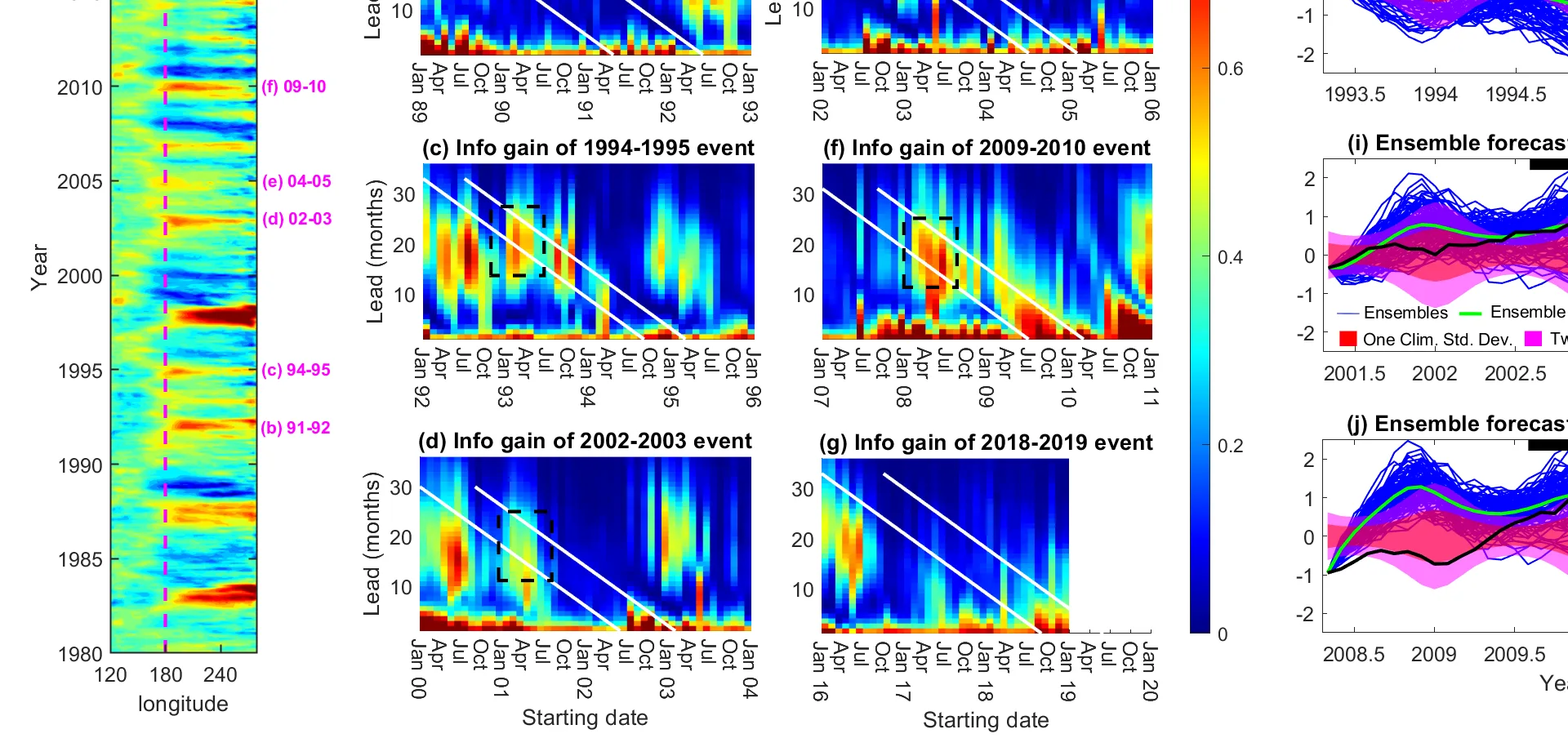
A flashlight beam in fog reaches some objects and fades before touching others. So it is with El Niño forecasts: for events in the central Pacific, the light reaches almost two years ahead, but for eastern events it gets lost in random wind gusts within six months. El Niño is a warm patch in the ocean that shifts rains and droughts across the planet, but its character is different each time.
To measure how far the beam travels, scientists compared two clouds of probabilities: one assembled from the entire climate history, the other from two thousand possible scenarios started from today's state. The distance between the clouds is the information gain, that is, how much new information the forecast provides compared to a simple “business as usual.”
It turns out that the light consists of two parts. One shows how much the average scenario differs from the usual; the second shows how much the scenarios themselves diverge from each other. For eastern events, it is the spread, not the mean, that carries the main information: some scenarios “guess” the event, others do not, and this already speaks of an impending shift.
The spring barrier, a known drop in forecast skill, ceases to be a wall. From a statistical point of view, it is not a fundamental limit but simply a stretch where the light temporarily weakens. If the atmospheric circulation over the tropics intensifies, the central Pacific becomes even more predictable in summer and autumn.
The practical takeaway: forecasting centers can decide in advance for which events it is worth attempting a long-range forecast, and for which it is a waste of effort. Model developers now see that they need to improve not only the mean scenario but also the ensemble spread. The flashlight beam in the fog has become a bit more steerable.
The information gain for central Pacific El Niño remains significant 20 months before the event, even though the ensemble mean in some cases is still far from the truth: some ensemble members 'guess' the event, while others do not.