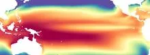
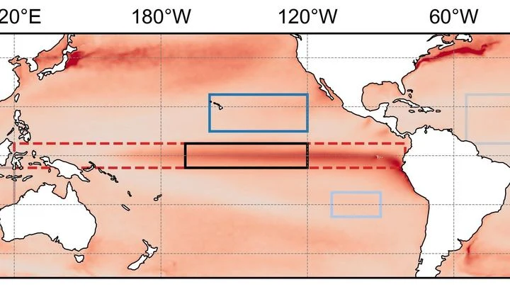
The volume of water warmer than 20 °C in the upper 300 m of the equatorial Pacific, between 120°E and 80°W. Measured by moored buoys and floats, published monthly by NOAA PMEL.
The warm water volume is a measure of the amount of heat stored in the upper layer of the equatorial Pacific Ocean. Specifically, it counts the water warmer than 20 °C in the top 300 meters, across a wide band from 120°E to 80°W. This region is the engine room of the El Niño–Southern Oscillation (ENSO), where shifts in ocean heat drive global weather patterns. When the volume is large, the ocean has stored extra energy that can later fuel an El Niño event; when it is small, conditions favor La Niña.
History
The concept emerged from the Tropical Ocean–Global Atmosphere (TOGA) program in the 1980s and 1990s, which set up the moored buoy array to monitor the equatorial Pacific. NOAA's Pacific Marine Environmental Laboratory (PMEL) has published the index since then.
How it works
Oceanographers track this volume because the 20 °C isotherm roughly marks the boundary between the warm surface layer and the colder, deeper water. By integrating the thickness of the warm layer over the entire equatorial band, they get a single number that summarizes how much heat is available to interact with the atmosphere. The measurement relies on a network of moored buoys (like the TAO/TRITON array) and drifting floats that record temperature at various depths, which are then combined into a monthly estimate.
In practice
Climate scientists and forecasters use warm water volume as a precursor indicator for El Niño and La Niña events, helping to issue seasonal outlooks months in advance.
Fun fact
A single large El Niño can release enough stored ocean heat to raise global average surface temperatures by a few tenths of a degree Celsius.
Swimming season opens when the water feels tolerable. But everyone has their own threshold: one person shivers at twenty degrees, another swims comfortably at fifteen. Scientists decided to figure out where this difference comes from.
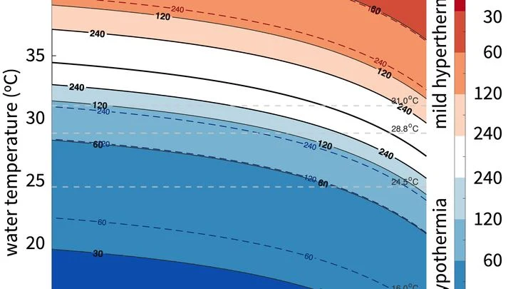
They compared a swimmer's body to a house trying to keep heat in while a cold wind blows outside.
Imagine water as a ballroom, where each molecule is a dancer, constantly forming fleeting partnerships. These hydrogen bonds give rise to local patterns: some resemble a stiff waltz — an ordered network with cavities (low-density structure), others a wild jitterbug, where partners crowd into chaotic dense clusters.
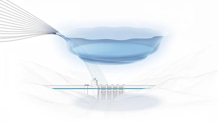
Inside the concrete dam, machines hum, running on empty. Three out of ten turbines are silent. The water level in Southeast Brazil’s largest reservoir has dropped so low that the blades are about to gulp air. The country’s 160 hydropower plants, which supply more than half its electricity, are linked into a single water network where every drop counts.
The cosmic microwave background is the petrified light of the first moments. Shortly after the Big Bang, microscopic quantum fluctuations were stretched by inflation to the scales of galactic superclusters.
A student who has spent years solving problems from other people's textbooks suddenly receives three notebooks with real ocean observations. There are few problems, but they have already seen hundreds of similar ones, and now a couple of examples suffice to catch the new teacher's style.
In the deep oceans of icy moons, water is not still. Warm plumes rise from the rocky seafloor, but the planet's rotation twists them into long, slanted rolls stretched along the rotation axis. Previously, this process could not be included in global models: it was too complex.
Every winter, the tropical Pacific Ocean seems to replay the same script: sea surface temperatures off the coast of Peru rise, trade winds weaken, and a wave of droughts and floods spreads across the planet. This is El Niño, and its peak almost always falls in December. Why winter in particular?
In the Pacific Ocean, there is a warm current that flows eastward against all the others. It is called the North Equatorial Countercurrent, or NECC. In normal years, this band of warm water, a few hundred kilometers wide, quietly carries heat from Indonesia toward the Americas.
Enceladus is a tiny moon of Saturn, covered in a thick crust of ice. Beneath it sloshes a salty ocean, and deep down, a hot, porous core may be at work, like a sponge soaked with water and heat. But how do you see through tens of kilometers of ice? No need to drill: you can use an electromagnetic "echo."
A person with a metal detector walks along a beach.
Beneath Enceladus's icy crust churns an ocean, acting like a perfect heat pump. It pushes heat from the equator to the poles, spending a thousand times less energy than it transports — like a perpetual motion machine built into the moon. The secret lies in salt.
In a wind tunnel, air accelerates to enormous speeds and breaks into a chaos of eddies. To see how this chaos dies on the smallest scales, scientists took a sensor thinner than a human hair and placed it in the flow.
Inside the tunnel, they created a shear layer — a region where fast air rubs against slow air, spawning vortices.
In summer, the Arabian Sea breathes like a pair of bellows: one moment it pumps heat, the next it exhales moisture over a billion people. But sometimes this breathing stumbles, and the water off the coasts of India and Pakistan runs a few degrees hotter than usual.
The ocean does not shout about its intentions. It whispers: a warm patch off the coast of Peru, a cold tongue near Hudson Bay, a barely perceptible shift in a current. The atmosphere does not respond immediately, and by winter Europe may get either mild slush or Siberian frosts.
Every few years, the Pacific Ocean off Peru warms so abruptly that fish disappear and rains flood the desert. This phenomenon is called El Niño, and it acts like a pendulum that swings the planet's climate. But when the planet itself warms, the pendulum behaves strangely: first its swing widens, then it suddenly fades.
Deep beneath us, hundreds of kilometers down, lies a layer that can absorb water like a sponge. The minerals there, wadsleyite and ringwoodite, can hold up to 1–2% water by weight within their crystal lattices.
The Pacific Ocean breathes slowly and deeply. Every few years, its warm surface waters shift eastward toward the coast of South America, and then Peru gets drenched while Australia goes up in flames. A year or two later, the water retreats, and the picture flips. This breathing is called El Niño, and until now its rhythm could only be guessed a couple of steps ahead.
The tropical Pacific Ocean heats and cools like a giant battery, and its rhythm affects weather from India to Canada. This rhythm is called El Niño–Southern Oscillation, or ENSO for short. Forecasting it months ahead is like predicting when a pot will boil without knowing the strength of the flame.
The Tibetan Plateau is a giant sponge that soaks up rain and snow, then releases water to Asia's rivers. Since 2000, the sponge has been getting wetter. Scientists decided to check: does this moisture make the sponge stronger, or does it soften it?
They used a measure of disorder — entropy.
In 1997, the Pacific Ocean warmed so much that corals bleached from Indonesia to the Galápagos, and floods and droughts swept across five continents. Such events, which climate scientists call extreme El Niños, occur every few decades, and to understand how often they will arrive in the future, we need thousands of years of observations.
The Pacific Ocean is like a giant swing: warm water piles up in the west, then slides toward the east, and the temperature off the coast of South America jumps. Such warm years are called El Niño, and cold ones La Niña. But the swing doesn't move on its own: it's pushed by the wind.
Imagine an interpreter in a negotiation room who hears the tropics whisper and repeats it too loudly. That is how the neural-network climate model DLESyM behaves when forced with real Pacific sea surface temperatures. The ocean whispers "El Niño," and the atmosphere shouts back as if being shaken by the shoulders.
A team of forty forecasters prepares an El Niño forecast two years ahead. Each works with the same model but slightly different initial conditions and settings, so their outputs diverge. Typically, forecasting centers average all forty opinions, assuming each member is equally useful.
In summer, the South China Sea can show a strange pattern: the water in the north warms while the south cools at the same time. A year later, it's the opposite. This isn't random; it's a steady seesaw that the ocean rocks every summer.
In May 2024, thermometers in Jalisco seemed to go haywire: on May 10, one station recorded 38.4°C, nearly matching the historical maximum from 1994. The heat was so intense that even agave plants, accustomed to scorching conditions, slowed their growth. And the rains, which usually arrive in June, were delayed, leaving farmers nervously glancing at the sky.
You can sit on a seesaw and pump your legs, or you can just tip from one side to the other. The Pacific Ocean does both. Every few years, warm water off the coast of Peru gives way to cooler water, and rainfall patterns, winds, and entire ecosystems across half the planet reshuffle. These shifts are called El Niño and La Niña, together known as ENSO: Earth's climate seesaw.
Picture a pendulum hanging in a room with drafts. Sometimes a gust pushes it harder, sometimes softer. If the pendulum barely loses energy, it will swing long and steady. But if friction is strong, each push quickly fades, and the motion becomes jerky: a sharp swing, then a long sway. That's exactly how the tropical Pacific behaves when the heat of El Niño gives way to the cold of La Niña.
From July 2023 to July 2024, Earth's atmosphere gained carbon dioxide at a rate of 3.66 parts per million per year. That is the fastest pace since 1979. The reason is not that factories and cars suddenly started emitting more CO₂. The planet's lungs—forests and soils—took a shallower breath.
The planet breathes through its green cover.
A translator at a high-stakes negotiation doesn't just render words quickly; they make sure the meaning doesn't get lost. CAMulator does the same: it takes the complex climate model CAM6 and translates it into the language of a neural network that runs hundreds of times faster, without losing the physical essence.
The Pacific Ocean breathes. Every few years, its warm western "lung" exhales eastward, and from Peru to Indonesia, rains, droughts, and hurricanes shift. This breath is called El Niño–Southern Oscillation, or ENSO.
A warm patch off the coast of Peru does not appear every year, but when it does, deserts are drenched with rain and Australia is plagued by wildfires. This is El Niño, a phenomenon that climate models struggle to reproduce. Simple models do well at estimating how often it occurs but lose spatial details.
Imagine a translator sitting in on a conversation between two parties: the ocean and the atmosphere. Usually, the translator conveys the meaning with a six-month delay, and in spring it loses the thread entirely. The new model, called CTEFNet, translates up to two years ahead and, on top of that, explains which remark turned the tide.
The Pacific Ocean, ten thousand kilometers wide, breathes: warm water shifts eastward, cold water retreats, and this in-and-out repeats every few years. A model that captures this breathing takes weeks of computation even on a supercomputer.
The Pacific Ocean is a giant network of nerve endings that warns of an impending attack a year in advance. In 2023–2024, El Niño, the warm phase of the Pacific climate oscillation, pushed global temperatures to record highs. Now, two independent methods, like two doctors examining the same symptoms, agree: no new attack in 2025.
An experienced navigator steers the ship by a well-tested chart, but in unfamiliar waters the chart lies. A cabin boy who has watched the navigator err for years learns to anticipate where the chart will fail. Together they plot a course more accurately than either could alone.
Each Atlantic hurricane season is like a game of dice, where the number of spots depends on three major climate forces: El Niño, ocean temperature in the 'hurricane nursery,' and the North Atlantic Oscillation.
The ocean breathes, and hurricanes swing on its breath like on a seesaw. Over the past seventy years, hundreds of tropical cyclones have crossed the North Atlantic, and not all of them behaved alike. Some decades brought a barrage of destructive storms to coastlines; others brought calm.
The Pacific Ocean behaves like a conductor setting the tempo for outages in the American power grid. When the ocean shifts into its cold phase, known as La Niña, lights start going out more often across the US. Researchers traced this connection over 24 years and confirmed that the ocean really does drive the weather, and the weather batters wires and transformers.
In the summer of 2023, thermometers around the world registered numbers that even the boldest forecasts had not anticipated. The planet's average temperature rose to 1.48°C above pre-industrial levels, a jump of 0.17°C that broke the previous record as if the climate had suddenly shifted gears.
A translator at an important negotiation starts by simply repeating words, but gradually begins to anticipate what the counterpart will say. The new weather model works similarly: physics provides the framework, and machine learning learns from errors and fills in the gaps.
In the summer of 2022, the sky over western India seemed to have forgotten about drought: rains fell more often than usual, while eastern states languished in dryness. Such an imbalance puzzled forecasters, because ocean currents in the Pacific had promised a steady, abundant monsoon across the country.