Monsoon under the Magnifying Glass: How Regional Models Change Rainfall Forecasts over West Africa ✛
Every year, the same drama unfolds over West Africa: from June to September, the sky fills with moisture and releases rains that determine the harvests of millet, sorghum, and maize. This rainy season is driven by the West African monsoon, a giant atmospheric pump that pulls moist air from the ocean deep into the continent. But this pump has three switches located far from Africa: the warm El Niño current in the Pacific Ocean, the Mediterranean Sea, and the equatorial Atlantic. Each can strengthen or weaken the rains, and climatologists have spent decades trying to figure out which lever matters most.
Global climate models (GCMs) see continents as a mosaic of large cells, each the size of a small country. In such a grid, the monsoon front gets smeared: models systematically shift the rain zone southward, so it pours too much over the Gulf of Guinea while Senegal and Gambia stay nearly dry. Regional models (RCMs) act like a magnifying glass: they take the coarse picture from a global model and recalculate it on a finer grid, capturing mountains, lakes, and vegetation bands that the global model simply cannot see. It seems logical to expect that better resolution would bring better ocean connections. But reality turned out to be trickier.
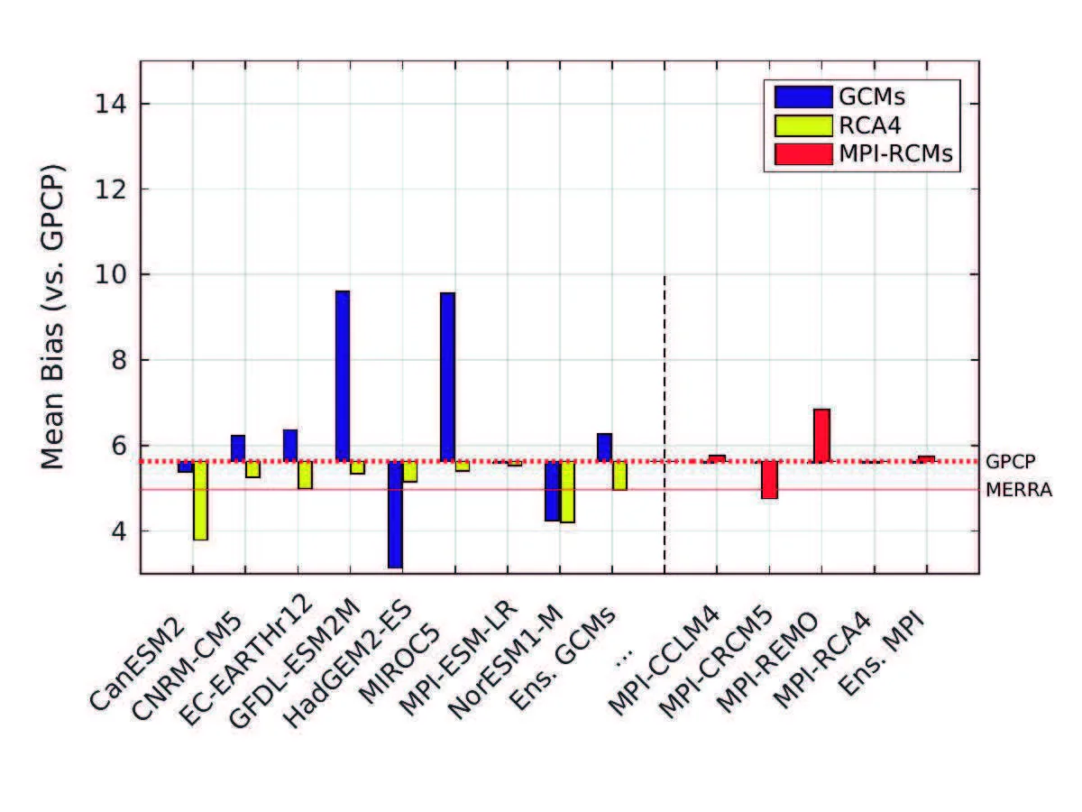
The authors compared 8 global models and 11 regional simulations against observations from 26 monsoon seasons (1979–2004). For each pair of “African rainfall and sea surface temperature,” they identified the main statistical bridge through which the ocean talks to the monsoon. They found that regional models indeed better capture the Mediterranean influence: a warm sea in late spring means a wetter July and August in the Sahel, and regional models correctly show the moisture transport from the southwest. But with El Niño, it is the opposite. Global models, albeit imperfectly, reproduce how a warm Pacific causes air to sink over the Sahel and suppress rains. Regional models lose this signal: they see El Niño only at the boundaries of their domain, and inside they rearrange the circulation in their own way, so the bridge breaks down.
The third signal, the equatorial Atlantic mode, remained a puzzle. Over the study period, it never appeared alone; it always paired with an opposite phase of El Niño, making it statistically impossible to separate their influences. It is like trying to hear a quiet voice in a noisy room where two people are shouting at once.
The practical takeaway is straightforward: for drought forecasts linked to El Niño, global models are better, while for assessing Mediterranean influence on the rainy season, regional models are preferable. This work shows for the first time that regional downscaling is not universally beneficial: it improves one ocean influence channel and destroys another. It is like a translator who perfectly conveys the intonations of one speaker but muffles the other.
Let us return to the beginning: the rainy season in the Sahel depends on three distant switches, and now we know which tool is best suited for each. Regional models are not a magic lens that makes everything sharper. They are a delicate instrument that must be tuned to the specific task. And when it comes to food for hundreds of millions of people, such tuning is not a luxury but a necessity.
The regional model SMHI-RCA4, when driven by different global models, consistently produces a spurious drought over the Congo. This defect also appears in other regional models, pointing to a common problem with convection parameterization in that part of Africa.