The Ocean Dictates the Rains of the Sahel ✛
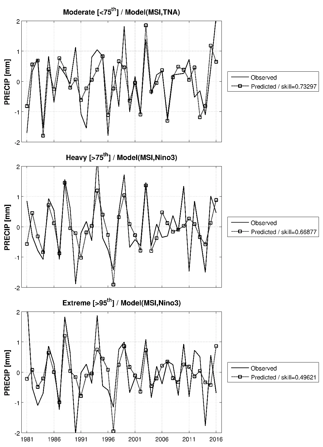
Every year, over the semi-arid belt south of the Sahara, the sky stages the same play: gentle rains that nourish millet, and violent downpours that wash away villages. Until recently, both acts were attributed to a single conductor: ocean surface temperature. But if you listen closely, each rain has its own control panel.
Strong and extreme downpours behave quite differently. They are triggered by La Niña, a cooling of the equatorial Pacific. Together with a warm Mediterranean Sea, it makes the air over the Sahel unstable: lower layers heat up, upper layers cool, and moisture shoots upward in a powerful updraft. This vertical lift spawns storms that in one hour dump as much water as a moderate rain gives in a day.
Separating rains by intensity changes the seasonal forecast. Previously, it was a black box: predicting total precipitation without distinguishing whether it would fall gently or come down in sheets. Now we can see which ocean is signaling what. A warm Atlantic, 2–3 months ahead, points to calm rains; La Niña in the Pacific, 4 months ahead, signals flood risk. For a farmer deciding whether to sow millet, and for a humanitarian agency stocking supplies, these are different scenarios.
Oceans, like conductors, lead the rain's score: the Atlantic sets the quiet melody of moderate showers, while the Pacific, through La Niña, strikes the loud chords of extreme storms. The Sahel hears both motifs, and now it has the sheet music.
Extreme storms in the Sahel now occur three times more often than 35 years ago, even though total annual rainfall has barely changed. This means rain has become less frequent but much more intense.