Precipitation is any form of water — liquid or solid — that falls from clouds to the Earth's surface under the influence of gravity. It includes rain, snow, sleet, and hail, and is a key component of the hydrological cycle, transferring water from the atmosphere to the ground. Precipitation patterns are changing with climate change, with many regions experiencing more intense but less frequent rainfall events, which has significant impacts on agriculture, water resources, and flood risk.
History
The scientific understanding of precipitation began in the 19th century with the work of meteorologists like Luke Howard, who classified clouds, and later with the development of cloud physics in the mid-20th century by researchers such as Tor Bergeron and Walter Findeisen.
How it works
Precipitation forms when moist air rises, cools, and reaches saturation, causing water vapor to condense onto tiny particles called cloudcondensation nuclei. The resulting droplets or ice crystals grow by colliding and coalescing with each other until they become heavy enough to overcome updrafts and fall as precipitation. The type of precipitation depends on the temperature profile of the atmosphere through which it falls.
In practice
Precipitation forecasting is critical for agriculture, disaster preparedness, and water management, and is used in climate models to project future water availability.
Fun fact
A single raindrop can be up to 5 millimeters in diameter, but larger drops break apart due to air resistance, so rain never falls as bigger drops.
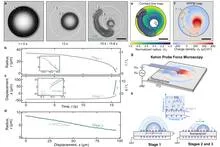
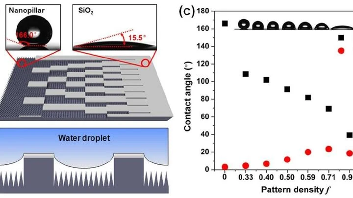
A water droplet on a fluoropolymer film initially behaves as expected: it sits and evaporates. But once it shrinks to a quarter of its initial size, it suddenly takes off and, within fractions of a second, covers a distance several times its own radius. Then it crawls slowly but persistently, leaving behind an invisible trail of electric charges. That trail is what drives the motion.
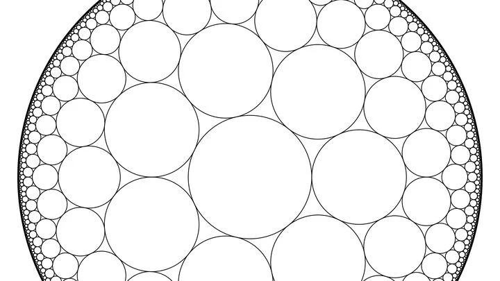
In a vast hall, billiard balls are scattered about. At first they lie sparsely, each on its own. Then someone adds more, and suddenly the balls compress into dense clusters. This is a phase transition — the moment when matter abruptly changes its state.
Physicists have long described such a picture with the hard-sphere model: particles are identical balls that cannot overlap.
Soil is not a solid sponge but a labyrinth of pores of various sizes. After rain, water does not fill them all at once: first the narrowest ones, then the wider ones. Physicists built a theory of this process based on a simple image — a set of communicating vessels.
At a weather station in Brazos County, Texas, rain is recorded on magnetic tape: every day, four years straight. Nine hundred millimeters in a good season, a hundred in a bad one. Then the tape falls silent. Drought creeps in without a sound — the slow fading of the earth's pulse. The standard SPI-3 index only catches on a month or two later, once the moisture is already gone.
For decades, global atmospheric models resembled artists forced to paint planetary storms with coarse brushstrokes: a resolution of 25–100 km forced them to 'guess' convection through approximate schemes, introducing systematic errors in rainfall and climate forecasts.
Perth residents know: when the daytime heat becomes unbearable, relief arrives from the ocean — a fresh breeze affectionately called the Freo Doctor. The same wind, only on a global scale, decides the fate of cosmic visitors plunging into the atmosphere. A meteorite fall is a two-act spectacle.
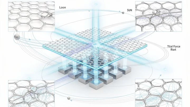
In the quiet of a laboratory, a graphite flake hovers above a magnetic grid. This is not just a demo of diamagnetism's magic — it's listening to the Universe. Like a spider casting its web to catch vibrations from an invisible world, this flake has become a gravitational web.
On a scorching afternoon, a stifling haze hangs over the city, and not a single cloud is on the horizon. Usually, in such weather, all you can do is wait for nature to take pity and send some cool relief. But what if shade and rain could be switched on schedule, like a light in a room?
A mosaic of large colored tiles. Each tile is the average precipitation over an entire month for an area the size of a small country. For a general understanding, the picture is fine, but if you need to know whether a downpour hit a specific city yesterday, it's useless.
A lightning strike splits the sky in a fraction of a second, leaving a branched trail. At the same moment, in a tiny superconducting crystal cooled to near absolute zero, an avalanche of magnetic field rushes through — thin fingers of magnetization piercing the material.
Drylands are like skin cracking from dehydration. When rainfall decreases, plants don't vanish overnight: they rearrange, leaving bare patches of soil between them. These patterns are visible even from space.
Scientists compared satellite images of eight arid regions, from the Sahel in Africa to Australian deserts.
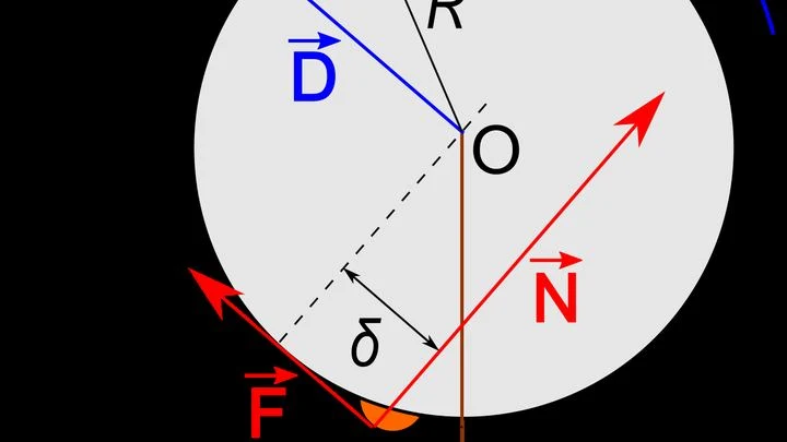
A drop of water on a table usually sits still. But make the table slightly softer on one edge and stiffer on the other, and the drop will crawl toward the stiffer side. This phenomenon is called durotaxis: the liquid itself chooses where to flow, without pumps or electricity.
This trick works because the surface under the drop is not uniform.
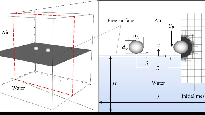
A raindrop falls into a puddle, and the impact sends up a little fountain of fine spray. Each of those droplets is a new, secondary drop. How many there are, how big they are, and how long they live depend on a host of factors: the fall speed, the drop size, the properties of the water. Scientists set out to make sense of this chaos using computer simulations.
A drop of oil in water, coated with soap molecules, behaves differently from a bare drop. Soap molecules are tiny rods: one end loves water, the other loves oil. In a quiescent fluid, they stand on the surface like a picket fence, lowering the surface tension — the force that pulls the drop into a sphere.
A raindrop falling to the ground strikes with a certain force. But what if the drop isn't round but elongated like a cigar or flattened like a pancake? It turns out that shape is everything: the impact force can vary by more than a factor of ten just because of how the drop looks at the moment of impact.
Water deep within the Earth is compressed more than a thousandfold compared to the surface. Even there, it continues to flow, but its internal structure changes. Researchers measured how water resists flow and compression as pressure rises from zero to 1.6 gigapascals — equivalent to placing a 16-ton weight on every square centimeter.
In 2023, the ocean off the coast of Peru warmed so much that fishermen came back empty-handed, while meteorologists argued over the strength of the upcoming El Niño. The sea surface temperature map they were looking at was the only one available, but how much could they trust it?
The Sun drives the water cycle, and rain returns it to the ground. But now, every drop is a tiny hammer striking the surface. Floating plastic particles (microplastics, mostly carbon) upon impact jump up like popcorn kernels on a hot skillet. But instead of popping, they get wrapped in a thin water film and turn into weightless beads.
The Kepler telescope William Borucki's caught the faint twinkling of distant stars and discovered thousands of planets around other suns. Among them gapes a gap: almost no worlds sized between rocky balls and puffy water giants.
A water droplet races across a taro leaf like a bead on a freshly waxed floor. But it doesn't just glide: it picks up electricity. Thirty years ago, scientists explained why lotus leaves stay dry: their surface is covered with microscopic bumps that trap air. Now it turns out that water on leaves has another, hidden power.
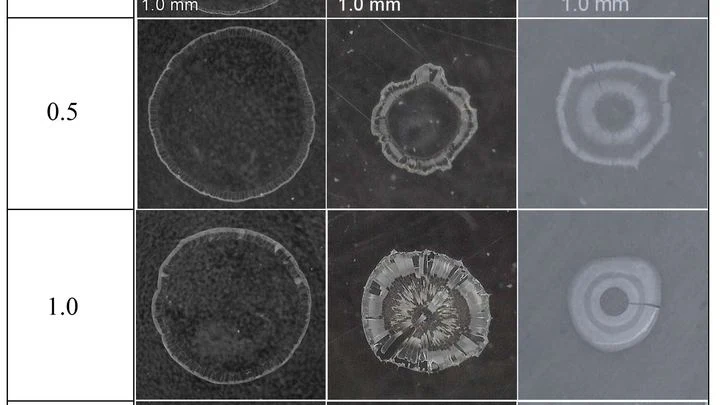
A coffee drop on a table dries and leaves a ring — coffee particles gather at the edge. But if charged nanoparticles float in the drop, the picture becomes richer: the deposit cracks like mud in a dried-up puddle. Physicists studied how the particle charge and the surface on which the drop dries change these cracks.
Rain doesn't fall just any old way. If you take records from nearly fifty thousand rain gauges scattered across the globe and compare how much water falls on a rainy day in different parts of the planet, you'll spot a surprising pattern.
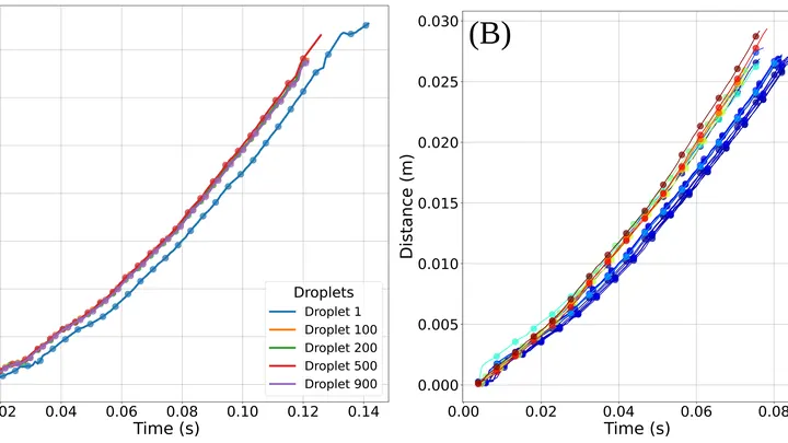
In a cloud, billions of droplets swirl around, collide, and merge: that's how rain is born. But exactly how turbulence, those invisible air swirls, helps or hinders droplet growth has been unclear. In the lab, researchers recreated a slice of a cloud and tracked every droplet.
A thin stream of water flows down a cold inclined board and, before your eyes, turns into an ice ridge. At first, the water paves itself a straight icy path, as if reinforcing its own banks. Then the trickle starts to meander, and the ice quickly spreads sideways. Finally, the ridge stops growing outward and begins to thicken, smoothing out irregularities.
For 36 days, tropical cyclone Freddy raged over the Indian Ocean, the longest-lived cyclone on record. Meteorologists tracked it from satellites, aircraft, and ground stations. But one detail eluded all instruments: the precise air density deep within the vortex. And that density determines where the cyclone will turn tomorrow.
In February 2022, the eastern coast of Australia was hit by rains that lasted several days in a row. Water inundated towns in Queensland and New South Wales, insurers paid out 3.35 billion dollars, and the flood became the costliest in the country's history.
In 2019, 16,000 villages in the Indian state of Maharashtra ran dry, and authorities began distributing water by ration coupons. In response to such crises, the government plans to transfer water from water-rich river basins to arid ones through a network of canals stretching 15,000 kilometers.
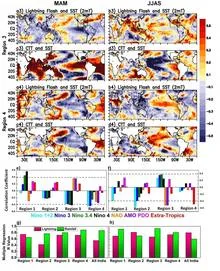
Every year, lightning kills thousands of people, especially in the tropics, where thunderstorms are most intense. In India, the share of lightning deaths among all victims of natural disasters is rising, despite an overall decline in fatalities from cyclones and floods. One might think that lightning is too fast and too local to predict months ahead.
In the Pacific Ocean, every few years the water off the coast of Peru warms up, and fishermen call it El Niño. Sometimes the warming is mild, sometimes so strong that it changes weather across the entire planet. Forecasting a strong El Niño six months to a year ahead is a task at the edge of possibility: weather is forgotten within two weeks, while climate remembers for decades.
Every summer, the same scene unfolds over India: clouds driven from the ocean by the wind release their rain, and how that rain falls on the fields determines the harvest for more than a billion people. Meteorologists have long tried to reduce this mosaic to a single number, the all-India rainfall index, which averages millimeters across the country.
Every summer, a giant atmospheric engine unfolds over India: moist ocean winds bring the rains that sustain crops and the lives of two billion people. But this engine sputters, and forecasting it a season ahead remains elusive. Models give only rough answers, and a monsoon forecast error can cost millions of tons of food.
Soil breathes. The top layer of the earth takes in moisture after rain, then releases it into the air, much like lungs inhale and exhale. This inhalation and exhalation happens everywhere on the planet, but its rhythm is not uniform: in some places it is fast and steady, in others irregular and deep.
In 1984, the Ethiopian sky stayed silent for months. Fields cracked, livestock died, and roads were clogged with people fleeing hunger. Droughts in this country have killed hundreds of thousands, but warning of them in advance was impossible: too many threads pull the weather in different directions.
The Pacific Ocean works like an invisible conductor.
Every June, the sky over India fills with moisture, and how much falls determines rice harvests, water reserves, and food prices for a billion people. But predicting the monsoon's strength in advance was like guessing someone's mood from a single photo: too many hidden springs.
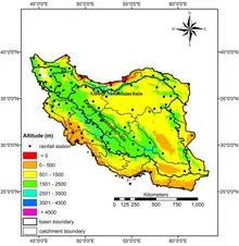
In 2019, northern and southwestern Iran received 50% more rainfall than usual, and rivers overflowed their banks. A year earlier, in 2018, rainfall was 53% below normal, and fields cracked under drought. Such swings are not random; they are responses to three distant oceanic pulses that set the rhythm for Iran's rains.
In 1988, the surface temperature of the Pacific Ocean began to change long before meteorologists declared the onset of El Niño. Points on the map scattered along the equator started behaving in concert: if water warmed in one place, it did so in a neighboring one too.
The coast works like a conductor: it doesn't create the music, but it sets the rhythm and direction. Every morning, the sun heats the land faster than the sea, and warm air rises over the sand, pulling in a moist breeze from the ocean. By evening, the land cools and the wind reverses. This daily pendulum lines up clouds along the water's edge, like musicians following the baton.
The Paraná River behaves like a seismograph that records not the shaking of the ground but the pulse of the Sun. A century of daily water-level measurements at the gauging station in the city of Corrientes, 900 kilometers from the river's mouth, shows that when the Sun has many sunspots, the river floods more. This connection is neither accidental nor weak.