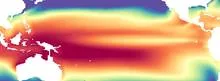
Sea surface temperature (SST) is the temperature of the ocean's top few meters, the layer that directly exchanges heat, moisture, and gases with the atmosphere. It is a fundamental variable in climate science because the ocean stores and releases enormous amounts of heat, and SST determines how much energy flows into the air above. Even small changes in SST—fractions of a degree—can shift weather patterns, influence hurricane intensity, and alter marine ecosystems.
History
Systematic measurement of SST began in the 19th century with ship-based observations, but global satellite monitoring started in the late 1970s, revolutionizing the field. The concept of SST as a key climate indicator was formalized in the mid-20th century as ocean-atmosphere interactions became a focus of research.
How it works
SST is measured by satellites that detect infrared or microwave radiation from the ocean surface, as well as by buoys and ships that take direct readings. The ocean's surface temperature is set by the balance of incoming solar radiation, heat loss through evaporation and longwave radiation, and mixing with deeper waters. Because water has a high heat capacity, SST changes slowly compared to air temperature, making it a kind of 'memory' of past climate conditions that can influence weather weeks or months later.
In practice
SST data are used in weather forecasting, hurricane tracking, and climate models, as well as in fisheries management to predict shifts in fish populations and coral bleaching events.
Fun fact
The warmest SSTs on Earth occur in the western Pacific 'warm pool,' where temperatures can exceed 30°C (86°F), fueling some of the most intense thunderstorms on the planet.
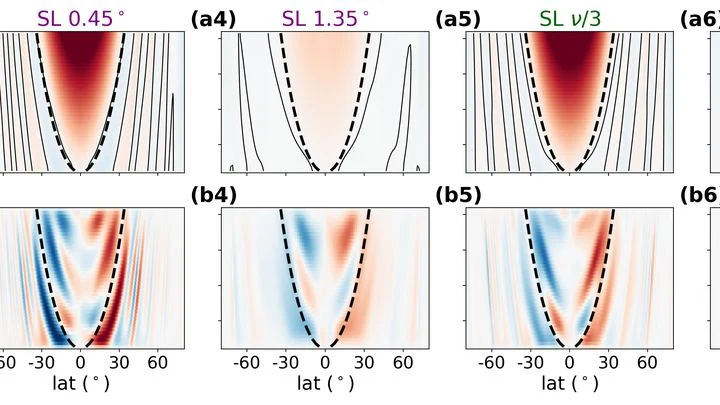
Picture a guitar string stretched between two frets. When you pluck it, a standing wave forms: some points on the string oscillate strongly, while others, the nodes, remain almost still. The chromosphere, a layer of the solar atmosphere sandwiched between the photosphere and the corona, behaves in much the same way.
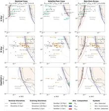
The JWST space telescope aimed its lens at the scorching rocky world 55 Cancri e, and spotted a dense gas envelope. But the cooler TRAPPIST-1 b, which orbits a dim red dwarf, showed no envelope: just bare rock. The picture came out upside down: hot planets hold onto atmospheres, while cooler ones lose them.
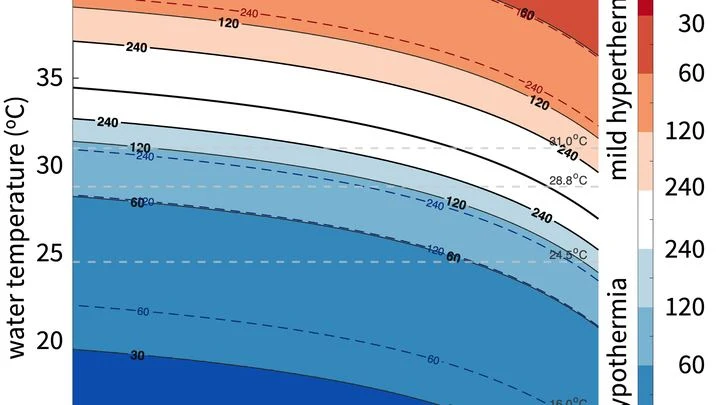
Swimming season opens when the water feels tolerable. But everyone has their own threshold: one person shivers at twenty degrees, another swims comfortably at fifteen. Scientists decided to figure out where this difference comes from.
They compared a swimmer's body to a house trying to keep heat in while a cold wind blows outside.
After a nuclear explosion, soot rises into the sky. It settles high above the clouds, in the stratosphere, and stays there for years. This soot acts like a thick curtain: it blocks some sunlight and alters the chemistry of the sky.
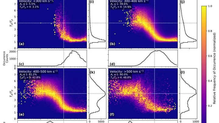
The solar wind is a continuous stream of charged particles flowing from the Sun. It has two main components: protons (hydrogen nuclei) and alpha particles (helium nuclei, four times heavier).
The cosmological debate is like two craftsmen measuring the same wall but getting different lengths. One uses a tape measure, applying it to nearby landmarks — Cepheids (pulsating beacon stars) and Type Ia supernovae (flashes of dying stars). He finds the wall is stretching at 73.5 arbitrary units.
For decades, global atmospheric models resembled artists forced to paint planetary storms with coarse brushstrokes: a resolution of 25–100 km forced them to 'guess' convection through approximate schemes, introducing systematic errors in rainfall and climate forecasts.
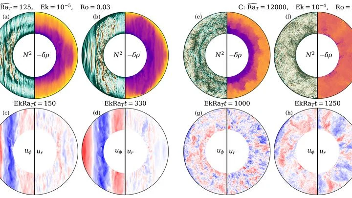
In the deep oceans of icy moons, water is not still. Warm plumes rise from the rocky seafloor, but the planet's rotation twists them into long, slanted rolls stretched along the rotation axis. Previously, this process could not be included in global models: it was too complex.
Every winter, the tropical Pacific Ocean seems to replay the same script: sea surface temperatures off the coast of Peru rise, trade winds weaken, and a wave of droughts and floods spreads across the planet. This is El Niño, and its peak almost always falls in December. Why winter in particular?
A scorching rocky planet is like a pot of boiling soup, except its lid is the atmosphere. Gases escape from the magma, wrap the world in a thick blanket, and in turn influence how quickly the celestial body cools. For GJ 1132 b, which orbits so close to its star that a year lasts just one and a half Earth days, this connection is especially important.
A tuning fork produces a pure tone, but if you strike it too hard, it starts to rattle, and a musician might mistake that rattle for complexity in the sound.
The planet WASP-121 b is a gas giant, heated to 2500°C. It always faces its star with one side, like a globe frozen under a lamp. But as it passes in front of the star's disk, its rotation reveals different facets to us — as if that globe were slowly turned, letting us peer into every corner.
A planet the size of Neptune, but glowing white-hot. Beneath the clouds lies an ocean of magma capable of absorbing an entire hydrogen atmosphere. The new SEAMIST model is the first to trace how such dissolution changes a planet's fate from birth to old age.
The big surprise is the mechanism of catastrophic boiling.
Deep underground, in the thickness of granite, detectors catch rare visitors from space — muons. These particles are born high in the atmosphere when cosmic rays slam into air nuclei. They make it to the underground lab thanks to their enormous speed, close to the speed of light.
An orchestra plays in a dark hall, and the listener hears only a hum: hundreds of instruments blend into a dense noise in which no melody can be discerned. That is roughly what spectra extracted from climate data by methods like the Koopman operator look like: hundreds of components, each with its own frequency, and it is unclear which ones are true musicians and which are the rattling of chairs.
The James Webb Space Telescope is gazing more and more at exoplanets — worlds orbiting alien stars. Some of them are scorching rocky spheres, tidally locked with one side forever facing their star. There, rock melts into oceans of liquid lava. How does this lava move?
Beneath Enceladus's icy crust churns an ocean, acting like a perfect heat pump. It pushes heat from the equator to the poles, spending a thousand times less energy than it transports — like a perpetual motion machine built into the moon. The secret lies in salt.
In summer, the Arabian Sea breathes like a pair of bellows: one moment it pumps heat, the next it exhales moisture over a billion people. But sometimes this breathing stumbles, and the water off the coasts of India and Pakistan runs a few degrees hotter than usual.
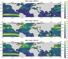
In 2023, the ocean off the coast of Peru warmed so much that fishermen came back empty-handed, while meteorologists argued over the strength of the upcoming El Niño. The sea surface temperature map they were looking at was the only one available, but how much could they trust it?
The ocean does not shout about its intentions. It whispers: a warm patch off the coast of Peru, a cold tongue near Hudson Bay, a barely perceptible shift in a current. The atmosphere does not respond immediately, and by winter Europe may get either mild slush or Siberian frosts.
Today's Martian surface is a cold, nearly airless home. Many dream of a full renovation: warming the planet, filling it with air from carbon dioxide and nitrogen.
The weather on the next street can differ from yours: cooler by the river, hotter over asphalt, windier between buildings. A regular forecast misses this: its grid cell is the size of a city, not a backyard.
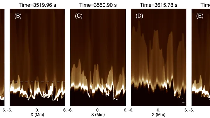
The Sun's surface boils like water in a pot. Hot gas rises, cools, and sinks: that's convection. Magnetic fields churn around, tearing and reconnecting. In this frenzy, spicules are born: narrow plasma jets that shoot thousands of kilometers upward.
For exoplanets that always face their star with one side, the night side is doomed to eternal cold. But mountains can turn things around. Surface irregularities shake up the ocean of air, steering moisture flows across the day-night boundary. Once in the dark, water freezes into clouds, and clouds act like a blanket: they trap heat and keep the world from cooling down.
Beneath a thin layer of red dust on Mars lies water ice. Its presence was confirmed by the Phoenix lander and orbital instruments, but the mystery remained: why is the ice always just a few centimeters below the surface?
The answer lies in the wobbles of Mars' axial tilt.
Inside giant planets like Jupiter and Saturn, heat doesn't always rise freely. Heavy elements, which are more abundant in some layers than others, prevent hot fluid from floating up. This creates semiconvection — a type of mixing where heat and composition spread at different rates.
An exoplanet — a planet outside our solar system — follows a slightly elongated orbit. With each revolution, it swings closer to its parent star and then farther away.
The James Webb Space Telescope is watching TRAPPIST-1—a tiny red dwarf with seven Earth-sized planets in orbit. And it sees something unusual: bright flares on this star barely reach 3500–4000 degrees. For comparison, a typical solar flare heats up to 9000–10000 degrees.
The Sun is slowly brightening, and in hundreds of millions of years its heat would become lethal for Earth. Fortunately, the built-in planetary thermostat — the carbon cycle — when overheating triggers rocks to absorb carbon dioxide faster, cooling the climate.
A fusion reactor resembles a giant boiler where hydrogen is 'cooked' into helium. The plasma inside is heated to 150 million degrees — ten times hotter than the Sun's core. But like any boiler, scale forms: harmful impurities that settle on the walls and quench the plasma.
An orchestra of two musicians plays from the same score, but each hears only their own line. The atmosphere and ocean in a climate model resemble such a duet: they exchange heat and moisture every few hours, yet until recently their neural network counterparts could not keep a common rhythm.
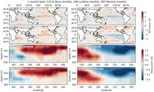
The ocean hums like a crowded hall: in one corner, voices argue about decades; in another, about years; in a third, about the changing seasons. To pick apart these voices, climatologists used to rely on filters they tuned themselves, letting through only slow waves or only fast ones. But the Pacific plays by its own rules: a warm patch off the coast of Peru can be a brief spike or part of a long-term rearrangement.
In summer, the South China Sea can show a strange pattern: the water in the north warms while the south cools at the same time. A year later, it's the opposite. This isn't random; it's a steady seesaw that the ocean rocks every summer.
A translator that learned the grammar of the wind, not just the vocabulary. The wind blows over the Pacific, and the water responds with waves, currents, and upwellings of cold depths. The KIST-Ocean neural network was taught not just to memorize how the ocean looked yesterday, but to understand why it will become what it is tomorrow.
A translator at a high-stakes negotiation doesn't just render words quickly; they make sure the meaning doesn't get lost. CAMulator does the same: it takes the complex climate model CAM6 and translates it into the language of a neural network that runs hundreds of times faster, without losing the physical essence.
In a meeting room, an interpreter listens not only to the speaker but to the entire buzz of voices, catching who is looking at whom and who falls silent before an important remark. That's how SEA-ViT reads the ocean: it sees not isolated points from buoys but the whole current field at once, like a single conversation of water.
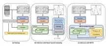
Imagine an interpreter in a huge hall who hears not only the person next to them but also a whisper in the far corner, and from those fragments reconstructs the entire conversation. That's how the CAS-Canglong neural network works: it picks up connections between pressure, wind, and heat across the whole planet and uses them to predict what the ocean will look like three months from now.
Two dancers stand facing each other but cannot see each other's faces. One is the atmosphere, fast and noisy, forgetting its moves after just a couple of weeks. The other is the ocean, slow and heavy, remembering every touch for months. For the dance to work, they need to learn to lead each other while only looking at their partner's hands.
Climate is like an orchestra without a conductor: each musician hears the others with a delay, and the score changes mid-concert. The ocean, atmosphere, ice, and land continuously exchange energy, and the slightest hiccup in one instrument can escalate into a shift of the entire melody.
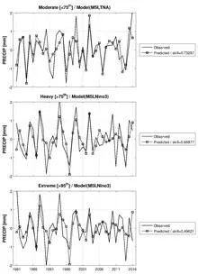
Every year, over the semi-arid belt south of the Sahara, the sky stages the same play: gentle rains that nourish millet, and violent downpours that wash away villages. Until recently, both acts were attributed to a single conductor: ocean surface temperature. But if you listen closely, each rain has its own control panel.