phenomenon

monsoon onset

The seasonal beginning of the rainy monsoon period, marked by a shift in atmospheric circulation and precipitation.
34 related articles

Description

Monsoon onset is the abrupt transition from the dry, pre-monsoon season to the rainy monsoon period, marked by a sudden shift in wind direction, a surge in atmospheric moisture, and the first sustained heavy rains. In India, this event typically occurs in early June, sweeping from the southern tip of Kerala northward over several weeks. The onset is not just a meteorological curiosity; it is a lifeline for agriculture, as farmers time their planting to the arrival of rains, and for water reservoirs that must fill to supply cities and irrigation for the year.

History

The formal study of monsoon onset dates began in the early 20th century, with the India Meteorological Department (founded in 1875) tracking the onset's progression. The concept of a 'monsoon onset' as a distinct phase was popularized by meteorologists like Sir Gilbert Walker, who studied the Indian monsoon in the 1920s.

How it works

The onset is triggered when the seasonal reversal of winds becomes established. As the land heats up, a low-pressure system develops over the Indian subcontinent, drawing in moist air from the Arabian Sea and the Bay of Bengal. The onset is marked by a rapid deepening of this low pressure, a strengthening of the cross-equatorial jet (a fast-moving air current), and the formation of a persistent band of thunderstorms. Once these conditions align, the monsoon 'bursts' — often within a few days — bringing a dramatic increase in rainfall that persists for weeks.

In practice

Accurate prediction of monsoon onset is used by agricultural agencies to advise farmers on optimal sowing dates, by water managers to plan reservoir releases, and by disaster preparedness teams to anticipate flooding risks.

Fun fact

The date of monsoon onset over Kerala has varied by as much as three weeks over the past century, and in some years the onset is preceded by a 'pre-monsoon' shower that fools locals into thinking the rains have begun.
Concept graph →

Related articles · 34

Stellar2026-08-092 minarXiv:2608.08470express
Rain on the Sun: Why It Falls Both Ways
In the solar corona, it rains from time to time — only not water, but plasma. The hot gas cools, clumps into blobs, and rushes downward along magnetic loops, like drops running down invisible gutters.
Reflation: When a Planet Inhales After Exhaling
The mystery of the radius valley — a sharp drop in the number of exoplanets with radii ~1.8 Earth — haunts astronomers. JWST, transit surveys like Kepler and TESS draw a clear gap: rocky super-Earths and gaseous sub-Neptunes are separated by almost a chasm.
Seasonal Climate Is Predictable Beyond Chaos
Two pendulums suspended from a single invisible spring swing in a shared air current. One always lags the other by exactly half a period: when the first swings left, the second is already returning from the right. By watching the first, you can tell where the second will be half a period later.
Stellar2026-05-262 minarXiv:2605.27057express
Space Weather by the Seasons
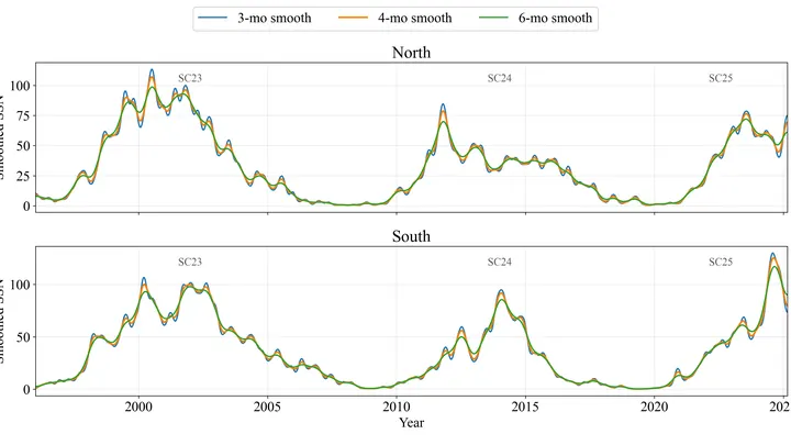
The Sun doesn't burn steadily: it erupts in series. Like a campfire that dies down and then suddenly throws out showers of sparks, these "fiery seasons" last from six months to a year and a half, and during them the star shows an unusually high number of sunspots.
Fingerprints of Chaos: How Trajectory Geometry Reveals the Moment of a Regime Shift
The heart beats steadily, then slips into arrhythmia. The climate holds its familiar rhythm for decades, then shifts to a new state over a single summer. Such regime shifts are like a flick of a switch, but in real data we see only a noisy one-dimensional signal in which the moment of the break is hidden.
Ocean Conductor: How Warm Blobs in the Arabian Sea Steer the Monsoon
In summer, the Arabian Sea breathes like a pair of bellows: one moment it pumps heat, the next it exhales moisture over a billion people. But sometimes this breathing stumbles, and the water off the coasts of India and Pakistan runs a few degrees hotter than usual.
The Dance of Two Pendulums: Why the Monsoon Can Be Predicted 18 Months Ahead
Two pendulums hang on the same wall, swinging out of sync, but suddenly they move as one, only with an 18-month delay. One pendulum is the Indian monsoon, the seasonal wind that brings rain to South Asian farmland. The other is the deep water of the tropical oceans, which slowly accumulates heat and remembers it for years.
Monsoon Receiver: How a Neural Network Finds Ocean Signals of Future Rains
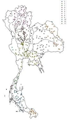
Tuning an old radio receiver requires patience: you slowly turn the dial, catch a crackle, turn it again, until a voice emerges through the static. In much the same way, a reinforcement learning agent searched the ocean for two patches whose temperature difference best predicts rains in Thailand.
Rain Is Learning to Fall Less Often but Harder
Rain doesn't fall just any old way. If you take records from nearly fifty thousand rain gauges scattered across the globe and compare how much water falls on a rainy day in different parts of the planet, you'll spot a surprising pattern.
Tibet's Moist Respite
The Tibetan Plateau is a giant sponge that soaks up rain and snow, then releases water to Asia's rivers. Since 2000, the sponge has been getting wetter. Scientists decided to check: does this moisture make the sponge stronger, or does it soften it? They used a measure of disorder — entropy.
Rain Relay: How Rare Runners Shape South American Weather
An invisible relay race runs through Earth's tropics: a wave of heavy rain and winds, which meteorologists call the Madden–Julian Oscillation, travels eastward at about five meters per second. Most runners tire quickly, but rare marathoners carry the torch all the way across the Pacific.
Thermometer in the Red: Heat and Rain in Jalisco in 2024
In May 2024, thermometers in Jalisco seemed to go haywire: on May 10, one station recorded 38.4°C, nearly matching the historical maximum from 1994. The heat was so intense that even agave plants, accustomed to scorching conditions, slowed their growth. And the rains, which usually arrive in June, were delayed, leaving farmers nervously glancing at the sky.
Network catches the monsoon beyond the horizon
In 2015, downpours in Chennai turned streets into rivers overnight. The city was caught unprepared: seasonal models offered only a vague warning. Yet the monsoon is not a whim of the sky; it is the pulse of a vast machine linking oceans and continents.
Ocean Hints at Rain: The Hidden Mechanics of the Monsoon
In the summer of 2022, the sky over western India seemed to have forgotten about drought: rains fell more often than usual, while eastern states languished in dryness. Such an imbalance puzzled forecasters, because ocean currents in the Pacific had promised a steady, abundant monsoon across the country.
The Ocean Dictates the Rains of the Sahel
Every year, over the semi-arid belt south of the Sahara, the sky stages the same play: gentle rains that nourish millet, and violent downpours that wash away villages. Until recently, both acts were attributed to a single conductor: ocean surface temperature. But if you listen closely, each rain has its own control panel.
India's Climate: A Pattern of Chaos and Order
Seventy-five years of weather observations in India, when plotted on a graph, resemble the cardiogram of a vast organism. Instead of a single steady pulse, there are fifteen different lines, each with its own rhythm. Somewhere the heartbeat is as steady as a sleeping person's, while elsewhere it falters, as if after a quick run.
El Niño 2023: a year-long warning
In May 2022, sea surface temperatures off the coast of Peru were a degree below normal. Nothing hinted at trouble, but two independent "seismographs" had already picked up a rumble from below: El Niño was coming in a year.
How River Interlinking Changes the Monsoon
In 2019, 16,000 villages in the Indian state of Maharashtra ran dry, and authorities began distributing water by ration coupons. In response to such crises, the government plans to transfer water from water-rich river basins to arid ones through a network of canals stretching 15,000 kilometers.
Echoes of Distant Oceans: How Seasonal Lightning Can Be Predicted from Slow Currents
Every year, lightning kills thousands of people, especially in the tropics, where thunderstorms are most intense. In India, the share of lightning deaths among all victims of natural disasters is rising, despite an overall decline in fatalities from cyclones and floods. One might think that lightning is too fast and too local to predict months ahead.
Monsoon 18 Months Ahead: Where Predictability Hides
In 1884, British meteorologist Henry Blanford built the first model for forecasting the Indian monsoon. Nearly a century and a half later, seasonal forecast skill has barely improved.
Monsoon Season: How a Single Index Captures India's Mosaic
Every summer, the same scene unfolds over India: clouds driven from the ocean by the wind release their rain, and how that rain falls on the fields determines the harvest for more than a billion people. Meteorologists have long tried to reduce this mosaic to a single number, the all-India rainfall index, which averages millimeters across the country.
Why the February Monsoon Forecast Is Deceptively Accurate
Every year, farmers in southern India wait for the same thing: the sky to open up and the monsoon to arrive. Whether rice sprouts and whether there is enough water for the whole season depends on it. So the monsoon forecast is not abstract science but a matter of survival for hundreds of millions of people.
The Monsoon's Icy Pulse: How Cloud Ice Predicts Rain
Every summer, a giant atmospheric engine unfolds over India: moist ocean winds bring the rains that sustain crops and the lives of two billion people. But this engine sputters, and forecasting it a season ahead remains elusive. Models give only rough answers, and a monsoon forecast error can cost millions of tons of food.
Pacific Ocean Conducts Ethiopia's Rains a Year Before Drought
In 1984, the Ethiopian sky stayed silent for months. Fields cracked, livestock died, and roads were clogged with people fleeing hunger. Droughts in this country have killed hundreds of thousands, but warning of them in advance was impossible: too many threads pull the weather in different directions. The Pacific Ocean works like an invisible conductor.
A Unevenly Woven Thread: The El Niño–Monsoon Link Strengthens Nonlinearly
In 1982, a warm current off the coast of Peru grew so large that it altered weather across the entire planet. That year, India saw drought, Australia wildfires, and California torrential rains. The world learned that ocean and sky are linked by invisible threads: an event in one hemisphere echoes as rainfall in another.
South Atlantic Pulse Predicts Indian Monsoon Five Months Ahead
Every June, the sky over India fills with moisture, and how much falls determines rice harvests, water reserves, and food prices for a billion people. But predicting the monsoon's strength in advance was like guessing someone's mood from a single photo: too many hidden springs.
Three Oceanic Conductors Control Iran's Rains
In 2019, northern and southwestern Iran received 50% more rainfall than usual, and rivers overflowed their banks. A year earlier, in 2018, rainfall was 53% below normal, and fields cracked under drought. Such swings are not random; they are responses to three distant oceanic pulses that set the rhythm for Iran's rains.
The Network That Hears El Niño a Year in Advance
The Pacific Ocean resembles a vast brass band, where each musician is a point on the weather map. Usually, they play each in their own way: in one place the air warms, in another it cools, and the overall melody seems like random noise. But every few years, the instruments suddenly begin to sound in unison, and then a wave of droughts, floods, and abnormal heat sweeps across the planet.
The Monsoon That Turned Out More Predictable Than We Thought
The Indian summer monsoon feeds a fifth of humanity, but its seasonal forecast has been considered nearly hopeless for decades: the potential predictability limit was estimated at only 45% of explained variability.
The Breath of Monsoons: How Random Gusts Settle into a Predictable Rhythm
Every summer, the same performance unfolds over the Indian Ocean: moist air rushes from the sea onto the scorched land, bringing rains that billions of people depend on.
El Niño and the Indian Monsoon: A Connection Under Pressure
The dance between two partners, the ocean and the sky, has been going on for thousands of years. El Niño warms the Pacific, and usually at the same time seasonal rains over India weaken. But in recent decades, the rhythm seems off: rains don't always respond to the warm current.
El Niño: Predicting Strength and Onset a Year in Advance
An orchestra falls out of tune before a storm, then plays in unison again. In the equatorial Pacific, within a rectangle stretching from 5°S to 5°N and from 120°W to 170°W, water temperatures usually change in concert, like musicians playing the same part. This area is called the Niño 3.4 region.
Breathing of Tropical Rains: How El Niño Phases Drive Precipitation Extremes
In 1998, the Pacific Ocean off the coast of Peru suddenly cooled, and tropical rains seemed to take a deep breath. Wet zones, where more than three meters of water falls in a year, crept westward, while dry patches, where less than two hundred millimeters accumulate, expanded off the coasts of Australia and the Americas.
The Coast as Rain Conductor
The coast works like a conductor: it doesn't create the music, but it sets the rhythm and direction. Every morning, the sun heats the land faster than the sea, and warm air rises over the sand, pulling in a moist breeze from the ocean. By evening, the land cools and the wind reverses. This daily pendulum lines up clouds along the water's edge, like musicians following the baton.