Lake Toba: Three Weights on the Scales
Lake Toba is a giant scale pan pressed down by three weights: the whims of the Pacific Ocean, a warming atmosphere, and human needs. The pan is slowly sinking: from 1957 to 2016, the water level dropped by an average of 2.4 centimeters per year. That is little for a single season, but over six decades it adds up to nearly one and a half meters. For a lake 228 meters deep, the loss seems modest, yet for those living on its shores, every centimeter changes fishing, tourism, and the operation of hydroelectric plants.
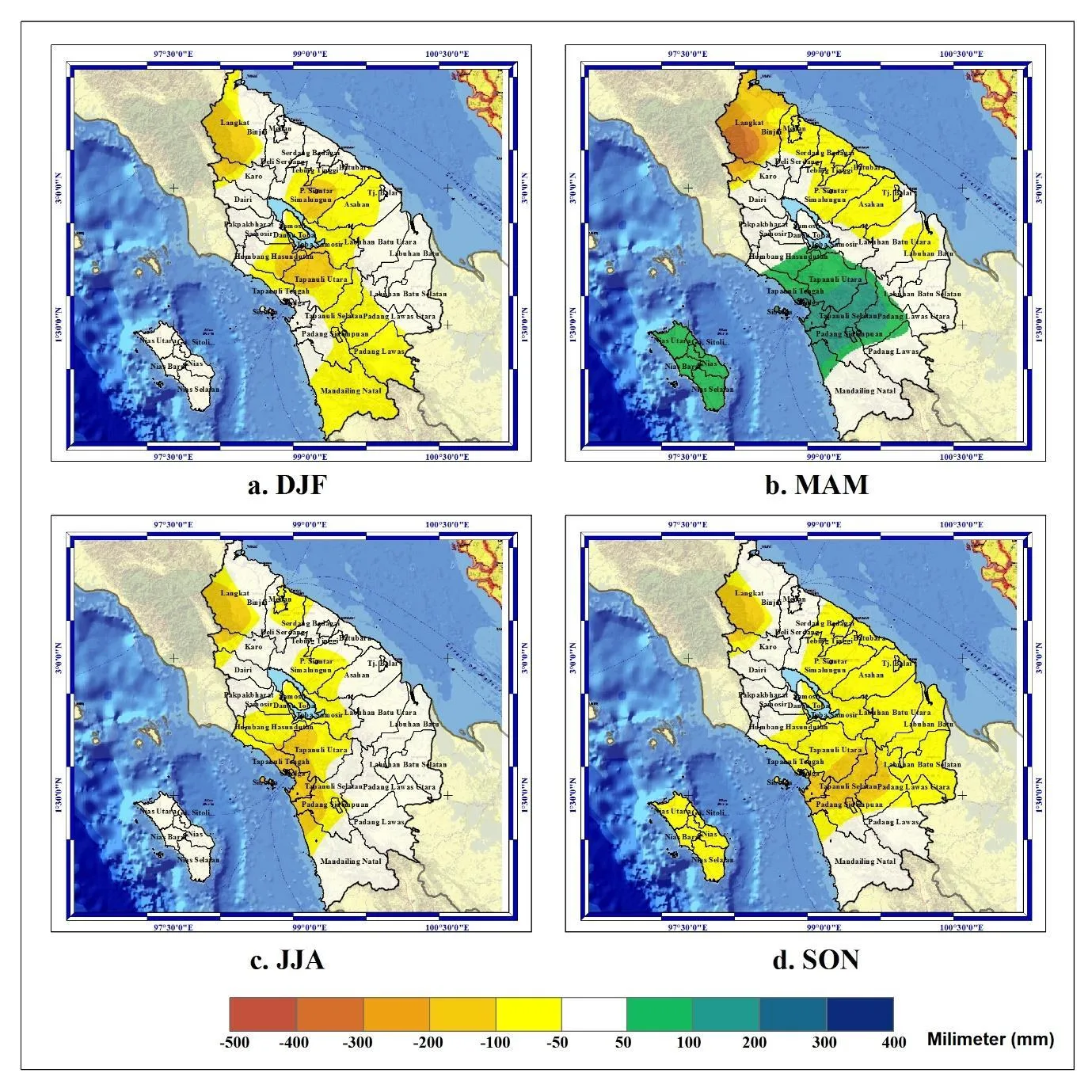
The first weight is El Niño, the warm current that every few years reshapes weather across the planet. During the strong events of 1982/83, 1997/98, and 2015/16, rainfall over the lake's catchment shrank by 50–100 millimeters per season, and the dry period stretched longer. The lake, like a bathtub with the tap partially closed, received less water, but evaporation did not stop. The second weight is local warming: according to data from the Parapat weather station, maximum air temperature is rising by 0.05 °C per year. That may seem like pocket change, but over decades, warm air draws ever more moisture from the lake. The third weight is human activity: deforestation and construction on the slopes, water withdrawal for an aluminum plant and growing settlements. The area of open land increased from 7.54 to 68.10 square kilometers, and the more bare land there is, the faster water runs off into the lake without soaking into the soil.
All three weights act simultaneously, but weighing each separately has not yet been possible. Water balance models paint a calm picture: inflow of 209.09 cubic meters per second against outflow of 82.37, meaning the lake should be filling. However, these models do not account for how weather will change with further warming. Climate projections allow for multi-year droughts, and then the scale pan could tip sharply downward. For comparison, at Lake Urmia in Iran, scientists were able to estimate that human activity accounts for 80% of the losses. For Toba, no such number exists.
The first weight is El Niño, the warm current that every few years reshapes weather across the planet. During the strong events of 1982/83, 1997/98, and 2015/16, rainfall over the lake's catchment shrank by 50–100 millimeters per season, and the dry period stretched longer. The lake, like a bathtub with the tap partially closed, received less water, but evaporation did not stop. The second weight is local warming: according to data from the Parapat weather station, maximum air temperature is rising by 0.05 °C per year. That may seem like pocket change, but over decades, warm air draws ever more moisture from the lake. The third weight is human activity: deforestation and construction on the slopes, water withdrawal for an aluminum plant and growing settlements. The area of open land increased from 7.54 to 68.10 square kilometers, and the more bare land there is, the faster water runs off into the lake without soaking into the soil.
All three weights act simultaneously, but weighing each separately has not yet been possible. Water balance models paint a calm picture: inflow of 209.09 cubic meters per second against outflow of 82.37, meaning the lake should be filling. However, these models do not account for how weather will change with further warming. Climate projections allow for multi-year droughts, and then the scale pan could tip sharply downward. For comparison, at Lake Urmia in Iran, scientists were able to estimate that human activity accounts for 80% of the losses. For Toba, no such number exists.
The scale pan continues to sink, but the needle has not yet shown which weight is heaviest. It could be El Niño, which blocks rainfall in dry years. It could be warming, which day after day evaporates water. Or it could be humans, who take water without regard for tomorrow. To answer, we need a unified model that accounts for all three forces at once. Until such a model exists, Lake Toba remains a giant natural experiment watched by all who depend on its water.
Lake Toba formed about 75,000 years ago in the caldera of a supervolcano after one of the largest eruptions in Earth's history. Its average depth is 228 m, and its water is used for cooling an aluminum smelter and generating electricity.