Three Pendulums on a Shared Spring: How a Simple Model Explains El Niño's Whims
Three pendulums hang from a long rope attached to the ceiling. One swings fast, another slow, and the third sometimes freezes and then lurches. But the rope is shared, so each jerk of one is felt in the motion of the others. This is roughly how the climate of the tropical Pacific works: fast wind bursts, the interannual El Niño cycle, and slow changes in the background circulation are all linked in a single system.
El Niño is a warm patch on the ocean surface that, every few years, changes weather across the planet. But the patch does not always appear in the same place. From 1980 to 2000, temperature anomalies concentrated near the coast of South America, but after 2000 they shifted toward the central Pacific. Scientists call this El Niño diversity: the eastern type, the central type, and mixed variants. Each type affects rains in Indonesia, droughts in Australia, and hurricanes in the Atlantic in its own way.
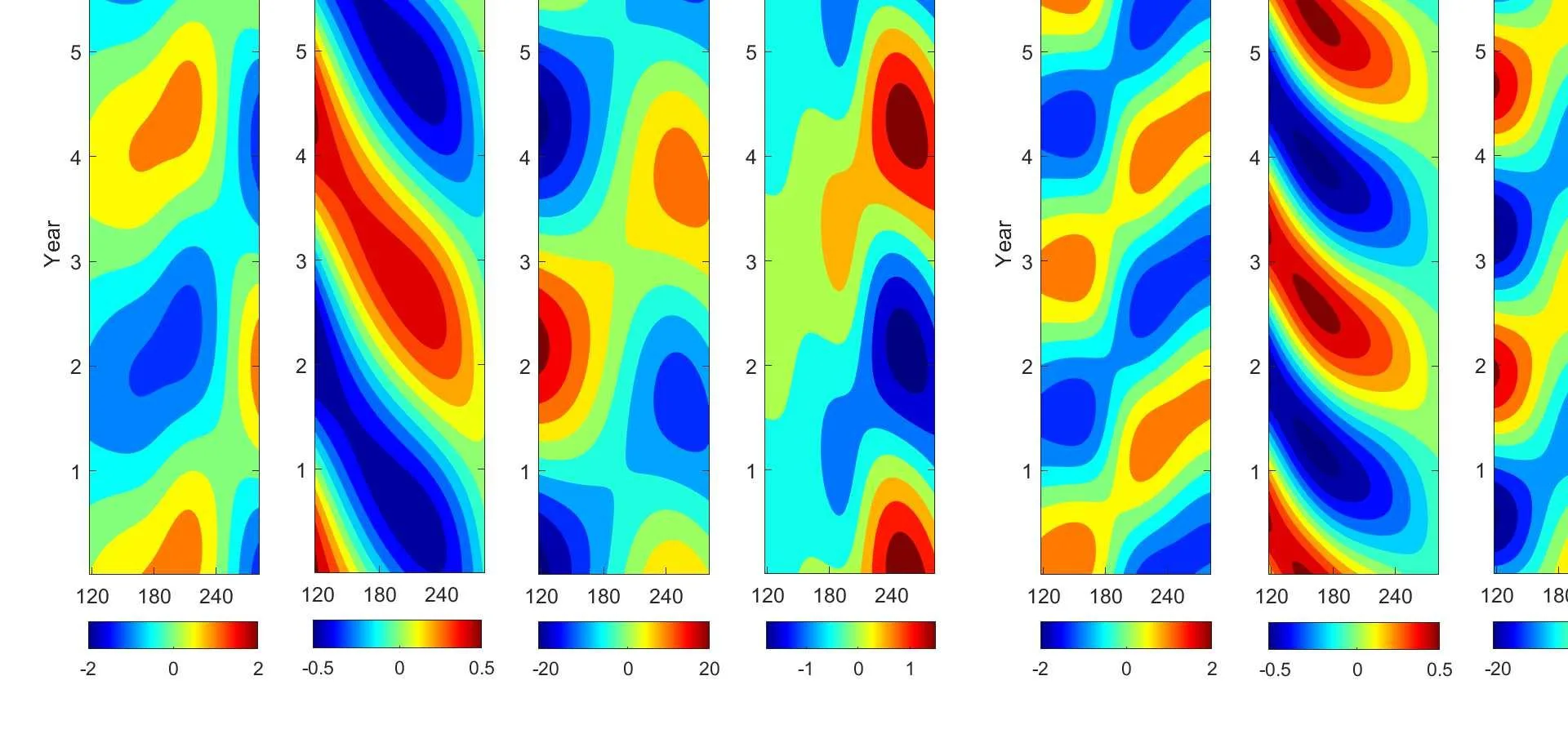
The authors built a model that combines three time scales. The first is fast wind bursts, lasting weeks and acting as random kicks. Their strength depends on the current ocean temperature: the warmer the water, the stronger the bursts can be. The second is the El Niño cycle itself, which develops over one to two years. The third is slow changes in the background Walker circulation, lasting decades and determining which type of El Niño is more likely in a given period. All are connected like pendulums on a shared rope.
The model was run for 3500 years of virtual time and compared with 70 years of real observations. It reproduced not only the mean characteristics but also the shape of sea surface temperature distributions. In the eastern Pacific, strong positive anomalies are more common than strong negative ones, which is called positive skewness. In the central Pacific, the opposite holds: strong negative anomalies occur more often. The model captured this subtlety, which more complex climate models often miss.
Previously, it was unclear how slow changes in the background circulation control the switch between eastern and central types. Now it is clear: decadal shifts in the Walker circulation alter the strength of the feedback, and the system transitions from one regime to another. Meanwhile, random wind bursts, whose strength depends on temperature, generate extreme events. Cubic damping in the central Pacific, added to the model, suppresses strong central anomalies and creates the observed negative skewness.
Three pendulums on a shared rope is not just an analogy. It is a working framework that allows predicting which type of El Niño will come next and assessing risks of droughts, floods, and hurricanes. The model can be used for statistical forecasting and for testing how climate change will affect the frequency of extreme events. The rope is taut, the pendulums are moving, and now we better understand their common rhythm.
The model reproduced the delayed super El Niño of 2014–2015, including the characteristic sequence of westerly, easterly, and again westerly wind bursts that first triggered, then suppressed, and then re-triggered the event.