Why Two Ice Columns from the Same Shore Sing in Different Voices ✛
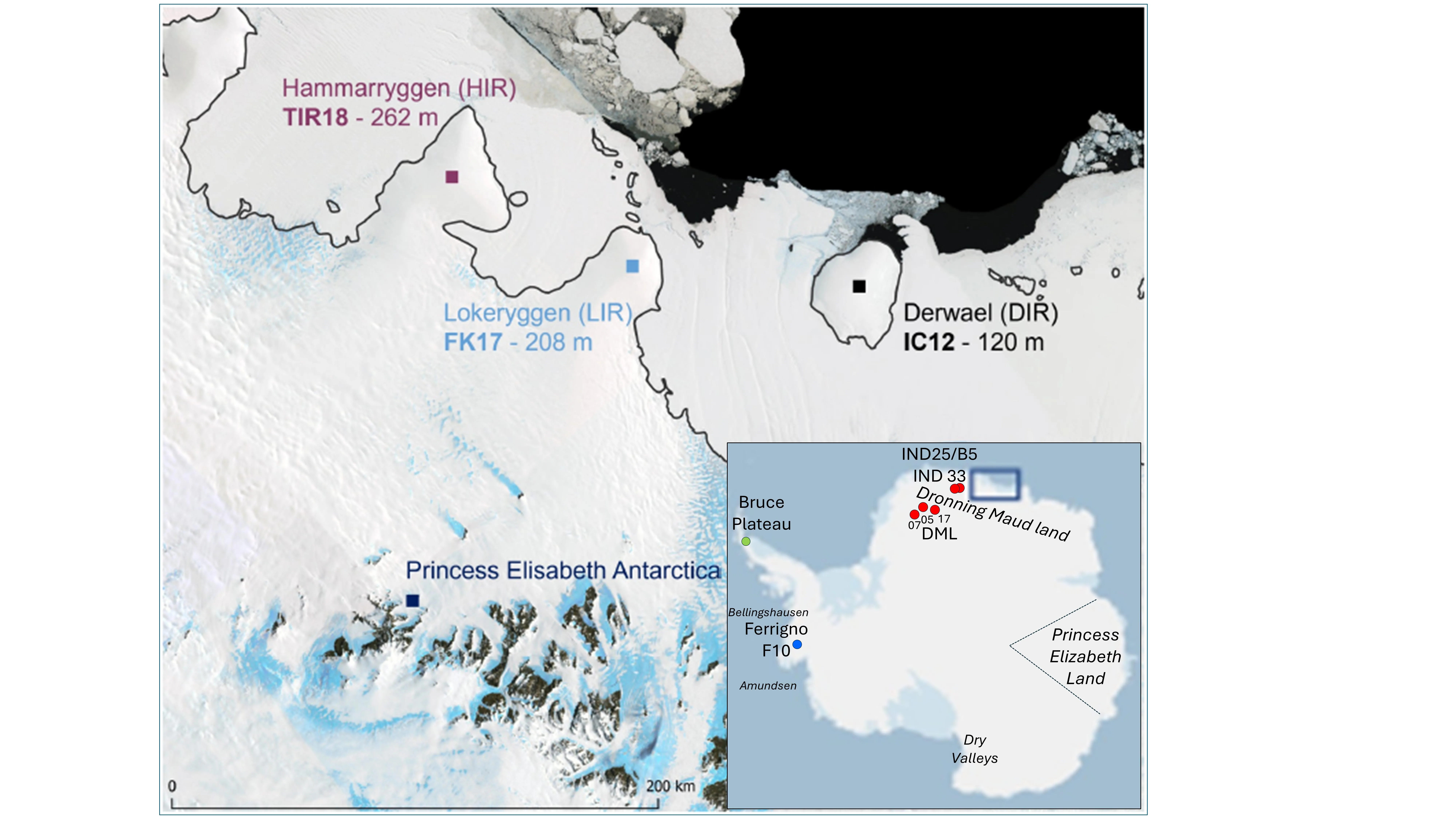
On the coast of Queen Maud Land, two ice cores stand like two seismographs on the same shore. One, FK17, was drilled on the crest of the Lokenryggen ice rise; the other, TIR18, on the crest of Hammarryggen. They are separated by a hundred kilometers, yet they pick up different tremors of climate. One hears the Pacific Ocean, the other the Atlantic and Indian Oceans.
Snow that fell here over 250 years has compacted into ice, preserving the oxygen isotope composition (δ18O), the ratio of heavy to light oxygen. This is a thermometer of the past: the warmer the air, the more heavy isotope in the snowflake. Scientists measured δ18O in the top 120 meters of each core at 5-centimeter intervals using a PICARRO L 2130-i laser spectrometer. This yielded time series from 1979 to 2010, cleaned of seasonal cycles and high-frequency noise.
Spectral analysis decomposed the signals into periodic components. FK17 showed sharp peaks at periods of 3, 4, 6, 8, and 10–12 years, while TIR18 showed more diffuse peaks at 3, 5, 7, and 22–28 years. But matching rhythms do not yet tell who controls whom. So the researchers applied causal analysis using the Liang–Kleeman method, which estimates the rate of information transfer from climate indices to δ18O based on changes in Shannon entropy. This allows distinguishing cause from mere coincidence.
Causal analysis showed that FK17 is significantly influenced by El Niño, the Pacific Decadal Oscillation, the Southern Annular Mode, the Indian Ocean Dipole, and sea ice extent in the 0–20°E and 20–40°E sectors. For TIR18, the main drivers turned out to be El Niño, the Pacific Decadal Oscillation, the Indian Ocean Dipole, the Atlantic Multidecadal Oscillation, and ice extent in the 20–40°E and 40–55°E sectors. The differences between the sites are linked to different air mass sources: TIR18 receives air from more eastern and continental directions.
So two seismographs on the same shore have revealed that each hears its own ocean. Previously, it was unclear which climate modes control the low-frequency variations of δ18O in coastal cores from Queen Maud Land and why neighboring sites produce different signals. Now it is clear: FK17 is affected by El Niño, the Pacific Decadal Oscillation, the Southern Annular Mode, the Indian Ocean Dipole, and sea ice in the western sectors, while TIR18 is affected by El Niño, the Pacific Decadal Oscillation, the Indian Ocean Dipole, the Atlantic Multidecadal Oscillation, and ice in the eastern sectors. The influence of the Indian Ocean Dipole has been identified for the first time. The method can be immediately applied to other proxies from these same cores and to any paleoclimate series where cause needs to be distinguished from correlation.
The two cores were drilled just a hundred kilometers apart, yet their isotopic spectra differ more than those of some cores separated by thousands of kilometers. The reason is that air masses reaching TIR18 come from the east and carry a more continental signal, while those reaching FK17 come from the west, over the Weddell Sea.