The Ocean's Palette: Why El Niño Comes in Different Shades ✛
An artist painting the ocean doesn't settle for a single blue. There's ultramarine, azure, turquoise: many shades. Likewise, El Niño, the warm current off Peru, is not always the same. Sometimes warm water gathers in the central Pacific, sometimes in the east, and that affects rains and droughts in different countries.
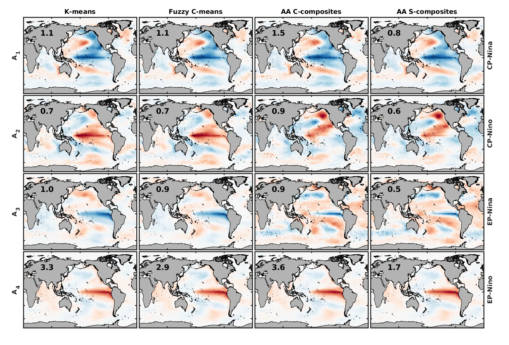
Previously, scientists often divided El Niño into two types: eastern and central. But that's not enough. In the new study, they applied a method that looks not for average states but for the most extreme ones, like pure colors on a palette. These extreme states are called archetypes. Taking ocean temperature maps over 41 years, the algorithm found four main archetypes: warm and cold variants in the center and in the east.
Now, instead of a simple "El Niño or La Niña," we can talk in terms of probabilities: how much the current state resembles one type or another. This helps better predict weather and prepare for its consequences. The ocean's palette has become richer, and the artist can paint the climate picture more precisely.
One of the largest eastern Pacific El Niño events, in 1982–1983, was so unusual that traditional monitoring systems initially missed it, because the warm anomalies appeared where they were not expected.