The Monsoon's Icy Pulse: How Cloud Ice Predicts Rain
Every summer, a giant atmospheric engine unfolds over India: moist ocean winds bring the rains that sustain crops and the lives of two billion people. But this engine sputters, and forecasting it a season ahead remains elusive. Models give only rough answers, and a monsoon forecast error can cost millions of tons of food. So scientists hunt for any clues that might let them peer into the future.
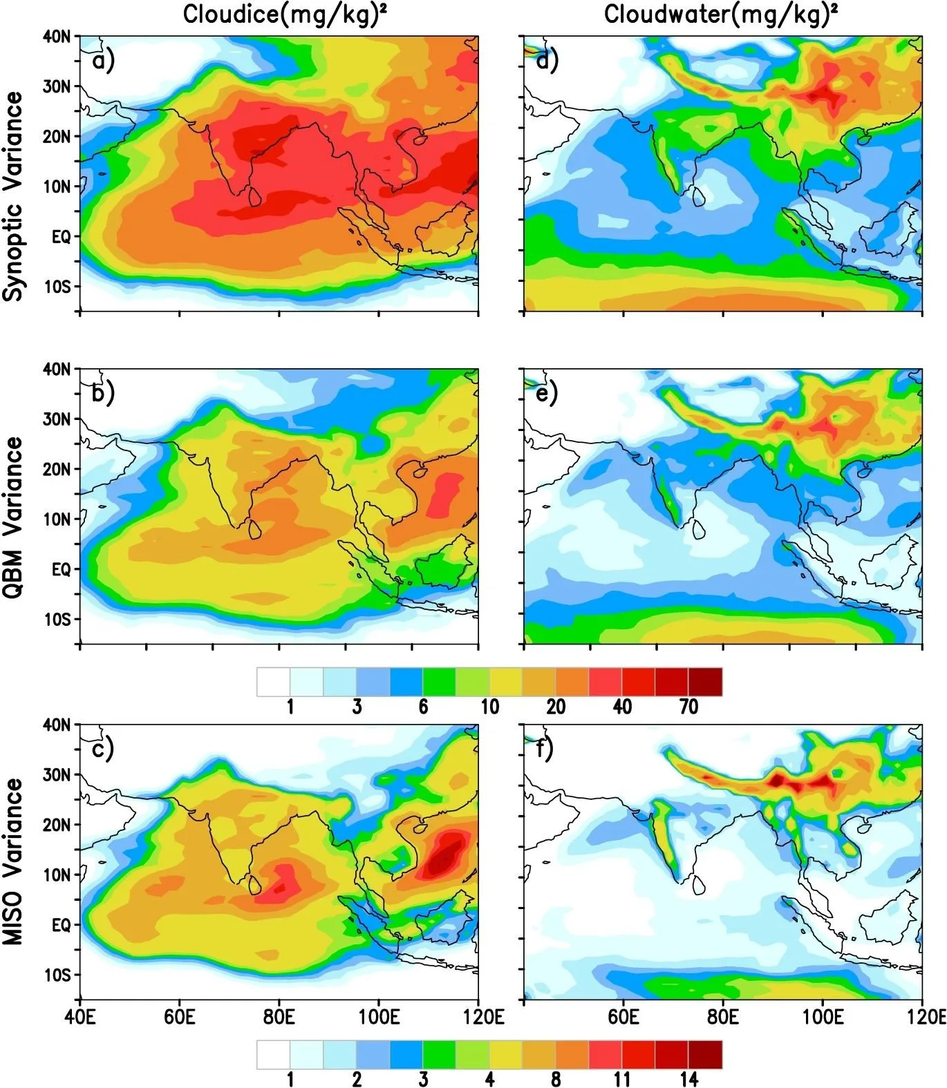
One such clue turns out to be cloud ice. This is not just crystals in clouds; it is a kind of pulse for the monsoon: the amount of ice in clouds over central India fluctuates with periods of 3–7 days, 10–20 days, and 30–60 days. The researchers analyzed thirty years of data and found that the fastest, synoptic ice variability (3–7 days) is most strongly tied to the total seasonal rainfall. The correlation coefficient reaches 0.6 at significance above 95%. In simpler terms, if icy clouds 'pulse' frequently in that rhythm early in the season, the summer is likely to be wet.
The reason for this link lies in cloud physics. Ice acts as a trigger: when a cloud holds many crystals, they grow, collide, and melt, releasing heat and strengthening updrafts. This sets off a chain that leads to a downpour within 2–3 days. So icy clouds act as an early signal: they precede rain rather than just accompany it. For cloud water, the strongest link to rainfall comes at the slower 10–20 day mode, pointing to different mechanisms for ice and droplets.
Testing with the CFSv2 model confirmed the importance of ice. In the standard model version, the link between cloud ice and El Niño has the wrong sign: the model predicts that a warm Pacific strengthens ice activity, when in reality it is the opposite. When the scientists improved the model's ice microphysics, it reproduced the observed pattern. Moreover, the seasonal monsoon forecast skill improved. This is direct proof: to predict rain, you must accurately describe how ice crystals form and grow in clouds.
The discovery changes the forecasting approach. Previously, subseasonal cloud fluctuations were thought too chaotic to carry information about the whole season. Now it is clear that the monsoon's icy pulse is partially predictable and can serve as an additional indicator. Perhaps in the future, forecasters will watch cloud ice variability as closely as ocean temperatures. Then the monsoon engine will become a bit less capricious, and forecasts more reliable.
About 40–50% of all rainfall events on Earth originate from melting ice. In the Indian monsoon, cloud ice over central India leads rainfall peaks by 2–3 days, acting as a natural harbinger of downpours.