The Icy Pulse of the Monsoon: How Cloud Ice Predicts Rain
Context
Forecasting the Indian monsoon a season ahead remains a challenge: models deliver only subpar accuracy, yet the rains are crucial for food security and the region's economy. This paper sits at the edge of the archive, with few neighbors, but thematically it aligns with research on the large-scale structure of the atmosphere and machine learning in climate science. Adjacent works address rainfall–El Niño connections, hurricane forecast improvements, and humidity, but none have examined the variability of cloud hydrometeors themselves on subseasonal timescales during the monsoon.
Methods
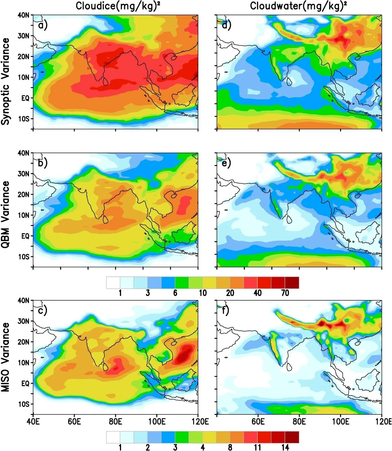
The study used MERRA reanalysis (cloud ice and water), GPCP and TRMM precipitation, HadISST sea surface temperatures, and NOAA outgoing longwave radiation for 1981–2010. From daily time series of cloud ice and water over all India and central India, the annual cycle harmonics were removed, then Lanczos filtering isolated the 3–7, 10–20, and 30–60 day bands. For each band, intraseasonal variance was computed for June–September and correlated with seasonal rainfall totals and the Niño3.4 index. Additionally, 50-year climate simulations were run with the CFSv2 model in both control and modified (MPHY) versions, where the ice-phase microphysics was improved.
Results
Synoptic (3–7 day) variance of cloud ice over central India correlates with seasonal monsoon rainfall more strongly than other bands: the correlation coefficient reaches 0.6 at significance above 95%. The same variance is significantly linked to Niño3.4 temperature (negative correlation around −0.5), pointing to predictability through the slowly varying El Niño forcing. For cloud water, the strongest link to rainfall appears in the quasi-biweekly mode (10–20 days), while the 30–60 day mode shows no correlation with Niño3.4. In the control CFSv2 model, the cloud ice–Niño3.4 link has the wrong sign, but the MPHY version reproduces the observed pattern. Composite events show that cloud ice leads rainfall by 2–3 days, consistent with its role as a trigger for convection.
Implications
The work follows neighboring studies that link subseasonal rainfall variability to slow predictors, but differs in its target: instead of rainfall, it examines cloud hydrometeors themselves. This is the first test showing that cloud ice variability on synoptic scales is partially predictable and can serve as a bridge between cloud microphysics and large-scale circulation. The result explains why improving ice microphysics in models enhances seasonal monsoon forecasts and provides a clear goal for further scheme development.
Future development
The topic could evolve toward explicitly incorporating cloud ice into statistical and hybrid seasonal forecasting schemes. A synoptic cloud ice activity index might be developed as an additional monsoon predictor. Also promising is exploring links to other slow modes, such as the Indian Ocean equatorial mode, and testing on next-generation models.
Impact
The findings will influence the development of cloud parameterizations in climate models and the practice of seasonal monsoon forecasting. They are also useful for adjacent fields where the link between microphysics and large-scale dynamics matters, such as tropical cyclone prediction.
Next steps
Verify the reproducibility of the link using other reanalyses (ERA5, JRA-55) and the CMIP model ensemble. Conduct additional sensitivity experiments with different ice microphysics schemes to isolate key processes.
Key open problems
A persistent challenge in atmospheric science is the interaction of clouds, convection, and circulation—the 'gray zone' of climate science. This work directly addresses how subseasonal variability of cloud condensates fits into seasonal predictability and proposes a concrete mechanism through the ice phase.
About 40–50% of all rainfall events on Earth originate from melting ice. In the Indian monsoon, cloud ice over central India leads rainfall peaks by 2–3 days, acting as a natural harbinger of downpours.
Key numbers
- correlation of synoptic cloud ice variance with rainfall: 0.6 (significance >95%)
- correlation with Niño3.4: around −0.5
- synoptic band period: 3–7 days
- fraction of rain from melting ice: 40–50%
- reanalysis record length: 30 years (1981–2010)