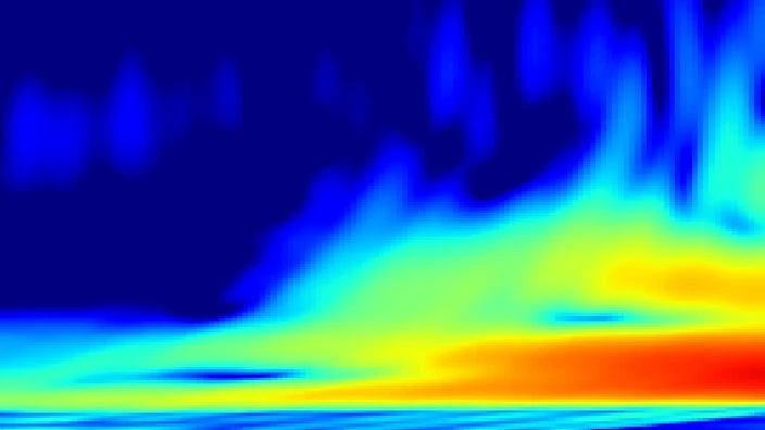
How much heat the planet radiates to space over a given patch of ocean, here 5N-5S, 160E-160W. Tall clouds are cold on top, so they radiate less: a NEGATIVE anomaly means the cloud tower has moved in.
Outgoing longwave radiation (OLR) is the infrared energy that Earth emits back to space. Over the equatorial Pacific, measuring OLR in a specific box (5°N–5°S, 160°E–160°W) reveals where deep convective clouds are active. Tall thunderstorm clouds have very cold tops, so they emit less infrared radiation than the warm ocean surface. Thus, a negative OLR anomaly in this region means that such cloud towers have moved in, indicating strong atmospheric convection and rising air.
History
Satellite measurements of OLR began in the 1970s with NOAA's polar-orbiting satellites, and the data have been used since then to monitor tropical convection and ENSO. The specific index over the equatorial Pacific became a standard tool in climate diagnostics.
How it works
Satellites measure the infrared radiance leaving the top of the atmosphere. In clear skies, the signal comes from the warm ocean surface, producing high OLR values. When thick, tall clouds are present, they block that surface emission and instead radiate from their cold tops, lowering the OLR. By averaging over the specified region and comparing to the long-term average, scientists get an index of convective activity. This is closely tied to the Walker circulation: when OLR is anomalously low (more clouds), it often signals the eastward shift of convection that accompanies El Niño.
In practice
OLR anomalies are used to track the Madden–Julian Oscillation and to provide real-time monitoring of convective activity that can trigger or respond to El Niño events.
Fun fact
A single large thunderstorm over the tropical Pacific can cool the local surface by shading it from sunlight, but its cold cloud top also reduces heat loss to space, creating a complex tug-of-war on the energy budget.
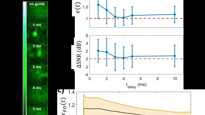
An ordinary flashlight shines in all directions, and after just a couple of dozen meters its beam fades so much it barely lights a wall. The atmosphere scatters light, and wind and heat currents distort it even more. But if you lay an invisible pipe for light right in the air, the beam will travel through it like water through a hose.
Ten billion years ago, the universe was speckled with strange crimson sparks. The JWST spotted them in images at distant redshifts — compact sources blazing like entire galaxies yet no larger than a tiny central region. Astronomers nicknamed them “little red dots.” Their nature long defied explanation.
A mosaic of large colored tiles. Each tile is the average precipitation over an entire month for an area the size of a small country. For a general understanding, the picture is fine, but if you need to know whether a downpour hit a specific city yesterday, it's useless.
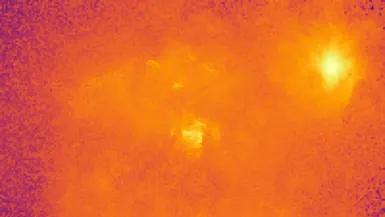
Every galaxy is wrapped in an invisible shell of hot gas, like steam rising from a pot of boiling water. This gas barely glows in X-rays, making it notoriously difficult to measure. Yet it holds the memory of stellar explosions and the galaxy's growth.
The new method uses light from a galaxy's bright center.
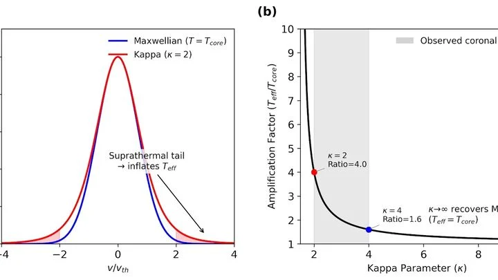
For eight consecutive years, two different methods of measuring the temperature of the solar corona have given different answers. One instrument, a radio telescope in Nancay, sees 600 thousand degrees. The other approach, calculating from how the gas is distributed with height, requires 1.5 million.
The solar corona, the Sun's outer atmosphere, stretches millions of kilometers, yet it's visible only during a total eclipse or with specialized instruments. Typically, we gauge the corona's density by how it scatters white light, but that method relies on simplifications that can skew the results.
A solar flare is like an explosion in a star's atmosphere: in minutes, it releases energy comparable to billions of nuclear bombs. On May 4, 2022, the RT-7.5 radio telescope in Moscow was watching an M5.7-class flare. The instrument was catching millimeter radio waves: those shorter than a centimeter and invisible to the eye.
At the heart of nearly every large galaxy lurks a supermassive black hole. As it devours gas, it blasts powerful outflows back into space, like a dragon that can't swallow all its prey and breathes fire. These 'winds' accelerate to thousands of kilometers per second and can sweep away the gas reservoirs from which stars are born.
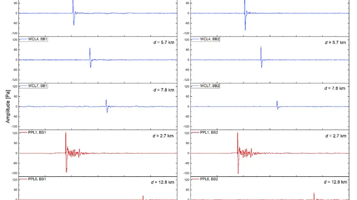
The same explosion can sound different: it all depends on which way the wind is blowing. In 2024, researchers set off charges equivalent to ten tons of TNT twice and recorded the sound with a network of 31 microphones spread over a radius of 23 kilometers. The source was identical, but the acoustic pictures turned out to be quite different.
In the stream of charged particles that constantly blows from the Sun, radio bursts sometimes occur — short, powerful signals at frequencies you can pick up on an ordinary radio. Until now, it was unclear how exactly these signals are born in that stream.
An oven with three racks, each baking a different dish: that's the image that comes to mind when you look at the galaxy I Zw 18. The top rack is blazing at 21,200 kelvins, the middle one at 17,290, and the bottom at 16,170.
Any device, from a toaster to a smartphone, heats up when operating. This is the inevitable result of energy conversion — there's always a heat trace left, like a hot stove burner after cooking.
In 1976, Canadian physicist Bill Unruh asked a simple question: what does an observer see when accelerating through empty space? The answer turned out to be strange: emptiness ceases to be empty. An accelerating observer bathes in thermal radiation with a temperature proportional to the acceleration.