The Oceanic Niño Index (ONI) is a specific metric that quantifies the strength of El Niño and La Niña events by measuring sea surface temperature anomalies in a defined region of the central-eastern tropical Pacific Ocean, known as the Niño 3.4 region. This region spans roughly from 120°W to 170°W longitude and 5°N to 5°S latitude. The ONI is calculated as the three-month running average of sea surface temperature anomalies in this area, relative to a 30-year baseline that is updated every five years.
History
The ONI was developed by the U.S. National Oceanic and Atmospheric Administration (NOAA) in the late 1990s as a standardized way to classify El Niño and La Niña events, replacing earlier, less consistent indices.
How it works
To compute the ONI, scientists average the sea surface temperature over the Niño 3.4 region for each month, subtract the corresponding climatological average, and then smooth the result over three consecutive months to reduce monthly noise. When the ONI exceeds +0.5°C for at least five consecutive overlapping seasons, an El Niño episode is declared; when it falls below -0.5°C for the same duration, a La Niña episode is declared. The magnitude of the index indicates the event's intensity, from weak to very strong.
In practice
The ONI is the primary operational index used by climate agencies worldwide to declare El Niño or La Niña conditions and to issue seasonal climate outlooks.
Fun fact
The ONI's baseline is updated every five years, so a historical event's classification can shift slightly as the reference period changes.
Spectroscopy has always been a way to hear the unheard. Back in the 19th century, Johann Balmer deciphered the elegant lines of hydrogen — a simple numerical harmony that foreshadowed quantum theory.
A tuning fork produces a pure tone, but if you strike it too hard, it starts to rattle, and a musician might mistake that rattle for complexity in the sound.
Deep underground, in the thickness of granite, detectors catch rare visitors from space — muons. These particles are born high in the atmosphere when cosmic rays slam into air nuclei. They make it to the underground lab thanks to their enormous speed, close to the speed of light.
An invisible fence blocks the strait. You can't climb over it or dive under it: it's not made of steel, but of a stream of particles penetrating the water column. That's one way to describe the idea of detecting nuclear submarines by their antineutrino emission.
Deep in a cave beneath the Italian Apennines, a tank of gas sits in the dark. Inside, charged particles fly through, leaving faint flashes of light in their wake. These flashes are like the wake of a boat on dark water: they reveal where the particle went and how fast.
Every second, invisible particles from space, cosmic rays, strike Earth's atmosphere. Colliding with air molecules, they produce showers of secondary particles, among which muons are especially abundant. A muon is a heavy cousin of the electron that lives only a couple of microseconds but still manages to reach the ground.
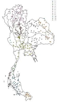
Tuning an old radio receiver requires patience: you slowly turn the dial, catch a crackle, turn it again, until a voice emerges through the static. In much the same way, a reinforcement learning agent searched the ocean for two patches whose temperature difference best predicts rains in Thailand.
In 1997, the Pacific Ocean warmed so much that corals bleached from Indonesia to the Galápagos, and floods and droughts swept across five continents. Such events, which climate scientists call extreme El Niños, occur every few decades, and to understand how often they will arrive in the future, we need thousands of years of observations.
A translator that learned the grammar of the wind, not just the vocabulary. The wind blows over the Pacific, and the water responds with waves, currents, and upwellings of cold depths. The KIST-Ocean neural network was taught not just to memorize how the ocean looked yesterday, but to understand why it will become what it is tomorrow.
From July 2023 to July 2024, Earth's atmosphere gained carbon dioxide at a rate of 3.66 parts per million per year. That is the fastest pace since 1979. The reason is not that factories and cars suddenly started emitting more CO₂. The planet's lungs—forests and soils—took a shallower breath.
The planet breathes through its green cover.
Each Atlantic hurricane season is like a game of dice, where the number of spots depends on three major climate forces: El Niño, ocean temperature in the 'hurricane nursery,' and the North Atlantic Oscillation.
Water remembers. Every current, every eddy, every degree of temperature in the ocean's depths does not vanish without a trace; it leaves a mark that can be read. But until recently, that mark was read only by bulky physical models that spent weeks on supercomputers and still got the details wrong.
In the summer of 2022, the sky over western India seemed to have forgotten about drought: rains fell more often than usual, while eastern states languished in dryness. Such an imbalance puzzled forecasters, because ocean currents in the Pacific had promised a steady, abundant monsoon across the country.
A fisherman in Queensland notices that in some years snapper are harder to catch, even though the nets and boat are the same. The reason hides not in the catch itself but in the water temperature several months earlier, when the fry were just hatching. A warm current arrived not for the whole year but only for a few weeks, and that short episode decided the fate of an entire fish generation.
A doctor who has followed the same patient for years learns to predict flare-ups from subtle signs: a slight pallor, labored breathing, restless sleep. The ocean is just such a complex patient, only instead of a thermometer it has thousands of buoys and satellites, and instead of a medical history, seventy years of daily measurements.
Every year in Costa Rica, dengue fever arrives like the rainy season: people expect it, they prepare for it, but the exact rhythm of outbreaks has remained a mystery. In some cantons, the disease flares up every year; in others, every two or three years.
An interpreter at an important negotiation keeps a draft of their speech at hand but checks against the live conversation as they go: if what is said diverges from the prepared text, they adjust the translation on the fly.
Every spring, the sky over the US Great Plains starts behaving like a giant steam boiler. Warm, moist air from the Gulf of Mexico collides with dry air from the west, and in that mix, thunderstorms are born that can rip the roof off a barn in minutes. Meteorologists have long tracked the 'fuel' for such storms, but so far they have mostly looked at average values.
The thermometer at a weather station in Delhi doesn't know it's part of a giant ear. Every day it records the temperature, and after forty years of such records, you can hear the breathing of an entire subcontinent. The India Meteorological Department divided the country's land into one-degree squares and took readings from 1970 to 2009.
Every summer, the same performance unfolds over the Indian Ocean: moist air rushes from the sea onto the scorched land, bringing rains that billions of people depend on.
Over the tropical Pacific, air pressure breathes with periods from two to fourteen years. The barometer on Tahiti rises while it falls in Darwin, Australia, and the entire planet's climate shudders: El Niño arrives. Meteorologists call this the Southern Oscillation and have tracked it for 138 years, but until now they couldn't answer a simple question: where do such periods come from?
An orchestra falls out of tune before a storm, then plays in unison again. In the equatorial Pacific, within a rectangle stretching from 5°S to 5°N and from 120°W to 170°W, water temperatures usually change in concert, like musicians playing the same part. This area is called the Niño 3.4 region.
Picture a map of China with sparse green patches scattered across a yellow desert. Those patches are where the GloSea5 climate model can genuinely look three months ahead, while the desert is everything else, where its forecasts are no better than a coin toss.
The river that circles Antarctica does not flow in a single channel: it sometimes splits into branches, sometimes merges into one stream. That is what the fronts of the Southern Ocean look like on maps built from satellite data on sea surface height. Previously, these fronts were sought along lines of equal water level, and they seemed to creep slowly southward.
A warm tongue of water stretches along the equatorial Pacific, and within weeks, Peru sees torrential rains while Australia's pastures dry out. That is how El Niño begins: a natural conductor that, at critical moments, makes only a few orchestra members play, but much louder.
The planet's winds are not free-flowing currents but rather obedient jets that can be nudged from an unexpected direction. The ocean surface, covered with waves, acts like a tuning knob: change its roughness, and giant air rivers shift by hundreds of kilometers.
Every clear night, a telescope in the Chilean desert records light from distant stars, and in those recordings, like old ship logs, traces of weather remain. The thin dark bands in the spectrum are imprints of water vapor that hung over the observatory at the moment of observation.
On April 16, 2012, Washington experienced heat no one expected. The thermometer climbed 18 degrees above normal. Sixty days earlier, Bucharest and Kyiv had weather unusual for them. The link between these events was found by an algorithm that scans pairs of cities worldwide, looking for recurring coincidences.
Every night, an invisible sentinel hangs over the Andes. The GOES-12 satellite, and later its successor GOES-13, watches Earth from an altitude of 36,000 kilometers, recording how the mountains breathe clouds. For five straight years, it tracked where the sky stayed clear and where it got wrapped in cotton.
The coast works like a conductor: it doesn't create the music, but it sets the rhythm and direction. Every morning, the sun heats the land faster than the sea, and warm air rises over the sand, pulling in a moist breeze from the ocean. By evening, the land cools and the wind reverses. This daily pendulum lines up clouds along the water's edge, like musicians following the baton.
Twice a day, at eleven in the morning and eleven at night, a white balloon with an instrument rises into the sky from a tiny station in San Pietro Capofiume, just eleven meters above sea level. Over twenty-two years, more than sixteen thousand such launches have recorded how air temperature changes with altitude: from the warm ground to the thin cold at twenty kilometers.
Every clear night, a telescope on the island of La Palma looked at the sky and recorded how much the air dimmed starlight. This was routine work for astronomers measuring stellar positions. But in these records, like in an old diary, traces of a different story remained: the arrivals of dust from the Sahara.
On an old film strip of rainfall, only the brightest frames are visible, and between them lies noise. A meteorologist assessing flood risk long looked only at such frames, that is, at annual rainfall maxima. Everything else, thousands of daily observations, remained off-screen. The new method develops the entire film, and details that were previously invisible come into view.