Satellite imagery refers to images of Earth captured by artificial satellites orbiting the planet. These images are used to observe and monitor surface features, atmospheric conditions, and large-scale patterns that are difficult or impossible to see from the ground. The technology has transformed fields such as meteorology, environmental science, agriculture, and urban planning by providing a synoptic view of the Earth's surface over time.
History
The first satellite images of Earth were taken by the TIROS-1 satellite in 1960, which marked the beginning of weather observation from space. Since then, the technology has evolved from simple television cameras to sophisticated multispectral and radar systems.
How it works
Satellites carry sensors that detect electromagnetic radiation reflected or emitted from Earth's surface and atmosphere. These sensors operate in various spectral bands, including visible light, infrared, and microwave, allowing them to capture data during both day and night and through cloud cover. The data is transmitted to ground stations, where it is processed into images that can be analyzed for specific features, such as vegetation health, soil moisture, or urban heat islands.
In practice
Satellite imagery is used in weather forecasting, disaster management (e.g., tracking hurricanes and wildfires), agricultural monitoring, and climate change research, as well as in archaeology and geology to identify surface features.
Fun fact
Some satellite images can detect underground structures, such as fungal networks in forests, by analyzing subtle variations in surface vegetation and soil moisture.
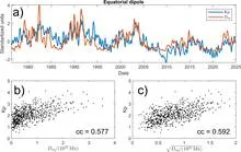
The Sun breathes, and that breath has a magnetic rhythm. Every 27 days, the visible surface of the star makes a full rotation, and with it, its magnetic field, like an invisible ribbon wrapped around the star.
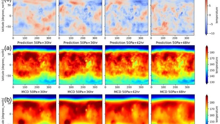
Meteorologists have grown used to trusting neural networks: the GraphCast model predicts Earth's weather days ahead by drawing on global snapshots of the atmosphere. But this 'brain' can be transplanted to another planet — where the air is thin and the Sun warms differently.
A mirror can direct a reflected beam onto one spot, even as it rotates. Engineers borrowed this trick for radio waves, building a smart mirror on a drone. It cancels out shakes and vibrations on the fly: it anticipates the drone's movements and instantly re-aims to keep the signal crisp.
Radio signals in a room act just like sound in a concert hall: bouncing off walls and objects, they create a unique pattern — a silent melody for every location. Your phone, like a keen ear, catches this melody amid noise and distortion. It remembers which chord matches the corner of the couch, and which one fits the doorway.
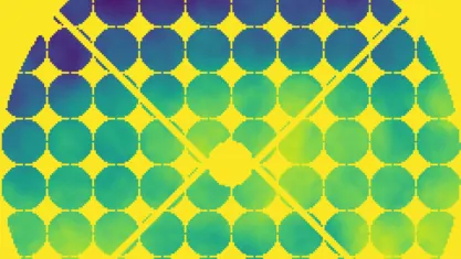
A single-pixel camera works like an artist creating a picture through a stencil with many holes. In each frame, only a portion of the light, modulated by a mask, a spatial light modulator, reaches the single sensor, and then the computer reconstructs the full image by assembling this mosaic with computational algorithms.
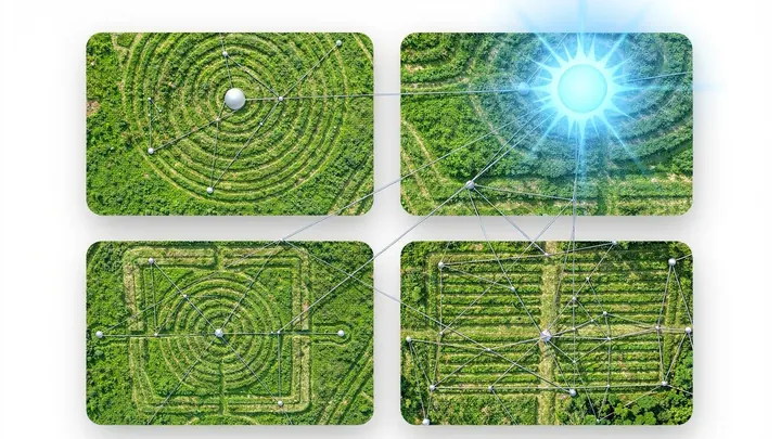
Deep in the Amazon rainforest, beneath a multi-layered canopy of leaves, lie vast earthen figures — squares, rectangles, the occasional rhombus. For decades they teased archaeologists with their silent geometry, until a researcher armed with orbital optics saw them as an astronomical instrument.
A solar telescope is like an eye trying to spot an ant through a pot of boiling soup. The daytime sky dazzles, the air shimmers, and the image swims. To freeze it, you need adaptive optics — a system that predicts distortions and corrects them hundreds of times per second.
Drylands are like skin cracking from dehydration. When rainfall decreases, plants don't vanish overnight: they rearrange, leaving bare patches of soil between them. These patterns are visible even from space.
Scientists compared satellite images of eight arid regions, from the Sahel in Africa to Australian deserts.
Beneath your feet in the forest, a quiet life unfolds: fungi weave around tree roots and trade nutrients with them. But how do you count how many fungal species are in the soil without digging up the whole forest? It turns out the answer can be seen from space.
Scientists search for planets around distant stars by detecting a slight wobble in the star's motion: the planet tugs on the star, making its light shift slightly toward the blue and then toward the red. But stars have their own ripples — dark spots and bright faculae on their surfaces. These also shift the light, making it hard to tell them apart from a planet.
Entangled photons are like twins: what affects one instantly affects the other, even if they are separated by kilometers. Until recently, observing such a connection required detectors that counted each photon individually in pitch darkness. Physicists simplified the task by swapping them out for a regular scientific camera.
The Sun is not just a ball — it's a magnetic mansion. Its invisible force lines, like electrical wiring, thread through space and control space weather. But until now, we've only seen this wiring from the landing — the plane of Earth's orbit. The attic and basement, the magnetic poles, remained a mystery.
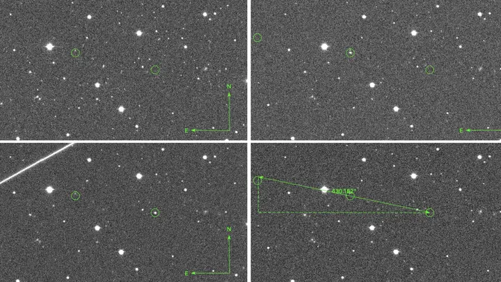
Back in the 18th century, William Herschel was searching for life on Mars. Today, astronomers are targeting not planets but artifacts — for example, alien probes lurking in the Solar System. The problem is that spotting a tiny object next to the blinding Sun is nearly impossible.
Setting up an orchestra without a conductor: the algorithm itself decides which instruments (basis functions) and at what volume (weights) should play to reproduce Earth's gravitational symphony.
Two images of the same place: one taken in the morning from a drone, the other in the evening from a satellite. The first shows shadows from trees, the second shows glints on the water. It's like two accounts of the same event in different dialects: the words are similar, but the grammar is different.