Polarimetric remote sensing is a technique that measures the polarization state of light reflected or emitted from a surface or atmosphere, rather than just its intensity. This extra information reveals physical properties that are invisible in ordinary images, such as the roughness of a surface, the shape of aerosol particles, or the phase of water (liquid vs. ice). It is widely used in Earth observation satellites and planetary missions to map minerals, track cloud properties, and study atmospheric composition.
History
The technique dates back to the 19th century with observations of polarized light from the sky, but modern remote sensing began in the 1970s with satellite instruments like the SMMR. The specific application to cloud phase discrimination using lidar was developed in the late 20th century.
How it works
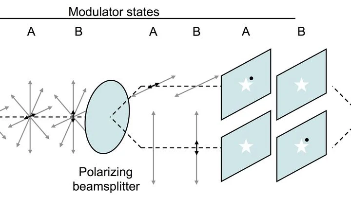
Light becomes polarized when it scatters off surfaces or particles, with the degree and angle of polarization depending on the material's refractive index, shape, and orientation. A polarimetricsensor measures the intensity of light through multiple polarizing filters at different angles. By comparing these measurements, the Stokes parameters are derived, which fully describe the polarization state. Algorithms then invert these parameters to infer the properties of the observed scene.
In practice
Used in satellite missions like NASA's PACE and ESA's EarthCARE to monitor ocean color, clouds, and aerosols, and in lidar systems to distinguish water droplets from ice crystals in clouds.
A fusion reactor is like a super-hot furnace where plasma reaches millions of degrees. The walls are made of tungsten, the most refractory metal there is. But even tungsten needs protection: fast particles from the plasma bombard the surface and knock atoms loose. These ejected atoms enter the plasma and cool it down, like a spoonful of cold milk in hot tea.
The orchestra plays, but the musicians can't hear each other. The conductor keeps stopping the music and walking over to each player to tune the instrument. That's roughly how space telescopes with segmented mirrors work.
Photographing an exoplanet orbiting another star is like trying to spot a firefly in front of a spotlight. Earth's atmosphere is constantly churning, which makes stars appear as dancing speckles through a telescope.
One hundred forty parsecs, a distance light traverses in four and a half centuries, separate us from the Taurus molecular cloud. Within its depths hide dark condensations: prestellar cores, where gas and dust slowly contract under their own weight.
An ordinary flashlight emits light whose waves oscillate in all directions at once. But pass that light through a special filter, and you get a beam that oscillates strictly in one plane: that's polarized light. When such a beam travels through biological tissue, the tissue's internal structure slightly alters the orientation of the oscillations.
Night on La Palma. The 4.2-meter William Herschel Telescope is aimed at Venus. At the focus is the experimental polarimeter ExPo, designed to catch the ghostly light of exoplanets.
A sound signal is conveniently represented as a complex number: its modulus (amplitude) reflects loudness, while its argument (phase) indicates the wave's position in time: its instantaneous shift.
Spectroscopy has always been a way to hear the unheard. Back in the 19th century, Johann Balmer deciphered the elegant lines of hydrogen — a simple numerical harmony that foreshadowed quantum theory.
In a close binary system, the hot star, like a searchlight, illuminates its cooler companion. Some of the light scatters off free electrons in its atmosphere — this is Thomson scattering — and acquires linear polarization. As the stars orbit each other, this polarization rotates, like the hand of a peculiar cosmic metronome.
Almost a century after Фриц Цвикки suspected something was amiss in the motion of galaxies in the Coma cluster, and Вера Рубин measured stellar velocities in spiral arms, the nature of тёмной материи remains one of the most vexing mysteries.
A spinning top whirling so fast that it forces light around it into spirals: that's a fitting image for what happens near a black hole's horizon. Hot plasma falls in and emits radio waves. Their polarization (the plane in which the wave oscillates) becomes an arrow pointing in the direction of energy flow.
Red giants are swollen, aging stars. Deep inside, an ocean of plasma churns: heat forces its way from the core to the surface, generating waves like a mighty surf. The star's magnetic field acts like an invisible seabed – it steers these waves, changing their height and speed.
Gravitational waves are the trembling of spacetime itself. Usually we only catch their overall hum, but each wave also has a direction of oscillation – polarization. Old maps were built only from signal loudness, which led to errors. It's like trying to see the bottom of a pond through sun glare.
The ionosphere at an altitude of 70 kilometers acts like a giant mirror for radio waves. Ground antennas constantly beam signals into it and listen for the reflection. When a solar flare occurs on the Sun, a stream of X-rays reaches Earth in 8 minutes and compresses the lower layer of the ionosphere.
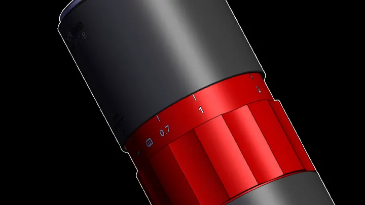
Light, like a shaken rope, oscillates in a specific plane. Astronomers and engineers often rotate images using a three-mirror system, the so-called K-mirror, but this inadvertently rotates the plane of oscillation as well. For precise measurements, that's a problem.
A conventional laser is like an orchestra where musicians must warm up before playing in unison. You first need to pump enough atoms with energy so they 'flip' and are ready to emit light: this is called population inversion. Only then does the beam flash. A polariton laser plays by different rules: its 'musicians'—a mix of light and matter — join in almost without preparation.
The neutron star 4U 1735-44 is gobbling up matter from a companion star. The matter spirals into a flat disk, like water going down a bathtub drain. But this disk shines in X-rays, and astronomers have for the first time measured how "combed" those rays are: that is, how polarized.
On the surface of a thin film of bismuth iron oxide, you can see neat stripes, like furrows in a plowed field. What lies beneath them has remained a mystery until now.
You can make a light beam look like a flower with several petals. If you send such a beam through a cloud of cold rubidium atoms and switch on a magnetic field, the petals start to rotate. The angle of rotation is directly linked to the field's strength.
A flashlight beam in fog breaks into thousands of faint specks. Each speck is light that has bounced off countless water droplets before reaching your eye. To make sense of this mess, physicists construct a special table — the scattering matrix. It records how each incoming ray turns into a set of outgoing ones.
A water droplet on a leaf disappears faster under the sun than heat calculations would predict. A few years ago, a hypothesis emerged: light itself, without heating, could knock water molecules off the surface. This was dubbed the photomolecular effect. If it exists, clouds, climate, and even everyday clothes drying could work differently.
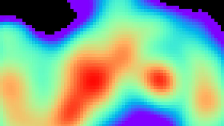
Gas is nearly invisible, but it has a temperature, and you can read it from how the gas 'shadows' the thermal background. In the experiment, a camera looks at a warm screen through a jet of carbon dioxide. If the gas is cooler than the background, it appears as a dark spot; if warmer, it appears bright.
In particle scattering experiments, the target is often polarized: nuclei are aligned so that their spins point predominantly in one direction. The degree of this alignment affects the collision outcomes.
To align particle spins in one direction, physicists usually cool a substance to near absolute zero and place it in a strong magnetic field. That is expensive and bulky.
A new method resembles tuning many spinning tops with a gentle touch: mediator molecules temporarily bind to target atoms and pass on their order.
The Sun is not a calm sphere. Waves constantly ripple through its interior, like a bell after being struck. These oscillations reach the surface and reveal what's happening on the far, invisible side. Astronomers have long been able to 'listen' to this ringing and find large sunspot groups there.
According to Einstein's theory, massive objects cause spacetime curvature, like a heavy ball warping a rubber sheet. As they accelerate, they create ripples — gravitational waves, akin to the circles from a stone dropped in a pond.
A glass marble in a glass of water is nearly invisible, but if you look through it at a checkered tablecloth, the lines behind it appear distorted. Transparent cells behave the same way: light passes through them but is slightly slowed and changes direction.
A fingernail-sized piece of ceramic is squeezed in a vise, and its internal structure rearranges like clay under your fingers. Inside, orderly rows of tiny domains line up where they were once randomly oriented. After this 'massage,' the crystal lets light through almost like glass and, at the same time, generates a strong electric charge when bent or pressed.
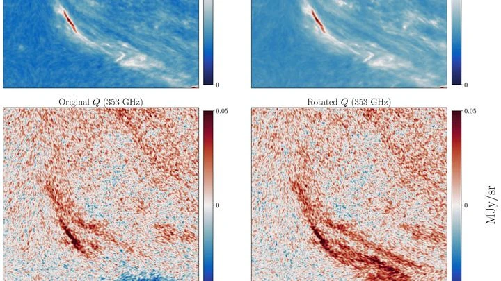
In the dark cloud L43, where stars are born, dust grains twirl like tiny compasses. Light from a young star pushes them, while the magnetic field lines them up in a specific direction. When a grain is turned sideways to us, its heat reaches us polarized, like light passing through a narrow slit.
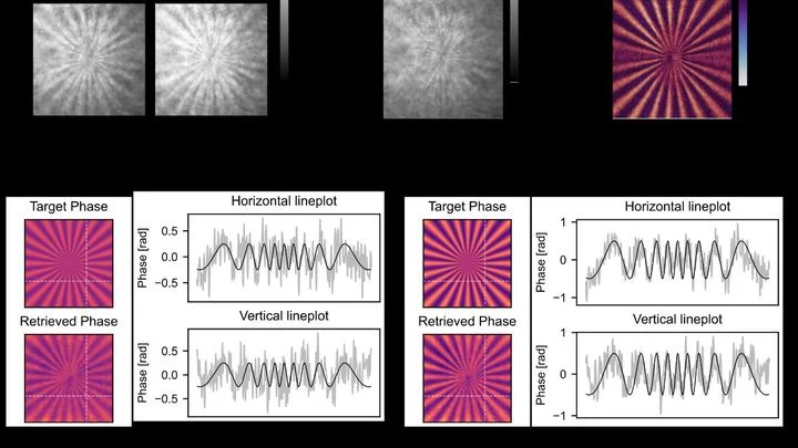
Light can draw patterns right inside your eye — no screen or glasses needed. When a specially shaped beam enters the pupil, it creates dark rays in your field of view, like the spokes of a spinning wheel. You see these rays because they are born in the retinal cells, not outside.
A flashlight in thick fog is useless: the beam scatters, and the reflected light drowns in noise. But if you tie two photons with an invisible thread, one can pass through the fog and come back, while the other stays safe. This connection is called quantum entanglement — when two particles behave as a single whole, even when far apart.
Terahertz radiation sits between microwaves and infrared light. It passes through clothing, paper, and plastic but is blocked by water and metal. That's why these waves are used in security scanners and for quality control of materials.
The cosmic microwave background is a faint glow left over from the Big Bang, like the cooling embers of a campfire. It encodes gravitational waves that may have arisen in the first fractions of a second, when the universe inflated faster than light.
Light from a star is not just a stream but a wave that can oscillate in different directions. Ordinary light is like a crowd where everyone waves their arms randomly. But after reflecting off dust grains or passing through a magnetic field, some waves align in a single line, like soldiers in a row.
Light traveling through an optical fiber is like a runner in a narrow corridor: it can run straight, or it can weave from side to side. The direction of these "weaves" is polarization. Physicists have learned to keep the runner on a straight path: they constantly check its trajectory and gently correct it, not letting it veer off.
A conventional thermal camera is like a thermometer that slowly heats up and cools down. It shows where heat is well, but it can't keep up with fast motion. The new sensor works differently: it counts individual quanta of heat, like a droplet counter during rain.
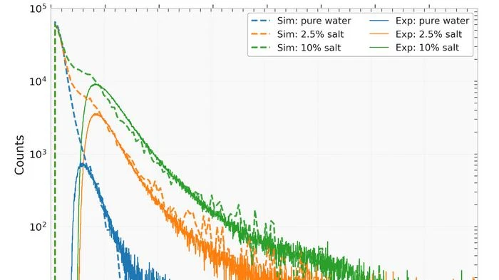
In a field stands a tank of water that usually catches particles from space. Now it keeps an eye on how much moisture is in the soil underfoot. The water in the tank acts as a trap for neutrons — tiny particles that fly out of the soil when cosmic rays hit it. The drier the ground, the more neutrons escape, and the more often the tank registers them.
An ordinary magnetic compass freezes when lightning strikes nearby. A sudden jump in the magnetic field throws the needle off. A similar problem has been hindering scientists trying to measure magnetism in strong pulsed fields: those that switch on for a thousandth of a second.
The new setup tackles this with a laser beam.
Light from distant galaxies passes through telescope lenses like through a stack of window panes. Each pane is coated with a thin film to reduce glare. But this film acts as a polarizing filter: one component of the light wave passes a bit more freely, the other a bit worse. As a result, the wave rotates slightly, and the telescope sees a different picture than what is in the sky.
The Sun is not just a ball — it's a magnetic mansion. Its invisible force lines, like electrical wiring, thread through space and control space weather. But until now, we've only seen this wiring from the landing — the plane of Earth's orbit. The attic and basement, the magnetic poles, remained a mystery.