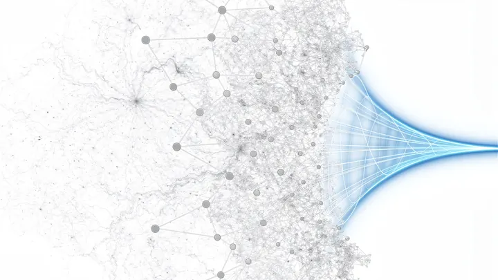
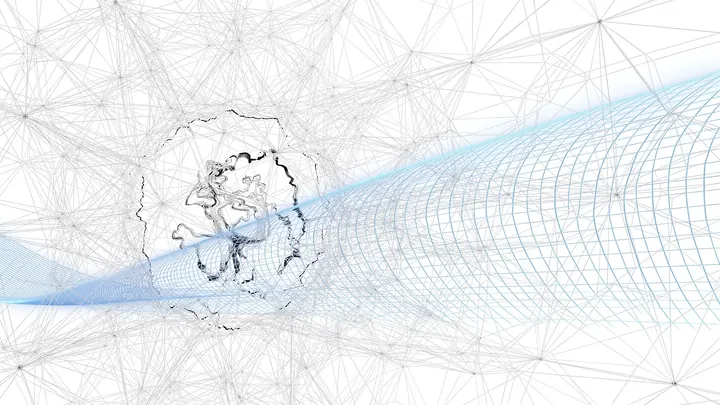
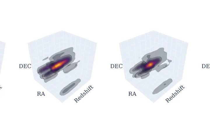
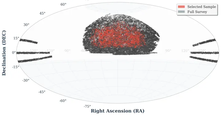
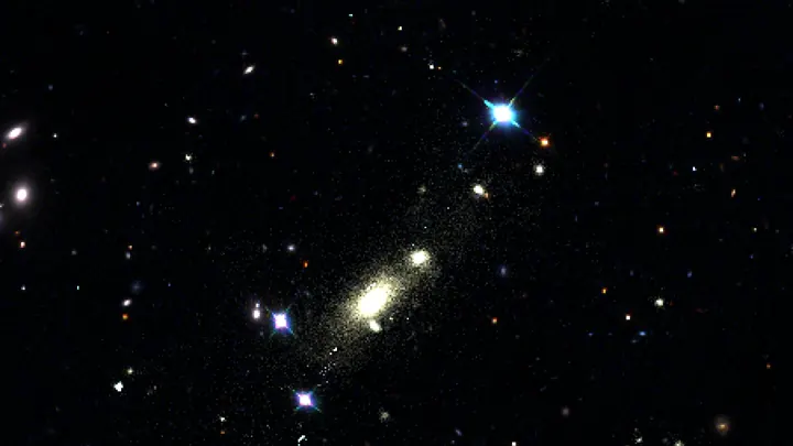
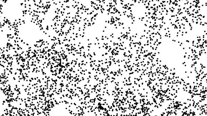
A three-dimensional map of the universe is a spatial representation where each point marks the position of a galaxy or galaxy cluster, revealing the large-scale structure of the cosmos. These maps show that galaxies are not uniformly distributed but form a vast web of filaments, sheets, and voids — often called the cosmic web. By charting the positions of millions of galaxies, astronomers can trace the distribution of matter, including dark matter, and study how the universe evolved from the Big Bang to its present state.
History
The first large-scale galaxy redshift surveys, such as the CfA Redshift Survey in the 1980s, revealed the cosmic web. The Sloan Digital Sky Survey (SDSS) in the 2000s mapped over a million galaxies, and ongoing projects like the Dark Energy Spectroscopic Instrument (DESI) are pushing to tens of millions.
How it works
Building such a map requires measuring the positions and distances of galaxies. Positions on the sky are obtained from telescopes, while distances come from redshift measurements: the expansion of the universe stretches light from distant galaxies, shifting it toward longer wavelengths. Combining sky coordinates with redshift-derived distances gives a three-dimensional distribution. Modern surveys use spectroscopic or photometric techniques to measure redshifts for millions of galaxies, and sophisticated algorithms, including machine learning, help fill in gaps and predict structures in unobserved regions.
In practice
Three-dimensional maps are used to constrain cosmological parameters, such as the density of dark energy and the rate of cosmic expansion, and to test theories of gravity and structure formation.
Fun fact
The largest three-dimensional map of the universe, from the DESI survey, covers over 11 billion years of cosmic history and contains more than 6 million galaxies.
A river drawn on a map is always a single line. But stand on the bank, and you will see that within the channel there are faster currents, eddies, and branches that merge and split. The cosmic web is like that river, but made of dark matter, and until recently astronomers drew it as a single line.
The night sky looks like a random scattering of stars. But zoom out to enormous distances, and the chaos disappears. Galaxies gather into long filaments and flat walls, with colossal voids gaping between them — cosmic voids. This structure is called the cosmic web.
The standard cosmological model ΛCDM (which includes dark energy and cold dark matter) is the score of a cosmic symphony. It describes how space expanded after the big bang. How dark matter clumped together. How galaxies ignited. For a long time, everything played flawlessly.
The early Universe was not just a hot soup of particles. In the first fractions of a second, mirror symmetry could have been broken: the world and its reflection would not be quite identical. If so, the large-scale cosmic web of galaxies would retain a barely noticeable 'curl'—as if all matter were slightly twisted in one direction.
The cosmos resembles silk fabric with threads of the dark web showing through. We only glimpse tiny swatches of the real tapestry — through telescopes, in actual galaxy catalogs. To separate the fundamental signal from astrophysical noise in the cosmic pattern, statistical analysis demands thousands of plausible sketches — synthetic sky maps.
Eight bright spots on the radio sky. They are all the same quasar HS 0810+2554, whose light passed through a gravitational lens — a massive foreground galaxy.
The optical sky background is a cosmic palimpsest, where light from billions of unresolved galaxies is layered, each layer corresponding to a different epoch. Until now we could only distinguish the brightest "letters"—individual stars and nearby galaxies.
Look at an equilateral triangle — the probability simplex for three assets. Each interior point is a portfolio: non-negative shares summing to one. The triangle's center, the barycenter, corresponds to an equal-weight allocation (1/3, 1/3, 1/3). It seems that by moving toward this point, you lower risk and avoid dangerous edges.
The cosmological principle – the notion that the Universe is homogeneous and isotropic on large scales – has guarded our understanding of the world since the time of Edwin Hubble and Georges Lemaître, whose ideas formed the basis of the Big Bang model.
Imagine a philharmonic orchestra playing, but the microphone picks up only a blended roar — a tutti where double basses, flutes, and timpani all merge. Physicists have grappled with a similar task for decades, staring at fields of density, temperature, or magnetic induction.
The cosmological constant is causing the universe to expand at an accelerating rate. In the far future, when all matter has dispersed, only empty de Sitter space will remain — an ideal cosmic backdrop.
From childhood, we're used to thinking of space as infinite and isotropic. But Einstein and Lemaître were already asking: could the Universe be closed in on itself, like a Möbius strip or a 3-torus?
Through the ripples on the water, pebbles at the bottom of a pool look shifted and warped. In a similar way, the gravity of invisible dark matter bends the light of distant galaxies — a phenomenon known as weak lensing.
Two black holes smash head-on at full speed — while a third one circles nearby. In ordinary life, such a crash would produce a burst of gravitational waves (ripples in space, like the ripples from a stone thrown into a pond). But here, part of the ripple passes by the massive neighbor, and changes, like light in a funhouse mirror.
When a massive star exhausts its fuel, the core collapse can spawn a supernova and a neutron star, but with enough mass, nothing halts the crush — a black hole is born.
You are pacing a huge hall in complete darkness. You walk from wall to wall, counting your steps, and suddenly realize that the distances don't add up as they should. It seems as if the floor is not flat but bulging like a hump or hollowed like a bowl. That's roughly what astronomers found when studying distant galaxies and sound waves frozen in the early Universe.
Toss a handful of glitter into a river, and some flakes will drift straight while others spin in tiny eddies. Galaxies in the universe do something similar: they don't just recede due to cosmic expansion: they also swirl in giant currents, like wood chips caught in invisible whirlpools.
The night sky looks as smooth as the surface of a calm lake. But if you look at gamma-ray bursts (brief, blinding explosions visible across the entire universe) you'll find ripples in that smoothness.
Scientists took a catalog of such bursts and divided the sky into two hemispheres. In the southern one, they found a tiny group: 4–5 bursts huddled together.
The cosmic web resembles a giant three-dimensional network: galaxies and clusters are connected by filaments of dark matter. These filaments act as invisible bridges along which matter flows toward major nodes. For a long time, scientists struggled to understand the density structure of these filaments, but results were contradictory.
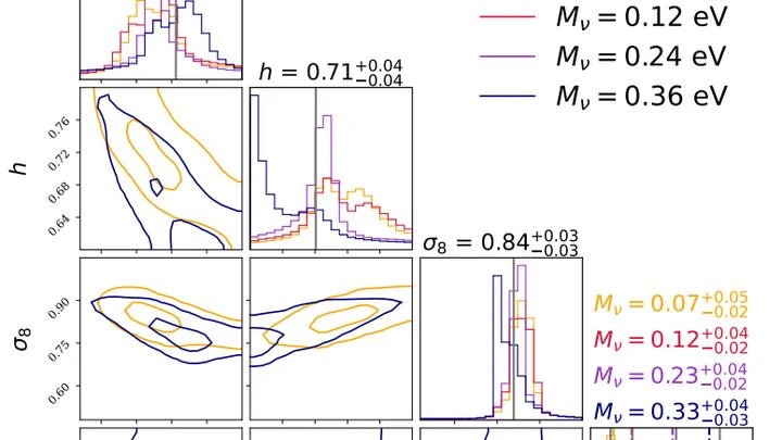
The Universe is a colossal web of invisible dark matter and galaxies, stretched by the expansion of space. Neutrinos, nearly intangible ghost particles, barely cling to the threads, but their collective mass subtly shifts the tension of the entire network.
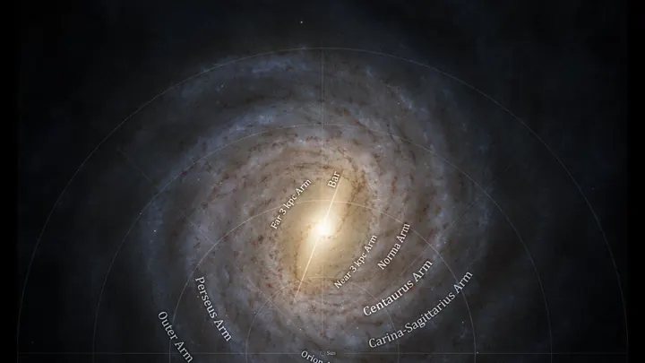
Other galaxies are just ancient snapshots, but we watch the Milky Way live. Comparing data over 30 years, scientists found that the Galaxy’s center is, like, speeding up: the supermassive black hole got heavier, swallowing the mass of a large asteroid each year; the stellar bar (a huge beam of billions of suns, like the…
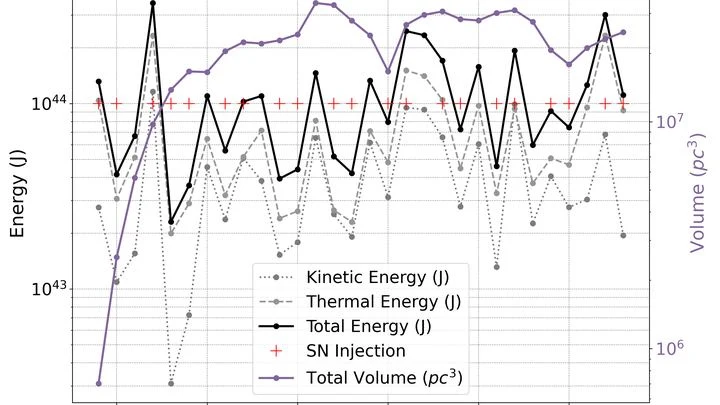
Superbubbles are cosmic giants, akin to soap bubbles, but instead of soap film, they contain rarefied interstellar gas, and they're inflated not by a breath but by a series of supernova explosions. In computer simulations, they behave like living things: they grow, cool, and move. But until now, we couldn't precisely trace their boundaries.
In the very center of the Milky Way, hidden behind a thick veil of dust, lies a giant accumulation of gas — the Central Molecular Zone. You can't see it with the naked eye: dust absorbs visible light, much like dense fog hides the lights of a city.
Images of distant galaxies are riddled with curved arcs and smears — light warped on its way to us. This effect, predicted by Albert Einstein, acts like a giant funhouse mirror: a massive galaxy cluster distorts the images of background sources.
Light from a distant star cuts through dust like a flashlight beam through fog. Dust holds back blue rays more than red ones, making the star appear redder than it really is. From this reddening, astronomers gauge how much dust lies in the light's path.
The Universe looks like a giant spiderweb: galaxies aren't scattered randomly but are gathered into knots and along filaments. Inside the filaments, there's plenty of gas, and that's where new stars most often flare up. But how has this changed over time? Scientists compared data from a computer model with real observations of thousands of galaxies.
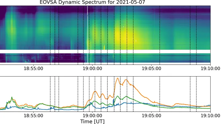
A solar flare is like a giant spring that gets twisted and twisted, and then suddenly snaps. The energy stored in the magnetic field is unleashed into space within minutes, heating plasma to millions of degrees.
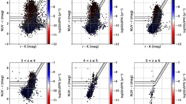
If you spill a handful of colorful beads on the floor, they will land differently: some will clump together, others will scatter into corners. Roughly the same way, galaxies of different colors (blue, green, and red) are scattered across the universe. Scientists decided to measure how 'clumpy' their distribution is using a number called the fractal dimension.
The cosmic microwave background is a faint glow left over from the Big Bang, like the cooling embers of a campfire. It encodes gravitational waves that may have arisen in the first fractions of a second, when the universe inflated faster than light.
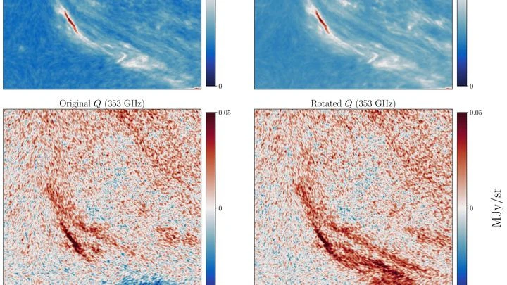
Earth's magnetic field is like an invisible river that meanders beneath our feet. Navigators and geologists rely on maps of this river, but instruments only take readings at scattered points, leaving blank spots in between. Filling those gaps is like trying to sketch the river's course from a few pebbles found on the bank.
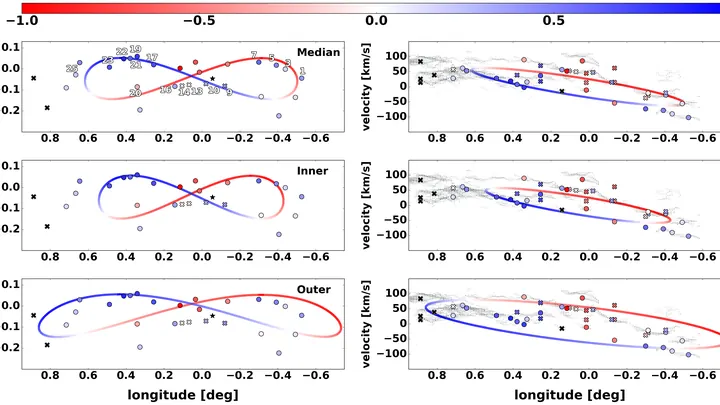
Imagine a city map where streets are replaced by car speeds and buildings by the metal content of stars. Such a map can tell you where the center is and where the outskirts are, even without knowing exact distances. This is precisely the approach astronomers took with our Galaxy, using longitude–velocity (ℓ–v) diagrams.
In the nearly empty regions of space, galaxies spin in unison, like dancers in the same troupe. This dance creates a difference in light from opposite sides: on one side stretching, on the other compression. This optical shift has become a probe of the first moments after the Big Bang.
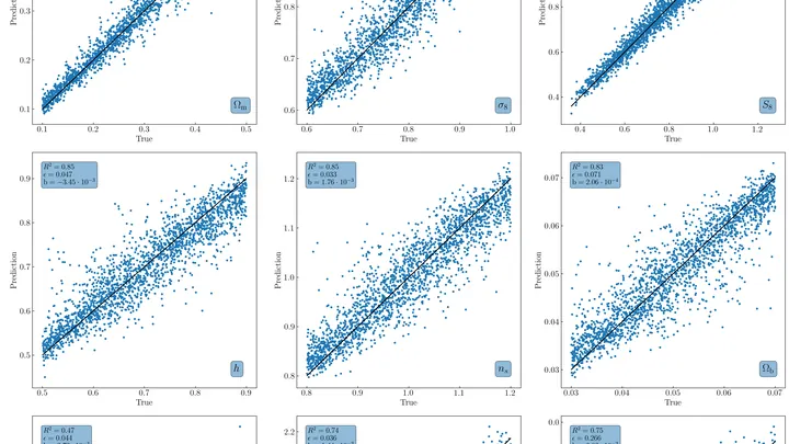
Thousands of universes were born in a computer, all to tell us about our own. Each one has its own galaxy clusters, arranged by the laws of gravity like peas in a jar shaken with varying force. From how the peas settle, you can tell what kind of hand shook the jar.
Dust in space is not just grime: it's the raw material for future stars and planets. But how it is distributed in our galaxy has long been a puzzle: dust is hard to measure directly, and it blocks the light of distant stars. Now astronomers have peered through this veil using data on five million stars: their brightness, color, and precise positions in the sky.
Three distant galaxies spin like giant carousels. Their stars and gas move along spiral arms, and from the speed of this motion you can calculate how much total matter the galaxy contains — visible and invisible.
Astronomers combined two views: radio telescopes revealed cold gas, while the James Webb Space Telescope showed the stars.
The Milky Way's stellar disk is like a glowing pinwheel, and тёмное вещество is an invisible cloud around it. For the first time, its shape has been precisely measured. Astronomers tracked the motions of millions of stars and built a 3D map of the тёмное гало out to 160,000 light-years.