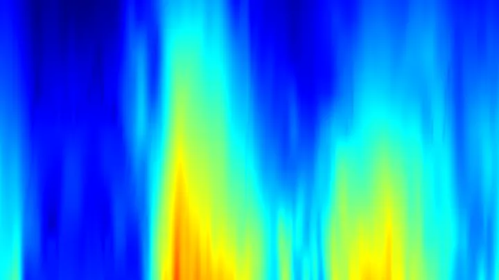
Temperature of four floors of the atmosphere measured from satellites: lower troposphere, mid troposphere, tropopause and lower stratosphere (UAH v6.1, monthly).
Satellite layers refer to the distinct vertical bands of Earth's atmosphere that are monitored remotely by instruments on weather and climate satellites. These layers are defined by their altitude and temperature profile: the lower troposphere (roughly 0–4 km), the mid-troposphere (about 4–8 km), the tropopause (the boundary around 8–16 km where temperature stops decreasing), and the lower stratosphere (about 16–25 km). Each layer responds differently to solar radiation, greenhouse gases, and weather systems, so tracking them separately reveals how the atmosphere is warming or cooling at different heights.
History
This technique was pioneered in the late 1970s with the launch of the first Microwave Sounding Unit on TIROS-N, and the University of Alabama in Huntsville (UAH) has maintained a continuous monthly dataset (version 6.1) since 1979.
How it works
Satellites carry microwave sounding units that measure thermal radiation emitted by oxygen molecules at specific frequencies. Because oxygen is evenly mixed in the atmosphere, the intensity of that radiation at different wavelengths corresponds to the average temperature of a particular altitude band. By comparing readings from multiple channels, scientists can reconstruct the temperature of each layer without needing ground-based thermometers.
In practice
These layer temperatures are used to monitor global warming trends, validate climate models, and study phenomena like the cooling of the stratosphere caused by ozone depletion or the enhanced warming of the troposphere from greenhouse gas increases.
Fun fact
The lower stratosphere has been cooling over recent decades even as the troposphere warms, a pattern that is a direct fingerprint of human-caused climate change.
Picture a guitar string stretched between two frets. When you pluck it, a standing wave forms: some points on the string oscillate strongly, while others, the nodes, remain almost still. The chromosphere, a layer of the solar atmosphere sandwiched between the photosphere and the corona, behaves in much the same way.
The JWST space telescope aimed its lens at the scorching rocky world 55 Cancri e, and spotted a dense gas envelope. But the cooler TRAPPIST-1 b, which orbits a dim red dwarf, showed no envelope: just bare rock. The picture came out upside down: hot planets hold onto atmospheres, while cooler ones lose them.
The Sun has a layer called the chromosphere, sitting just above the visible surface. Bright arcs often flare up there, visible through telescopes, but to understand what ignites them, you need to look at invisible magnetic fields.
From 1987 to 1991, astronomers last measured how Jupiter's icy moons reflect radio waves. Then came a long pause. In 2011–2024, researchers aimed a radar beam at Europa again: this time using the 70-meter antenna at Goldstone and the Green Bank Telescope.
Ice is nearly transparent to radio waves, like clear window glass is to light.
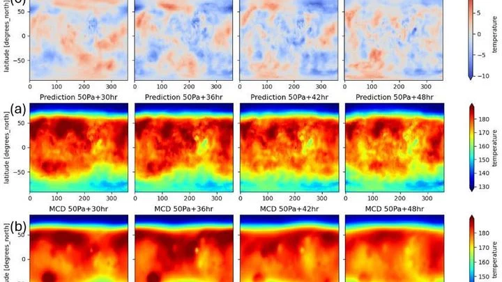
Meteorologists have grown used to trusting neural networks: the GraphCast model predicts Earth's weather days ahead by drawing on global snapshots of the atmosphere. But this 'brain' can be transplanted to another planet — where the air is thin and the Sun warms differently.
Jupiter's atmosphere resembles a layered cake, where each layer plays its role. Scientists took data from four instruments at once (VLT/MUSE, Cassini/VIMS, IRTF/SpeX, and Juno/JIRAM) and built a model of clouds and ammonia in the planet's equatorial zone, from 0.1 to 10 bar (pressure equivalent to hundreds of kilometers below Earth's…
Throw a stone into water: right at the point of impact, the waves are chaotic — that's the near field. Farther out, they spread in smooth circles — the far field. This same principle governs antennas for terahertz communications — the future of super-fast internet.
The cosmological debate is like two craftsmen measuring the same wall but getting different lengths. One uses a tape measure, applying it to nearby landmarks — Cepheids (pulsating beacon stars) and Type Ia supernovae (flashes of dying stars). He finds the wall is stretching at 73.5 arbitrary units.
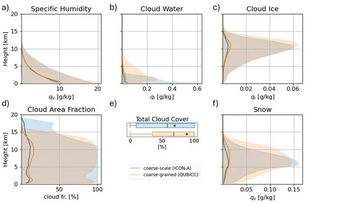
For decades, global atmospheric models resembled artists forced to paint planetary storms with coarse brushstrokes: a resolution of 25–100 km forced them to 'guess' convection through approximate schemes, introducing systematic errors in rainfall and climate forecasts.
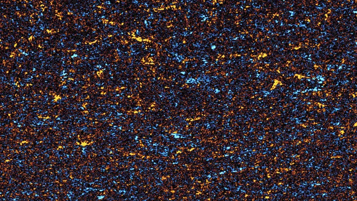
Imagine a philharmonic orchestra playing, but the microphone picks up only a blended roar — a tutti where double basses, flutes, and timpani all merge. Physicists have grappled with a similar task for decades, staring at fields of density, temperature, or magnetic induction.
The Sun is a giant nuclear reactor that continuously sends us light and heat. But it also has another, almost silent postal service: every second, tens of billions of neutrinos, ghostly particles born in the thermonuclear furnace, fly through a square centimeter of your palm. Most of them leave no trace.
The ionosphere at an altitude of 70 kilometers acts like a giant mirror for radio waves. Ground antennas constantly beam signals into it and listen for the reflection. When a solar flare occurs on the Sun, a stream of X-rays reaches Earth in 8 minutes and compresses the lower layer of the ionosphere.
For decades, the search for extraterrestrial intelligence has waited for quiet, coherent signals from space — a kind of 'whistle' in the radio silence. However, our own technosphere has created a continuous radio background — the hum of a vast metropolis, emitted by all communications, radars, and broadcasting stations.
Beneath your feet in the forest, a quiet life unfolds: fungi weave around tree roots and trade nutrients with them. But how do you count how many fungal species are in the soil without digging up the whole forest? It turns out the answer can be seen from space.
In 2023, the ocean off the coast of Peru warmed so much that fishermen came back empty-handed, while meteorologists argued over the strength of the upcoming El Niño. The sea surface temperature map they were looking at was the only one available, but how much could they trust it?
A seismometer is the planet's ear. It picks up the faintest tremors in the ground and turns them into an electrical signal. But this ear isn't perfect: its sensitivity depends on temperature. In the cold and in the heat, the instrument hears slightly differently, and that introduces error into measurements.
The weather on the next street can differ from yours: cooler by the river, hotter over asphalt, windier between buildings. A regular forecast misses this: its grid cell is the size of a city, not a backyard.
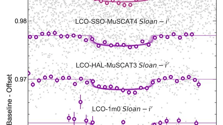
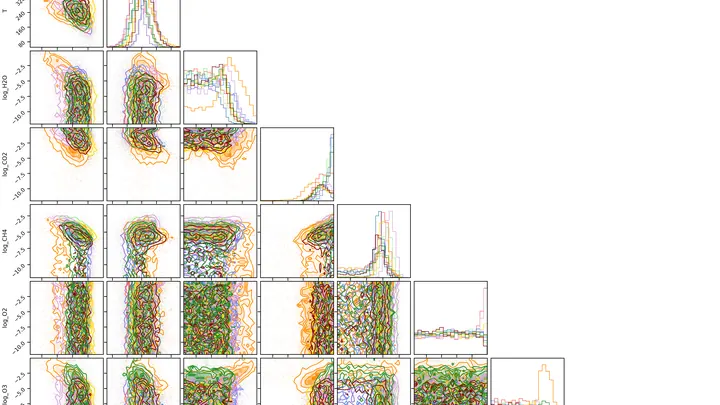
When a planet passes in front of its star, some starlight filters through its atmosphere. Gases in the atmosphere block certain colors and let others through, like the colored glass of a stained-glass window. By seeing which colors are dimmed, you can figure out what the air of a distant world is made of.
Beneath a thin layer of red dust on Mars lies water ice. Its presence was confirmed by the Phoenix lander and orbital instruments, but the mystery remained: why is the ice always just a few centimeters below the surface?
The answer lies in the wobbles of Mars' axial tilt.
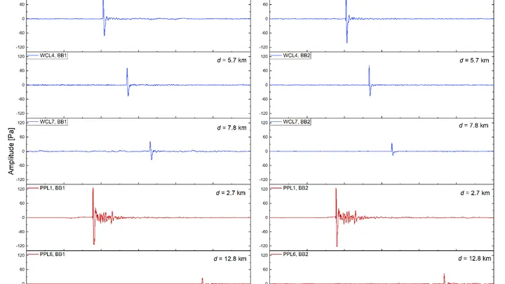
The same explosion can sound different: it all depends on which way the wind is blowing. In 2024, researchers set off charges equivalent to ten tons of TNT twice and recorded the sound with a network of 31 microphones spread over a radius of 23 kilometers. The source was identical, but the acoustic pictures turned out to be quite different.
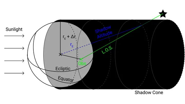
At night, the sky is never completely black. Even far from cities, the upper atmosphere glows faintly: sunlight makes hydrogen atoms emit a reddish glow that astronomers call geocoronal emission. For a telescope, it's like a fogged-up window: it adds extra light and hinders seeing distant galaxies.
Two new planets are circling dim red stars. One is nearly the size of Earth, the other is three and a half times larger. Both lie in what astronomers call the warm zone: a region where starlight doesn't scorch the surface but also doesn't leave it in perpetual cold.
The host stars are red dwarfs, the most common stars in the galaxy.
Eavesdropping on a distant planet's atmosphere is hampered by the star's noise. In the TRAPPIST-1 system, astronomers used a planet-"bug": TRAPPIST-1 b — an airless neighbor that records only the interference.
The Sun is not just a ball — it's a magnetic mansion. Its invisible force lines, like electrical wiring, thread through space and control space weather. But until now, we've only seen this wiring from the landing — the plane of Earth's orbit. The attic and basement, the magnetic poles, remained a mystery.
Climate forecasting is like a complex recipe: one wrong pinch and the whole dish is ruined. So it is with clouds — small but decisive. Climate models divide the sky into 50–100 km cells and don't see individual clouds. It's like throwing pepper by the handful when the recipe calls for a pinch.
An orchestra of two musicians plays from the same score, but each hears only their own line. The atmosphere and ocean in a climate model resemble such a duet: they exchange heat and moisture every few hours, yet until recently their neural network counterparts could not keep a common rhythm.
In winter, air over the Northern Hemisphere does not move haphazardly; it spends days at a time in the same pattern before rearranging itself. These patterns are like rooms in a maze: the system enters, lingers, then finds a door to another room. Each room has its own weather: somewhere over Europe it is warm and humid, while over Siberia it is frosty and clear.
The RATAN-600 radio telescope is a ring of hundreds of aluminum panels on a mountainside in Karachay-Cherkessia. In the spring of 2018, its mirror caught radio waves from sixteen red dwarfs — small, dim, but very long-lived stars.
The orchestra of world weather is playing a tune we didn't expect. The first violin is not carbon dioxide but chlorofluorocarbons—gases that until recently hid in refrigerators and aerosol cans. They trap heat ten thousand times more effectively than CO₂, and for decades they have been quietly warming the planet.
In the vast concert hall of the atmosphere, ozone plays a part that changes from tier to tier. Near the surface, its notes sound alarming, for there it is a pollutant that irritates lungs and leaves. At 25 kilometers up, the same gas becomes a protective shield that absorbs harsh ultraviolet radiation.
The thermometer at a weather station in Delhi doesn't know it's part of a giant ear. Every day it records the temperature, and after forty years of such records, you can hear the breathing of an entire subcontinent. The India Meteorological Department divided the country's land into one-degree squares and took readings from 1970 to 2009.
For a century, climatologists have measured the ocean's pulse with a barometer. Indices like El Niño or the North Atlantic Oscillation are built on atmospheric pressure differences between two points, and then we wonder why rivers don't obey.
In 2008, drought hung over South America. Rivers shrank, pastures yellowed, and farmers stared at the sky waiting for rain that never came. Meanwhile, 450 kilometers above, two satellites flying 220 kilometers apart continued their invisible work: they were weighing the continent.